Category:Fenny Stratford
Jump to navigation
Jump to search
town in Buckinghamshire, England, United Kingdom  | |||||
| Upload media | |||||
| Instance of | |||||
|---|---|---|---|---|---|
| Location | Bletchley and Fenny Stratford, City of Milton Keynes, Buckinghamshire, South East England, England | ||||
 | |||||
English: Fenny Stratford is a constituent town of Milton Keynes, ceremonial Buckinghamshire, England and in the Civil Parish of Bletchley and Fenny Stratford. Originally an independent town, it was included in the Milton Keynes "designated area" area in 1967. From 1895 it formed an urban district with Bletchley, until 1974 when it became part of the borough of Milton Keynes (since 1997 a unitary authority). It is located at the south east edge of the city and is its gateway to northbound travellers on the A5.
Italiano: Fenny Stratford è una delle quattro comunità che, aggregate, formano la città di Milton Keynes, nella contea del Buckinghamshire, in Inghilterra.
Nederlands: Fenny Stratford is een plaats in het graafschap Buckinghamshire in het zuidoosten van Engeland. Het valt binnen het district (unitary authority) Milton Keynes.
Norsk bokmål: Fenny Stratford er en by i Buckinghamshire, England. Den ligger sørøst i distriktet Milton Keynes, helt inntil Bletcley.
Subcategories
This category has the following 5 subcategories, out of 5 total.
Media in category "Fenny Stratford"
The following 50 files are in this category, out of 50 total.
-
 - Fenny Stratford canal cottage.jpg 4,608 × 3,456; 5.27 MB
-
 1125423 - Fenny Stratford, 43 Aylesbury Street.jpg 4,000 × 3,000; 3.1 MB
-
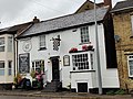
 1125424 - Fenny Stratford, Maltsters Pub.jpg 4,000 × 3,000; 2.61 MB
-
 1125425 - Fenny Stratford, 59 Aylesbury Street.jpg 4,000 × 3,000; 2.78 MB
-
 1125434 - 60 Watling Street, Fenny Stratford.jpg 4,000 × 3,000; 3.76 MB
-
 1125435 - Fenny Stratford, 48 Watling Street.jpg 4,000 × 3,000; 3.25 MB
-
 1125436 - Fenny Stratford, 11 and 13 Watling Street.jpg 4,000 × 3,000; 3.55 MB
-
 1160200 - Fenny Stratford, The Elms.jpg 4,000 × 3,000; 3.61 MB
-
 1332224 - Fenny Stratford, Outhoused rear number 30 The Bull.jpg 4,000 × 3,000; 3.55 MB
-
 1332225 - Bracknell House.jpg 4,000 × 3,000; 4.63 MB
-
 1332226 - Fenny Stratford, 49 and 51 Aylesbury Street.jpg 4,608 × 3,456; 3.95 MB
-
 1332230 - Fenny Stratford, Manor Farmhouse.jpg 4,000 × 3,000; 4 MB
-
 1332233 - Fenny Stratford Lock View Pine View.jpg 4,000 × 3,000; 3.68 MB
-
 1332255 - Fenny Stratford, Former stable block to Fenny Lodge.jpg 4,000 × 3,000; 3.28 MB
-
 40 Miles to Braunston - geograph.org.uk - 1354226.jpg 480 × 640; 121 KB
-

-

-

-
 Deep, Deep Shopping Joy^ - geograph.org.uk - 680054.jpg 640 × 480; 54 KB
-

-
 Fenny Stratford bollards.jpg 4,000 × 3,000; 4.62 MB
-
 Fenny Stratford pump house.jpg 4,608 × 3,456; 5.11 MB
-

-

-

-
 Grand Union Canal at Fenny Stratford - geograph.org.uk - 1516206.jpg 640 × 360; 167 KB
-
 Herbert akroyd stuart plaque.jpg 1,000 × 705; 321 KB
-
 High Street North, Fenny Stratford - geograph.org.uk - 1519692.jpg 640 × 360; 138 KB
-
 High Street North, Fenny Stratford - geograph.org.uk - 1522286.jpg 640 × 360; 135 KB
-

-
 Level crossing in Simpson Road - geograph.org.uk - 1586821.jpg 640 × 480; 169 KB
-

-
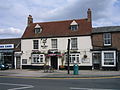 MK FennyStratford Bull and Butcher.jpg 2,048 × 1,536; 785 KB
-
 MK FennyStratford GrandUnionCanal01.JPG 1,536 × 2,304; 573 KB
-

-

-

-
 Ordnance Survey Sheet SP 83 Bletchley, Published 1956.jpg 7,404 × 7,536; 4.18 MB
-

-
 The Bridge Inn, Fenny Stratford - geograph.org.uk - 1516220.jpg 640 × 360; 121 KB
-

-

-

-

-

-

-
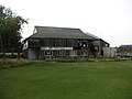 Bletchley Rugby and Cricket Club House - geograph.org.uk - 209843.jpg 640 × 480; 111 KB
-
 BT Telephone Exchange - geograph.org.uk - 208310.jpg 640 × 480; 137 KB
-
 Roundabout on the A4146 - geograph.org.uk - 210507.jpg 640 × 480; 126 KB
-
 Tesco and a Roundabout - geograph.org.uk - 208303.jpg 640 × 480; 119 KB


