Category:Fen Ditton
Jump to navigation
Jump to search
village and civil parish on the northeast edge of Cambridge in Cambridgeshire, England  | |||||
| Upload media | |||||
| Instance of | |||||
|---|---|---|---|---|---|
| Location | South Cambridgeshire, Cambridgeshire, East of England, England | ||||
| Population |
| ||||
| official website | |||||
 | |||||
Subcategories
This category has the following 15 subcategories, out of 15 total.
1
- 14 and 16 High Ditch Road (2 F)
B
- Biggin Abbey (18 F)
- Blue Lion, Fen Ditton (2 F)
D
F
- Fen Ditton War Memorial (9 F)
- Flendyshe House, Fen Ditton (4 F)
H
- Home Farm, Fen Ditton (4 F)
K
- Kings Head, Fen Ditton (3 F)
M
- Musgrave Farm, Fen Ditton (7 F)
O
- The Old Rectory, Fen Ditton (5 F)
Media in category "Fen Ditton"
The following 200 files are in this category, out of 674 total.
(previous page) (next page)-
 15 - 17, High Ditch Rd - geograph.org.uk - 5269066.jpg 640 × 426; 59 KB
-
 16, Church St - geograph.org.uk - 5044989.jpg 426 × 640; 48 KB
-
 20, Church St - geograph.org.uk - 5044973.jpg 640 × 426; 42 KB
-
 6, High Ditch Rd - geograph.org.uk - 5269068.jpg 640 × 426; 50 KB
-
 A barley field near Biggin Abbey - geograph.org.uk - 6549496.jpg 1,024 × 768; 1.08 MB
-
 A bend in the bridle path - geograph.org.uk - 6259901.jpg 1,024 × 683; 933 KB
-
 A farm track in The Fens - geograph.org.uk - 5324126.jpg 1,024 × 768; 1.33 MB
-
 A fenland track - geograph.org.uk - 6475446.jpg 1,024 × 683; 901 KB
-
 A field of beans near Biggin Abbey - geograph.org.uk - 4029947.jpg 3,872 × 2,592; 4.13 MB
-
 A Finnish flag in Fen Ditton - geograph.org.uk - 5620626.jpg 1,024 × 819; 827 KB
-
 A four, an eight and the A14 - geograph.org.uk - 2820778.jpg 1,024 × 719; 1,009 KB
-
 A gentle climb to Horningsea Road - geograph.org.uk - 2460344.jpg 1,024 × 768; 982 KB
-
 A Girton eight practising - geograph.org.uk - 4029944.jpg 3,872 × 2,592; 2.95 MB
-
 A kissing gate by the Cam - geograph.org.uk - 5620621.jpg 1,024 × 768; 1.25 MB
-
 A March morning near Baits Bite Lock - geograph.org.uk - 2853002.jpg 1,024 × 759; 918 KB
-
 A muddy gateway on Fen Ditton Meadows - geograph.org.uk - 3855833.jpg 1,200 × 900; 1.32 MB
-
 A November Sunday morning on Ditton Meadows - geograph.org.uk - 5191779.jpg 1,024 × 731; 863 KB
-
 A pylon at Snout Corner - geograph.org.uk - 6247809.jpg 819 × 1,024; 1.03 MB
-
 A pylon near Honey Hill - geograph.org.uk - 5470191.jpg 819 × 1,024; 1.07 MB
-
 A railway once - geograph.org.uk - 6599994.jpg 1,024 × 1,024; 1.63 MB
-
 A Secluded Cottage - geograph.org.uk - 2708727.jpg 640 × 480; 59 KB
-
 A shady stretch - geograph.org.uk - 3171469.jpg 1,024 × 735; 1.29 MB
-
 A single oak - geograph.org.uk - 5324132.jpg 1,024 × 768; 1.01 MB
-
 A young crop - geograph.org.uk - 5035741.jpg 640 × 426; 58 KB
-
 A1303 - geograph.org.uk - 5263579.jpg 640 × 426; 73 KB
-
 A14 - geograph.org.uk - 5263694.jpg 640 × 426; 45 KB
-
 A14 Bridge - geograph.org.uk - 5044918.jpg 640 × 426; 59 KB
-
 A14 Bridge over the Cam - geograph.org.uk - 4864879.jpg 640 × 426; 74 KB
-
 A14 Bridge over the Harcamlow Way - geograph.org.uk - 5044902.jpg 640 × 426; 58 KB
-
 A14 bridge over the River Cam - geograph.org.uk - 2547063.jpg 1,600 × 1,200; 555 KB
-
 A14 bridge over the River Cam - geograph.org.uk - 5044900.jpg 640 × 426; 63 KB
-
 A14 eastbound east of Fen Ditton - geograph.org.uk - 5086606.jpg 640 × 480; 45 KB
-
 A14, westbound - geograph.org.uk - 4131275.jpg 640 × 375; 30 KB
-
 A14, westbound - geograph.org.uk - 4131278.jpg 640 × 430; 41 KB
-
 Across the Cam - geograph.org.uk - 4414392.jpg 1,024 × 731; 1.04 MB
-
 Across the Cam below Baits Bite - geograph.org.uk - 6388909.jpg 1,024 × 1,024; 1.14 MB
-
 Across the Cam to Fen Ditton - geograph.org.uk - 6339709.jpg 1,024 × 731; 983 KB
-
 Across wheatfields towards Quy - geograph.org.uk - 4071154.jpg 1,024 × 732; 1.01 MB
-
 After harvest at the edge of The Fens - geograph.org.uk - 6247843.jpg 1,024 × 768; 887 KB
-
 Aircraft landing Lights - geograph.org.uk - 5263699.jpg 640 × 426; 59 KB
-
 Airport Way - geograph.org.uk - 6426310.jpg 1,024 × 680; 139 KB
-
 Almshouses - geograph.org.uk - 5045002.jpg 640 × 426; 78 KB
-
 Almshouses - geograph.org.uk - 5045005.jpg 640 × 426; 100 KB
-
 Almshouses - geograph.org.uk - 5045023.jpg 640 × 415; 86 KB
-
 An angler near the A14 bridge - geograph.org.uk - 5191700.jpg 819 × 1,024; 1.16 MB
-
 An Easter Sunday walk by the river - geograph.org.uk - 4414509.jpg 819 × 1,024; 1.33 MB
-
 An eight on the Cam near Fen Ditton - geograph.org.uk - 4038729.jpg 3,872 × 2,592; 4.75 MB
-
 Approaching Baits Bite Lock - geograph.org.uk - 5323602.jpg 1,024 × 768; 1.2 MB
-
 Approaching Fen Ditton on High Ditch Road - geograph.org.uk - 6608666.jpg 1,024 × 731; 888 KB
-
 Ashtree Cottage - geograph.org.uk - 5092898.jpg 640 × 426; 60 KB
-
 At Fen Ditton crossroads - geograph.org.uk - 5589334.jpg 1,024 × 682; 808 KB
-
 At work on Saturday morning - geograph.org.uk - 5324279.jpg 1,024 × 768; 943 KB
-
 Autumn cultivation in the Cambridgeshire Fens - geograph.org.uk - 6300276.jpg 1,024 × 731; 805 KB
-
 B1047 - geograph.org.uk - 5035721.jpg 640 × 426; 67 KB
-
 B1047 - geograph.org.uk - 5035727.jpg 640 × 426; 76 KB
-
 B1047, Fen Ditton - geograph.org.uk - 5269070.jpg 640 × 426; 65 KB
-
 B1047, Horningsea Rd - geograph.org.uk - 5035734.jpg 640 × 426; 67 KB
-
 Back where we belong - geograph.org.uk - 3641771.jpg 640 × 427; 96 KB
-
 Baits Bite Lock - geograph.org.uk - 1877814.jpg 1,280 × 856; 223 KB
-
 Baits Bite Lock - geograph.org.uk - 2060733.jpg 640 × 428; 83 KB
-
 Baits Bite Lock on The River Cam - geograph.org.uk - 5122000.jpg 4,301 × 3,225; 2.66 MB
-
 Baits Bite weir in winter - geograph.org.uk - 2799053.jpg 1,024 × 768; 914 KB
-
 Baits Bite weir, December sunlight - geograph.org.uk - 3261736.jpg 1,024 × 747; 243 KB
-
 Baits Bite, lock gate, sluice and weir - geograph.org.uk - 4221557.jpg 1,024 × 731; 1.29 MB
-
 Barley fields near Baits Bite Lock - geograph.org.uk - 6549492.jpg 1,024 × 768; 1.13 MB
-
 Barn conversion, Fen Ditton - geograph.org.uk - 5269045.jpg 640 × 426; 58 KB
-
 Barn, Poplar Hall - geograph.org.uk - 5044913.jpg 640 × 426; 79 KB
-
 Beer garden at The Plough - geograph.org.uk - 3641825.jpg 640 × 427; 316 KB
-
 Beer garden of the Plough - geograph.org.uk - 4120451.jpg 640 × 430; 95 KB
-
 Beer garden of The Plough, Fen Ditton - geograph.org.uk - 4037223.jpg 3,872 × 2,592; 5.08 MB
-
 Beet and wheat on the Cambridgeshire Fens - geograph.org.uk - 4071117.jpg 1,024 × 768; 1.04 MB
-
 Behind Marshall Jaguar - geograph.org.uk - 4804879.jpg 1,600 × 1,002; 168 KB
-
 Behind Marshall Land Rover - geograph.org.uk - 4804871.jpg 1,600 × 1,200; 324 KB
-
 Below the A14 - geograph.org.uk - 5044904.jpg 640 × 406; 61 KB
-
 Bend, River Cam - geograph.org.uk - 4070821.jpg 640 × 407; 56 KB
-
 Bends in the Cam below Fen Ditton - geograph.org.uk - 6339575.jpg 1,024 × 768; 1.01 MB
-
 Blocked byway - geograph.org.uk - 732458.jpg 640 × 480; 71 KB
-
 Boat houses by the Cam - geograph.org.uk - 2547076.jpg 1,600 × 1,200; 681 KB
-
 Boat shed on Fen Ditton Ditch - geograph.org.uk - 6425563.jpg 1,024 × 732; 960 KB
-
 Boat sheds, Baits Bite Lock - geograph.org.uk - 4070700.jpg 640 × 430; 105 KB
-
 Boat sheds, Baits Bite Lock - geograph.org.uk - 4864861.jpg 640 × 426; 102 KB
-
 Boathouse by the Cam - geograph.org.uk - 5419381.jpg 1,600 × 1,200; 522 KB
-
 Boating near Milton, Cambridgeshire - geograph.org.uk - 5121970.jpg 4,320 × 3,240; 3.83 MB
-
 Boats moored on Long Reach - geograph.org.uk - 4037229.jpg 3,872 × 2,592; 4.4 MB
-
 Bridge over the Cambridge-Mildenhall railway - geograph.org.uk - 2459936.jpg 1,024 × 768; 1.09 MB
-
 Bridge over the Mildenhall Branch - geograph.org.uk - 2459876.jpg 1,024 × 723; 1.06 MB
-
 Bridle way to Horningsea - geograph.org.uk - 6299628.jpg 1,024 × 731; 781 KB
-
 Bus stop on Newmarket Road (A1303) - geograph.org.uk - 4706338.jpg 640 × 480; 63 KB
-
 Buttercups by the Cam - geograph.org.uk - 6463981.jpg 1,024 × 768; 1.12 MB
-
 Buttercups on Ditton Meadows - geograph.org.uk - 6463836.jpg 1,024 × 768; 1.01 MB
-
 By the Cam near Fen Ditton - geograph.org.uk - 5864525.jpg 1,024 × 768; 1.11 MB
-
 Byway bridge over the A14 - geograph.org.uk - 3422728.jpg 1,200 × 900; 1.31 MB
-
 Cambridge - May Bumps - geograph.org.uk - 373575.jpg 640 × 427; 124 KB
-
 Cambridge - May Bumps - geograph.org.uk - 373576.jpg 640 × 427; 154 KB
-
 Cambridge - May Bumps - geograph.org.uk - 373578.jpg 640 × 427; 149 KB
-
 Cambridge Airport - geograph.org.uk - 6442407.jpg 1,024 × 681; 93 KB
-
 Cambridge ice rink under construction - geograph.org.uk - 6006362.jpg 1,600 × 1,207; 500 KB
-
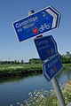
 Cambridge Jubilee Cycleway - geograph.org.uk - 1039276.jpg 640 × 468; 96 KB
-
 Cambridge Jubilee Cycleway - geograph.org.uk - 4056900.jpg 1,600 × 1,200; 645 KB
-
 Cambridge Jubilee Cycleway - geograph.org.uk - 4274389.jpg 1,600 × 1,200; 627 KB
-
 Canada geese at Fen Ditton - geograph.org.uk - 2255959.jpg 1,024 × 768; 911 KB
-
 Car dealership under construction - geograph.org.uk - 5301895.jpg 1,600 × 1,200; 479 KB
-
 Car park entrance, The Plough - geograph.org.uk - 5044965.jpg 640 × 426; 66 KB
-
 Cemetery at Fen Ditton - geograph.org.uk - 386874.jpg 640 × 480; 140 KB
-
 Cereal crop, Fen Ditton - geograph.org.uk - 5525875.jpg 640 × 480; 60 KB
-
 Chestnut tree - geograph.org.uk - 4070808.jpg 640 × 430; 63 KB
-
 Church of England Hall, Fen Ditton - geograph.org.uk - 5044980.jpg 640 × 411; 86 KB
-
 Church of St Mary - geograph.org.uk - 5033434.jpg 640 × 426; 94 KB
-
 Church of St Mary - geograph.org.uk - 5044993.jpg 640 × 426; 90 KB
-
 Church of St Mary - geograph.org.uk - 5044996.jpg 640 × 426; 71 KB
-
 Church of St Mary - geograph.org.uk - 5092902.jpg 640 × 426; 95 KB
-
 Church of St Mary - geograph.org.uk - 5092905.jpg 426 × 640; 92 KB
-
 Church of St Mary - geograph.org.uk - 5092907.jpg 640 × 426; 76 KB
-
 Church of St Mary - geograph.org.uk - 5092908.jpg 426 × 640; 97 KB
-
 Church of St Mary - geograph.org.uk - 5269309.jpg 640 × 426; 82 KB
-
 Church of St Mary - geograph.org.uk - 5269316.jpg 640 × 426; 107 KB
-
 Church Road, Fen Ditton - geograph.org.uk - 1656494.jpg 640 × 480; 140 KB
-
 Church St - geograph.org.uk - 5044970.jpg 426 × 640; 69 KB
-
 Citroen Cactus for sale - geograph.org.uk - 5301879.jpg 1,600 × 1,157; 747 KB
-
 Clogged ditch - geograph.org.uk - 927730.jpg 640 × 480; 135 KB
-
 Cottage by Baits Bite Lock - geograph.org.uk - 4718448.jpg 1,600 × 1,067; 638 KB
-
 Cottage by the Cam - geograph.org.uk - 5044921.jpg 640 × 426; 61 KB
-
 Cottage by the River Cam - geograph.org.uk - 4070812.jpg 640 × 430; 87 KB
-
 Cottage near the Cam - geograph.org.uk - 4290070.jpg 1,280 × 960; 713 KB
-
 Course of the Mildenhall branch line - geograph.org.uk - 2221920.jpg 800 × 600; 217 KB
-
 Crews on the Cam - geograph.org.uk - 6317513.jpg 1,024 × 768; 973 KB
-
 Cricket at Fen Ditton - geograph.org.uk - 2551928.jpg 640 × 480; 87 KB
-
 Crossing the railway - geograph.org.uk - 2459843.jpg 640 × 454; 94 KB
-
 Crossroads, Fen Ditton - geograph.org.uk - 5269069.jpg 640 × 426; 58 KB
-
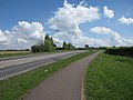
 Cycle routes by the River Cam - geograph.org.uk - 1877687.jpg 856 × 1,280; 163 KB
-
 Cyclepath around Marshall's Airport - geograph.org.uk - 1845225.jpg 1,600 × 1,200; 596 KB
-
 Disused railway line - geograph.org.uk - 5263726.jpg 640 × 426; 116 KB
-
 Ditch by Newmarket Rd - geograph.org.uk - 5263578.jpg 640 × 426; 140 KB
-
 Ditton Fields, a walk by the river - geograph.org.uk - 6371115.jpg 1,024 × 1,024; 1.29 MB
-
 Ditton Hall - geograph.org.uk - 5092913.jpg 640 × 426; 66 KB
-
 Ditton Hall farm, Fen Ditton-geograph.org.uk-3855860.jpg 1,200 × 963; 1.46 MB
-
 Ditton Lane (B1047) - geograph.org.uk - 5525876.jpg 640 × 480; 80 KB
-
 Ditton Lane, advice to motorists - geograph.org.uk - 6439864.jpg 1,024 × 1,024; 1.31 MB
-
 Ditton Meadow - geograph.org.uk - 5033420.jpg 640 × 426; 54 KB
-
 Ditton Meadows - geograph.org.uk - 4120624.jpg 640 × 430; 42 KB
-
 Ditton Meadows - geograph.org.uk - 5033412.jpg 640 × 426; 55 KB
-
 Ditton Meadows - geograph.org.uk - 5092940.jpg 640 × 426; 54 KB
-
 Ditton Meadows - geograph.org.uk - 927727.jpg 640 × 480; 139 KB
-
 Ditton Meadows - geograph.org.uk - 927755.jpg 640 × 480; 121 KB
-

-
 Drain enters the River Cam - geograph.org.uk - 4120470.jpg 640 × 430; 69 KB
-
 Drainage channel, Ditton Hall - geograph.org.uk - 5092922.jpg 640 × 426; 86 KB
-
 Drive to Fen Ditton Hall - geograph.org.uk - 5033421.jpg 640 × 426; 116 KB
-
 DS5 and DS3, Marshall Motor Group - geograph.org.uk - 5301883.jpg 1,600 × 1,229; 485 KB
-
 Due north in the Cambridgeshire Fens - geograph.org.uk - 6620187.jpg 1,024 × 731; 974 KB
-
 East from Low Fen Drove Way - geograph.org.uk - 2222525.jpg 800 × 600; 170 KB
-
 East on Newmarket Road - geograph.org.uk - 6596222.jpg 1,024 × 768; 856 KB
-
 Eastbound A14, Cambridge Bypass - geograph.org.uk - 3842271.jpg 640 × 480; 260 KB
-
 Eastbound A14, Junction 34 (Fen Ditton) - geograph.org.uk - 3842116.jpg 640 × 480; 240 KB
-

-
 Edge of Cambridge - geograph.org.uk - 2563234.jpg 1,600 × 1,200; 601 KB
-
 Electricity Pylon by the River Cam - geograph.org.uk - 4705864.jpg 640 × 480; 58 KB
-
 Empty Cambridge, the A1303 Newmarket Road - geograph.org.uk - 6450611.jpg 1,024 × 732; 741 KB
-
 Enjoying the Cam on Sunday morning - geograph.org.uk - 6634274.jpg 1,024 × 731; 930 KB
-
 Entering Fen Ditton - geograph.org.uk - 5263719.jpg 640 × 426; 108 KB
-
 Entering Fen Ditton, B1047 - geograph.org.uk - 5035742.jpg 640 × 426; 79 KB
-
 Exploratory digs by Newmarket Road - geograph.org.uk - 4804887.jpg 1,600 × 1,171; 254 KB
-
 Fallen tree, Cambridge 4 - geograph.org.uk - 2752968.jpg 640 × 480; 147 KB
-
 Farmland - geograph.org.uk - 5263724.jpg 640 × 426; 60 KB
-
 Farmland by High Ditch Rd - geograph.org.uk - 5269039.jpg 640 × 426; 49 KB
-
 Farmland in the Cam valley - geograph.org.uk - 4070712.jpg 640 × 430; 53 KB
-
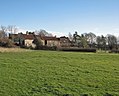
 Fen Ditton - geograph.org.uk - 5045016.jpg 640 × 426; 85 KB
-
 Fen Ditton - geograph.org.uk - 5092899.jpg 640 × 426; 80 KB
-
 Fen Ditton - Manor Farmhouse, 22 High Ditch Road.jpg 3,326 × 3,326; 4.83 MB
-
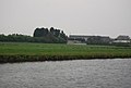
 Fen Ditton across the River Cam - geograph.org.uk - 4070816.jpg 640 × 430; 68 KB
-
 Fen Ditton bridleway 13 - geograph.org.uk - 2566113.jpg 3,872 × 2,592; 3.05 MB
-
 Fen Ditton Church - geograph.org.uk - 3443307.jpg 1,600 × 1,000; 837 KB
-
 Fen Ditton Church Hall - geograph.org.uk - 6590356.jpg 1,024 × 682; 893 KB
-
 Fen Ditton churchyard and The Old Rectory - geograph.org.uk - 6363473.jpg 819 × 1,024; 1.09 MB
-
 Fen Ditton Community Primary School - geograph.org.uk - 5035729.jpg 640 × 426; 67 KB
-
 Fen Ditton crossroads - geograph.org.uk - 3855902.jpg 1,200 × 904; 1.3 MB
-
 Fen Ditton crossroads - geograph.org.uk - 5191792.jpg 1,024 × 732; 1.02 MB
-
 Fen Ditton Ditch in May - geograph.org.uk - 6464148.jpg 1,024 × 768; 1.21 MB
-
 Fen Ditton from a distance (in Spring) - geograph.org.uk - 3436996.jpg 1,024 × 745; 224 KB
-
 Fen Ditton from a distance - geograph.org.uk - 3310138.jpg 1,200 × 888; 1.38 MB
-
 Fen Ditton from Ditton Meadows - geograph.org.uk - 5973291.jpg 1,024 × 768; 899 KB
-
 Fen Ditton from River Cam.jpg 640 × 480; 88 KB
-

-
 Fen Ditton High Street - geograph.org.uk - 4222200.jpg 1,024 × 731; 1.06 MB
-
 Fen Ditton High Street - geograph.org.uk - 4746716.jpg 1,024 × 732; 929 KB
-
 Fen Ditton High Street - geograph.org.uk - 6069412.jpg 1,024 × 682; 717 KB
-
 Fen Ditton High Street in January - geograph.org.uk - 5257646.jpg 1,024 × 683; 833 KB
-
 Fen Ditton High Street in September - geograph.org.uk - 2626435.jpg 1,024 × 788; 933 KB
-
 Fen Ditton High Street on a bright July evening - geograph.org.uk - 5840359.jpg 1,024 × 1,024; 1.17 MB
-
 Fen Ditton High Street on a May afternoon - geograph.org.uk - 6464176.jpg 1,024 × 682; 750 KB
-
 Fen Ditton High Street on a November afternoon - geograph.org.uk - 5973310.jpg 1,024 × 682; 758 KB
-
 Fen Ditton High Street, Flendyshe House - geograph.org.uk - 6464173.jpg 1,024 × 819; 1.2 MB
-
 Fen Ditton High Street, winter sunlight - geograph.org.uk - 5620823.jpg 1,024 × 768; 914 KB
-
 Fen Ditton in the snow - geograph.org.uk - 1656481.jpg 640 × 460; 100 KB
-
 Fen Ditton Memorial - geograph.org.uk - 2714411.jpg 3,240 × 4,320; 2.88 MB
-
 Fen Ditton Recreation Ground - geograph.org.uk - 5157082.jpg 1,024 × 731; 815 KB
-

-
 Fen Ditton Village Sign - geograph.org.uk - 5269071.jpg 426 × 640; 70 KB
-
 Fen Ditton Village Sign Side 1 - panoramio.jpg 4,000 × 3,000; 3.51 MB
-
 Fen Ditton Village Sign Side 2 - panoramio.jpg 4,000 × 3,000; 3.66 MB


_-_geograph.org.uk_-_4706338.jpg)


_-_geograph.org.uk_-_5525876.jpg)


_-_geograph.org.uk_-_3842116.jpg)


_-_geograph.org.uk_-_3436996.jpg)


