Category:Feldkapelle Ziegelhof (Eichstätt)
Jump to navigation
Jump to search
This is the category of the Bavarian Baudenkmal (cultural heritage monument) with the ID D-1-76-123-364 (Wikidata)
|
| Object location | | View all coordinates using: OpenStreetMap |
|---|
building in Eichstätt, Upper Bavaria, Germany  | |||||
| Upload media | |||||
| Instance of | |||||
|---|---|---|---|---|---|
| Location | Eichstätt, Upper Bavaria, Bavaria, Germany | ||||
| Street address |
| ||||
| Heritage designation | |||||
 | |||||
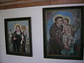
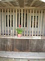
Media in category "Feldkapelle Ziegelhof (Eichstätt)"
The following 10 files are in this category, out of 10 total.
-
 Feldkapelle Ziegelhof-Wimpasing -1.jpg 2,048 × 1,536; 1,008 KB
-
 Feldkapelle Ziegelhof-Wimpasing -2.jpg 2,048 × 1,536; 1,003 KB
-
 Feldkapelle Ziegelhof-Wimpasing -4.jpg 1,536 × 2,048; 1.01 MB
-
 Feldkapelle Ziegelhof-Wimpasing -3.jpg 1,536 × 2,048; 903 KB
-
 Feldkapelle Ziegelhof-Wimpasing innen -1.jpg 2,048 × 1,536; 1.01 MB
-
 Feldkapelle Ziegelhof-Wimpasing innen -2.jpg 2,048 × 1,536; 959 KB
-
 Feldkapelle Ziegelhof-Wimpasing innen -3.jpg 1,536 × 2,048; 962 KB
-
 Feldkapelle Ziegelhof-Wimpasing innen -4.jpg 1,536 × 2,048; 945 KB
-
 Feldkapelle Ziegelhof-Wimpasing innen -5.jpg 1,536 × 2,048; 905 KB
-
 Feldkapelle Ziegelhof-Wimpasing innen -6.jpg 1,536 × 2,048; 969 KB


