Category:February 2011 floods in York
Jump to navigation
Jump to search
Media in category "February 2011 floods in York"
The following 13 files are in this category, out of 13 total.
-
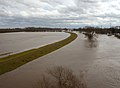
 Flooded River Ouse - geograph.org.uk - 2259916.jpg 480 × 640; 58 KB
-
 Have a Break - geograph.org.uk - 2265805.jpg 640 × 480; 88 KB
-
 National Route 65 - geograph.org.uk - 2265813.jpg 640 × 480; 101 KB
-
 Nether Poppleton - geograph.org.uk - 2265686.jpg 640 × 473; 72 KB
-
 Path to Nowhere - geograph.org.uk - 2265787.jpg 640 × 480; 53 KB
-
 Rawcliffe and Poppleton Ings - geograph.org.uk - 2265791.jpg 640 × 480; 58 KB
-
 Rawcliffe Ings - geograph.org.uk - 2265721.jpg 640 × 468; 53 KB
-
 Rawcliffe Ings - geograph.org.uk - 2265728.jpg 640 × 480; 59 KB
-
 Rawcliffe Ings - geograph.org.uk - 2265738.jpg 640 × 385; 44 KB
-
 Rawcliffe Ings - geograph.org.uk - 2265782.jpg 640 × 466; 62 KB
-
 Rawcliffe Ings - geograph.org.uk - 2265798.jpg 640 × 480; 51 KB
-
 Rawcliffe Ings - geograph.org.uk - 2265815.jpg 640 × 480; 92 KB
-
 White Rose Cycle Route - geograph.org.uk - 2265776.jpg 640 × 480; 72 KB


