Category:February 2010 in County Down
Jump to navigation
Jump to search
English: Images taken in County Down, Northern Ireland in this month of 2010 (not the date of the upload).
| Jan | Feb | Mar | Apr | May | Jun | Jul | Aug | Sep | Oct | Nov | Dec | ||
| ← | 46 | 56 | 50 | 41 | 45 | 4 | 28 | 38 | 42 | 19 | 26 | 47 | → |
|---|
Subcategories
This category has only the following subcategory.
D
- February 2010 in Down (district) (47 F)
Media in category "February 2010 in County Down"
The following 55 files are in this category, out of 55 total.
-
 "Welcome to Loyalist Ballybeen" - geograph.org.uk - 1706291.jpg 3,648 × 2,736; 4.97 MB
-
 A Bann-side farm near Mc Combs Bridge - geograph.org.uk - 1749809.jpg 1,024 × 575; 77 KB
-

-

-
 Abbeyfield House, Downpatrick, February 2010.JPG 4,272 × 2,848; 5.84 MB
-
 Apartments overlooking the Shimna River - geograph.org.uk - 1748727.jpg 1,024 × 769; 127 KB
-
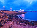 Back of the Eisenhower Pier, Bangor - geograph.org.uk - 1732848.jpg 640 × 480; 505 KB
-
 Ballymoney Hill, Banbridge (2) - geograph.org.uk - 1730056.jpg 640 × 392; 113 KB
-
 Bangor Marina - geograph.org.uk - 1720294.jpg 640 × 502; 309 KB
-
 Bangor Marina at night - geograph.org.uk - 1725045.jpg 640 × 410; 196 KB
-
 Bank of Ireland, Downpatrick, February 2010.JPG 4,272 × 2,848; 3.74 MB
-
 Belfast Road, Downpatrick, February 2010 (01).JPG 4,272 × 2,848; 5.24 MB
-
 Belfast Road, Downpatrick, February 2010 (02).JPG 4,272 × 2,848; 5.7 MB
-
 Belfast Road, Downpatrick, February 2010 (03).JPG 4,272 × 2,848; 6.2 MB
-
 Belvoir Street, Belfast - geograph.org.uk - 1727930.jpg 640 × 411; 90 KB
-
 Bonmarche, Downpatrick, February 2010.JPG 4,272 × 2,848; 3.97 MB
-
 BP petrol station, Downpatrick, February 2010.JPG 4,272 × 2,848; 4.62 MB
-
 Breens Lane sign, Downpatrick, February 2010.JPG 4,272 × 2,848; 6.05 MB
-
 Breens Lane, Downpatrick, February 2010.JPG 4,272 × 2,848; 5.46 MB
-
 Brendans Bar and Restaurant, Downpatrick, February 2010.JPG 4,272 × 2,848; 3.78 MB
-
 Bridge Street sign, Downpatrick, February 2010.JPG 4,272 × 2,848; 6.04 MB
-
 Bridge Street, Downpatrick, February 2010.JPG 4,272 × 2,848; 6.01 MB
-
 Cabin Bar, Downpatrick, February 2010 (02).JPG 4,272 × 2,848; 3.82 MB
-
 Cabin Bar, Downpatrick, February 2010 (03).JPG 2,848 × 4,272; 3.09 MB
-
 Castle Avenue, Castlewellan - geograph.org.uk - 1737638.jpg 1,024 × 648; 112 KB
-
 Church Road, Downpatrick, February 2010 (03).JPG 2,848 × 4,272; 7.33 MB
-
 Church Street road signs, Downpatrick, February 2010.JPG 4,272 × 2,848; 3.24 MB
-
 Church Street sign, Downpatrick, February 2010.JPG 4,272 × 2,848; 7.26 MB
-
 CourthouseDownpatrick 01.JPG 4,000 × 3,000; 4.69 MB
-
 CourthouseDownpatrick 02.JPG 3,000 × 4,000; 4.35 MB
-
 Dead tree, Edenderry, Belfast - geograph.org.uk - 1704071.jpg 607 × 366; 101 KB
-
 Down Cathedral, February 2010 (02).JPG 2,848 × 4,272; 9.23 MB
-
 Downpatrick Credit Union, February 2010.JPG 2,848 × 4,272; 4.05 MB
-
 Downpatrick High Cross, February 2010 (02).JPG 2,848 × 4,272; 4 MB
-
 Downpatrick Station, February 2010 (04).JPG 4,272 × 2,848; 7.3 MB
-
 Downpatrick Taxis, February 2010.JPG 4,272 × 2,848; 4.05 MB
-
 Early morning on the Clanrye River - geograph.org.uk - 1729965.jpg 1,024 × 768; 152 KB
-
 Field, Edenderry, Belfast - geograph.org.uk - 1704471.jpg 640 × 403; 100 KB
-

-
 Gate to Quoile, Belfast Road, Downpatrick, February 2010.JPG 4,272 × 2,848; 8.18 MB
-
 Glasswater Primary School, February 2010 (01).JPG 4,272 × 2,848; 5.41 MB
-
 Greystown Road sign, Downpatrick, February 2010 (02).JPG 4,272 × 2,848; 5.77 MB
-
 Grove Shopping Centre, Downpatrick, February 2010 (02).JPG 2,848 × 4,272; 3.32 MB
-
 Grove Shopping Centre, Downpatrick, February 2010 (03).JPG 2,848 × 4,272; 3.26 MB
-
 Path, Edenderry, Belfast - geograph.org.uk - 1704135.jpg 596 × 375; 92 KB
-

-

-
 Toals Bookmakers, Downpatrick, February 2010.JPG 4,272 × 2,848; 3.96 MB
-

-

-

-

-

-

-
 Workhouse memorial, Banbridge (7 of 7) - geograph.org.uk - 1731076.jpg 618 × 307; 112 KB


_-_geograph.org.uk_-_1730056.jpg)


.JPG)
.JPG)
.JPG)


.JPG)
.JPG)

.JPG)


.JPG)

.JPG)
.JPG)


_-_geograph.org.uk_-_1729697.jpg)

.JPG)
.JPG)
.JPG)
.JPG)


_2003_Optare_Solo_M850,_20_February_2010.jpg)
_-_geograph.org.uk_-_1730985.jpg)
_-_geograph.org.uk_-_1731000.jpg)
_-_geograph.org.uk_-_1731046.jpg)
_-_geograph.org.uk_-_1731057.jpg)
_-_geograph.org.uk_-_1731068.jpg)
_-_geograph.org.uk_-_1731076.jpg)