Category:February 2009 in the Metropolitan Borough of Calderdale
Jump to navigation
Jump to search
Media in category "February 2009 in the Metropolitan Borough of Calderdale"
The following 32 files are in this category, out of 32 total.
-

-
 Beacon Hill Road - geograph.org.uk - 1362626.jpg 640 × 480; 125 KB
-
 Bridleway off Danny Lane, Luddenden Foot - geograph.org.uk - 1170040.jpg 640 × 467; 140 KB
-

-
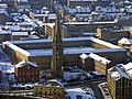
 Central Buildings, Sowerby Bridge - geograph.org.uk - 1181793.jpg 622 × 640; 167 KB
-
 Dean House Lane - geograph.org.uk - 1169031.jpg 640 × 480; 63 KB
-
 Gorple Cottages - geograph.org.uk - 1156498.jpg 640 × 426; 58 KB
-

-
 Hebble Court Mill - geograph.org.uk - 1843176.jpg 640 × 480; 94 KB
-
 Hebble Water - geograph.org.uk - 1843192.jpg 480 × 640; 106 KB
-
 Hebden Bridge Picture House - geograph.org.uk - 1385247.jpg 640 × 480; 97 KB
-
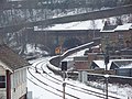
 Mytholmroyd Station - geograph.org.uk - 1199152.jpg 640 × 480; 114 KB
-
 Mytholmroyd Station - geograph.org.uk - 1199163.jpg 640 × 480; 125 KB
-

-
 Oxygrains Bridge - geograph.org.uk - 1177903.jpg 640 × 480; 96 KB
-
 Path (3306483299).jpg 1,790 × 2,509; 5.59 MB
-

-

-
 Rishworth School (3329390146).jpg 2,272 × 1,514; 3.16 MB
-
 River Ryburn (3316608827).jpg 1,920 × 2,560; 5.2 MB
-

-
 Sheepfold, Commons (3317416200).jpg 1,920 × 2,560; 3.34 MB
-
 Slush on Winding Road - geograph.org.uk - 1363291.jpg 480 × 633; 106 KB
-
 Snow in West Yorkshire, Feb 5 2009.jpg 4,000 × 3,000; 2.86 MB
-
 Styes Lane, Sowerby - geograph.org.uk - 1201100.jpg 640 × 480; 118 KB
-

-
-
 Towngate Avenue, Clifton - geograph.org.uk - 1180593.jpg 640 × 440; 76 KB
-
 Track to White Rock Farm - geograph.org.uk - 1169032.jpg 640 × 480; 66 KB
-
 Triangle Milestone - geograph.org.uk - 1195774.jpg 640 × 480; 90 KB
-
-
 View from the north end of Beacon Hill - geograph.org.uk - 1369479.jpg 640 × 480; 119 KB


.jpg)


.jpg)
.jpg)

.jpg)


