Category:Feanwâldsterwâl
Jump to navigation
Jump to search
| Object location | | View all coordinates using: OpenStreetMap |
|---|
human settlement in the Netherlands .jpg)    | |||||
| Upload media | |||||
| Instance of | |||||
|---|---|---|---|---|---|
| Named after | |||||
| Location | Dantumadiel, Friesland, Netherlands | ||||
| official website | |||||
 | |||||
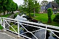
English: Feanwâldsterwâl (Dutch: Veenwoudsterwal) is a village in Dantumadiel and Tytsjerksteradiel, two municipalities in the Dutch province of Friesland.
Nederlands: Feanwâldsterwâl (Nederlands: Veenwoudsterwal) is een dorp in de Friese gemeentes Dantumadiel en Tytsjerksteradiel.
Subcategories
This category has only the following subcategory.
B
- Buildings in Feanwâldsterwâl (17 F)
Media in category "Feanwâldsterwâl"
The following 10 files are in this category, out of 10 total.
-
 20210609 Feanwaldsterwal.jpg 5,184 × 3,456; 4.07 MB
-
 20210609 tunneltje2 Feanwaldsterwal.jpg 4,032 × 3,024; 2.29 MB
-
 Feanwâldsterwâl, plaknammeboerd Dantumadiel.jpg 2,000 × 1,334; 1.49 MB
-
 Feanwâldsterwâl, plaknammeboerd Tytsjerksteradiel.jpg 2,000 × 1,334; 1.84 MB
-
 Feanwâldsterwâl.jpg 1,600 × 908; 208 KB
-
 Overzicht - Veenwouden - 20239090 - RCE.jpg 1,190 × 1,200; 283 KB
-
 Spoorbrug veenwoudsterwal IMG 4437.jpg 2,992 × 2,186; 1.11 MB
-
 Veenwoudsterwal - hoofdstraat (1).jpg 3,203 × 2,403; 2.47 MB
-
 Veenwoudsterwal - hoofdstraat (2).jpg 4,000 × 3,000; 3.9 MB
-
 Veenwoudsterwal - hoofdstraat (3).jpg 3,640 × 2,184; 3.06 MB


.jpg)
.jpg)