Category:Fawley, Hampshire
Jump to navigation
Jump to search
village and civil parish in Hampshire, England, United Kingdom  | |||||
| Upload media | |||||
| Instance of | |||||
|---|---|---|---|---|---|
| Location | New Forest, Hampshire, South East England, England | ||||
| Population |
| ||||
 | |||||
Subcategories
This category has the following 12 subcategories, out of 12 total.
A
B
C
F
- Fawley railway station (2 F)
H
L
O
- Fawley Refinery (88 F)
P
- Fawley Power Station (1 P, 85 F)
W
Media in category "Fawley, Hampshire"
The following 200 files are in this category, out of 755 total.
(previous page) (next page)-

-
 'The Lookout', Lepe - geograph.org.uk - 6044348.jpg 1,024 × 768; 453 KB
-
 12 pounder QF gun on the roof of Calshot Castle - geograph.org.uk - 6072954.jpg 1,600 × 900; 160 KB
-

-
 24 pounder guns at Calshot Castle - geograph.org.uk - 6072500.jpg 1,600 × 900; 341 KB
-
 9 pounder guns at Calshot Castle - geograph.org.uk - 6072372.jpg 1,600 × 900; 265 KB
-
 A buoy in Southampton Water - geograph.org.uk - 2654243.jpg 800 × 600; 211 KB
-
 A buoy in Southampton Water - geograph.org.uk - 2655052.jpg 800 × 600; 229 KB
-
 A flying boat at RAF Calshot - geograph.org.uk - 6216482.jpg 916 × 615; 204 KB
-
 A Red Funnel ferry - geograph.org.uk - 4250712.jpg 800 × 531; 81 KB
-

-
 All Saints, Fawley - geograph.org.uk - 5573488.jpg 640 × 476; 196 KB
-
 Ammunition locker on the roof of Calshot Castle - geograph.org.uk - 6072907.jpg 1,600 × 900; 331 KB
-
 Ancient barn at Stanswood - geograph.org.uk - 3459658.jpg 640 × 480; 246 KB
-
 Ancient oaks bestride Stanswood Road - geograph.org.uk - 3133291.jpg 3,124 × 2,543; 1.59 MB
-
 Approaching the oil terminal - geograph.org.uk - 5189051.jpg 640 × 427; 88 KB
-
 Approaching the oil terminal - geograph.org.uk - 5189055.jpg 640 × 427; 88 KB
-
 Arcadia off Calshot Spit - geograph.org.uk - 1915291.jpg 640 × 480; 133 KB
-
 Artwork on doors of Sunderland Hangar - geograph.org.uk - 5878018.jpg 1,024 × 683; 109 KB
-
 Ashlett Creek - geograph.org.uk - 5882128.jpg 1,600 × 1,200; 880 KB
-
 Ashlett Creek - geograph.org.uk - 6386606.jpg 1,024 × 683; 191 KB
-
 Ashlett Mill - geograph.org.uk - 4435435.jpg 1,024 × 768; 140 KB
-
 Ashlett Mill - geograph.org.uk - 6386583.jpg 1,024 × 683; 170 KB
-
 Ashlett Sailing Club - geograph.org.uk - 4435463.jpg 1,024 × 768; 117 KB
-
 Ashlett Sailing Club, seen from the hard - geograph.org.uk - 6386603.jpg 1,024 × 683; 121 KB
-
 Ashlett, access land - geograph.org.uk - 4435669.jpg 1,024 × 768; 212 KB
-
 Ashlett, footpath - geograph.org.uk - 4435677.jpg 1,024 × 768; 369 KB
-
 Ashlett, Jolly Sailor - geograph.org.uk - 4435414.jpg 1,024 × 768; 159 KB
-
 Ashlett, kissing gate - geograph.org.uk - 4435481.jpg 1,024 × 760; 144 KB
-
 Ashlett, moorings - geograph.org.uk - 4435450.jpg 1,024 × 765; 242 KB
-
 Ashlett, saltmarsh - geograph.org.uk - 4435661.jpg 1,024 × 753; 245 KB
-
 Ashlett, slipway - geograph.org.uk - 4435420.jpg 1,024 × 768; 174 KB
-
 B3053 enters Fawley - geograph.org.uk - 3132411.jpg 3,648 × 2,736; 2.33 MB
-
 B3053 south of Badminston Farm - geograph.org.uk - 3132884.jpg 3,310 × 2,454; 1.11 MB
-
 B3053 west of Ower Farm - geograph.org.uk - 3132890.jpg 3,587 × 2,643; 1.73 MB
-
 Badminston Common - geograph.org.uk - 3501863.jpg 640 × 427; 96 KB
-
 Badminston Common - geograph.org.uk - 4444040.jpg 1,024 × 759; 158 KB
-
 Badminston Common, cattle feeder - geograph.org.uk - 4444101.jpg 1,024 × 768; 146 KB
-
 Badminston Common, gate ^ stile - geograph.org.uk - 4444108.jpg 1,024 × 768; 188 KB
-
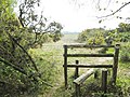 Badminston Common, stile - geograph.org.uk - 4444013.jpg 1,024 × 768; 269 KB
-
 Badminston Farm - geograph.org.uk - 5302133.jpg 640 × 427; 131 KB
-
 Badminston Farmhouse - geograph.org.uk - 4435964.jpg 1,024 × 768; 159 KB
-
 Badminston Lane - geograph.org.uk - 4435982.jpg 1,024 × 768; 287 KB
-
 Badminston Plantation, bridleway - geograph.org.uk - 4444164.jpg 1,024 × 768; 191 KB
-
 Badminston Plantation, embankment ^ ditch - geograph.org.uk - 4444171.jpg 1,024 × 768; 295 KB
-
 Badminston Plantation, forestry road - geograph.org.uk - 4444121.jpg 1,024 × 768; 202 KB
-
 Badminston Plantation, road junction - geograph.org.uk - 4444150.jpg 1,024 × 768; 233 KB
-
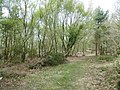 Badminston, woodland - geograph.org.uk - 4444176.jpg 1,024 × 768; 321 KB
-
 Barracks on the first floor of Calshot Castle. - geograph.org.uk - 6072621.jpg 1,600 × 900; 219 KB
-

-
 Beach alongside Houston House, Calshot Spit - geograph.org.uk - 6069362.jpg 1,600 × 900; 332 KB
-
 Beach and beach huts at Calshot - geograph.org.uk - 6068398.jpg 1,600 × 900; 400 KB
-
 Beach at Lepe Country Park - geograph.org.uk - 6549060.jpg 1,600 × 1,067; 355 KB
-
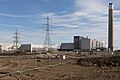
 Beach by Fawley Power Station - geograph.org.uk - 4045870.jpg 1,600 × 1,159; 473 KB
-
 Beach hardening mats - geograph.org.uk - 2695426.jpg 2,272 × 1,704; 2.67 MB
-
 Beach huts on Calshot Spit - geograph.org.uk - 5877996.jpg 1,024 × 683; 163 KB
-
 Beach huts, Calshot - geograph.org.uk - 4039393.jpg 1,600 × 976; 181 KB
-
 Beacon near Fawley - geograph.org.uk - 6654255.jpg 1,024 × 768; 115 KB
-
 Bench with a view - geograph.org.uk - 3464888.jpg 1,500 × 1,000; 215 KB
-
 Bench with a view of the Isle of Wight - geograph.org.uk - 3464914.jpg 1,500 × 978; 183 KB
-
 Bethany Gospel Hall, Holbury - geograph.org.uk - 3580912.jpg 3,130 × 2,368; 1.17 MB
-
 Blackfield Cemetery - geograph.org.uk - 2621591.jpg 1,024 × 768; 251 KB
-
 Blackfield, gates - geograph.org.uk - 4443891.jpg 1,024 × 768; 287 KB
-
 Blackfield, Green Lane - geograph.org.uk - 4443868.jpg 1,024 × 736; 200 KB
-
 Blackfield, marsh - geograph.org.uk - 4443925.jpg 1,024 × 768; 293 KB
-
 Blackfield, Mopley - geograph.org.uk - 4443861.jpg 1,024 × 768; 200 KB
-
 Blackfield, recreation ground - geograph.org.uk - 4443883.jpg 1,024 × 768; 141 KB
-
 Blackfield, stream - geograph.org.uk - 4443909.jpg 1,024 × 768; 321 KB
-
 Blackwell Common - geograph.org.uk - 2621511.jpg 1,024 × 768; 211 KB
-
 Blackwell Common, cattle grid - geograph.org.uk - 2621583.jpg 1,024 × 768; 287 KB
-
 Blackwell Common, pony - geograph.org.uk - 2621514.jpg 1,024 × 768; 240 KB
-
 Blade Runner Two, Southampton Water - geograph.org.uk - 5572751.jpg 640 × 460; 104 KB
-
 Boat and jetties near Ashlett - geograph.org.uk - 3502302.jpg 640 × 427; 74 KB
-
 Boats at Ashlett Creek - geograph.org.uk - 3739782.jpg 800 × 600; 255 KB
-
 Bollards across the shore path - geograph.org.uk - 6386756.jpg 1,024 × 683; 200 KB
-
 Bridleway to Dean's Bridge - geograph.org.uk - 438574.jpg 640 × 480; 144 KB
-

-
 Buildings at Calshot Activities Centre - geograph.org.uk - 6069961.jpg 1,600 × 900; 361 KB
-

-
 Buildings at Calshot Spit - geograph.org.uk - 6070065.jpg 1,600 × 900; 222 KB
-
 Buildings at Ower Farm - geograph.org.uk - 5302168.jpg 640 × 427; 116 KB
-
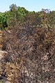 Burnt furze, Tom's Down - geograph.org.uk - 438640.jpg 427 × 640; 124 KB
-

-

-

-

-

-

-
 Cadland Marker Buoy - geograph.org.uk - 5189053.jpg 640 × 427; 90 KB
-
 Cadland Marker Buoy, Southampton Water - geograph.org.uk - 5045893.jpg 640 × 481; 384 KB
-
 Cadland Port Channel Buoy and cargo ships - geograph.org.uk - 1935754.jpg 2,048 × 1,536; 1.21 MB
-
 Cadland Port Channel Buoy, Southampton Water - geograph.org.uk - 2592550.jpg 3,748 × 2,811; 6.65 MB
-
 Calshot - Sunderland Hangar - geograph.org.uk - 6199112.jpg 1,479 × 1,000; 954 KB
-
 Calshot Activities Centre - geograph.org.uk - 6192261.jpg 1,024 × 768; 183 KB
-
 Calshot Activities Centre, Simulated rock climbing - geograph.org.uk - 4893686.jpg 3,678 × 2,455; 5.21 MB
-
 Calshot Castle - Bridge over moat to entrance - geograph.org.uk - 6199047.jpg 1,000 × 1,369; 1.25 MB
-
 Calshot Castle - geograph.org.uk - 4589208.jpg 2,592 × 1,944; 937 KB
-
 Calshot Castle - geograph.org.uk - 4590038.jpg 1,024 × 768; 197 KB
-
 Calshot Castle - geograph.org.uk - 4893630.jpg 3,522 × 2,332; 4.35 MB
-
 Calshot Castle - geograph.org.uk - 4893632.jpg 4,081 × 2,548; 4.39 MB
-
 Calshot Castle - geograph.org.uk - 5878020.jpg 1,024 × 683; 190 KB
-
 Calshot Castle - geograph.org.uk - 6070101.jpg 1,600 × 900; 249 KB
-
 Calshot Castle - geograph.org.uk - 6070104.jpg 1,600 × 742; 304 KB
-
 Calshot Castle - geograph.org.uk - 6192293.jpg 1,024 × 768; 237 KB
-
 Calshot Castle - geograph.org.uk - 6199044.jpg 1,235 × 1,000; 1,005 KB
-
 Calshot Castle - geograph.org.uk - 6371818.jpg 4,160 × 3,120; 2.39 MB
-
 Calshot Castle - geograph.org.uk - 6371947.jpg 3,551 × 1,997; 1.56 MB
-
 Calshot Castle - Small roofs over outer buildings - geograph.org.uk - 6199051.jpg 1,689 × 1,000; 1.47 MB
-

-
 Calshot Castle and Fawley Power Station - geograph.org.uk - 4256281.jpg 1,024 × 680; 107 KB
-

-
 Calshot Castle and Sunderland Hangar - geograph.org.uk - 5878009.jpg 1,024 × 683; 178 KB
-

-
 Calshot Castle, entrance detail - geograph.org.uk - 4893647.jpg 3,564 × 2,265; 5.07 MB
-

-

-

-
 Calshot Lifeboat Station - geograph.org.uk - 4590029.jpg 1,024 × 762; 117 KB
-
 Calshot Lifeboat Station - geograph.org.uk - 6069996.jpg 1,600 × 900; 261 KB
-

-
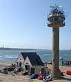
 Calshot NCI Tower - geograph.org.uk - 6372441.jpg 3,120 × 4,160; 397 KB
-
 Calshot Road, Fawley. - geograph.org.uk - 1541901.jpg 640 × 480; 60 KB
-
 Calshot Sailing Club - geograph.org.uk - 4039413.jpg 1,600 × 919; 230 KB
-
 Calshot Spit - geograph.org.uk - 5049755.jpg 640 × 480; 391 KB
-
 Calshot Spit Beach and Sailing Club - geograph.org.uk - 5421792.jpg 640 × 427; 376 KB
-

-
 Calshot Tower and RNLI station - geograph.org.uk - 6199018.jpg 1,000 × 1,165; 774 KB
-

-
 Calshot, algae - geograph.org.uk - 4590010.jpg 1,024 × 750; 223 KB
-
 Calshot, castle entrance - geograph.org.uk - 4070112.jpg 480 × 640; 72 KB
-

-
 Calshot, Creek Slipway - geograph.org.uk - 4590053.jpg 1,024 × 768; 173 KB
-
 Calshot, Lawrence House - geograph.org.uk - 4590017.jpg 1,024 × 768; 144 KB
-
 Calshot, Lomax puts on a display (1) - geograph.org.uk - 4070071.jpg 640 × 480; 33 KB
-
 Calshot, Lomax puts on a display (2) - geograph.org.uk - 4070076.jpg 480 × 640; 30 KB
-
 Calshot, Lomax puts on a display (3) - geograph.org.uk - 4070078.jpg 640 × 480; 49 KB
-
 Calshot, Lomax puts on a display (4) - geograph.org.uk - 4070084.jpg 480 × 640; 24 KB
-
 Calshot, Lomax puts on a display (5) - geograph.org.uk - 4070085.jpg 640 × 480; 37 KB
-
 Calshot, Lomax puts on a display (6) - geograph.org.uk - 4070088.jpg 640 × 481; 33 KB
-

-

-
 Calshot, muddy shingle - geograph.org.uk - 4590007.jpg 1,024 × 751; 232 KB
-
 Calshot, path between moat and shore - geograph.org.uk - 4070116.jpg 640 × 480; 73 KB
-
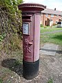 Calshot, postbox № SO45 165 - geograph.org.uk - 4069978.jpg 480 × 640; 117 KB
-
 Calshot, sand - geograph.org.uk - 4589990.jpg 1,024 × 768; 145 KB
-
 Calshot, shingle - geograph.org.uk - 4589999.jpg 1,024 × 763; 205 KB
-
 Calshot, shingle bar - geograph.org.uk - 4589980.jpg 1,024 × 763; 221 KB
-
 Calshot, Sopwith Hangar - geograph.org.uk - 4590045.jpg 1,024 × 768; 127 KB
-
 Calshot, Sunderland Hangar - geograph.org.uk - 4590021.jpg 1,024 × 768; 212 KB
-
 Calshot, the air ambulance comes in - geograph.org.uk - 4070134.jpg 640 × 481; 36 KB
-

-

-

-

-

-

-

-
 Calshot, top of the lookout tower - geograph.org.uk - 4070069.jpg 640 × 480; 41 KB
-

-
 Calshot, Yachts - geograph.org.uk - 4893641.jpg 4,574 × 3,032; 6.97 MB
-

-
 Cemex sign - geograph.org.uk - 2835898.jpg 1,024 × 768; 303 KB
-
 Church of St. Francis, West Common - geograph.org.uk - 3727803.jpg 640 × 427; 89 KB
-
 Close shave ^ - geograph.org.uk - 6752902.jpg 3,803 × 2,852; 2.88 MB
-
 Closed Cemex Quarry - geograph.org.uk - 2835891.jpg 1,024 × 768; 305 KB
-
 Concrete 'lay-by' by Whitefield Farm - geograph.org.uk - 3456192.jpg 640 × 480; 200 KB
-
 Coniferous woodland west of Stanswood Road - geograph.org.uk - 3132930.jpg 3,648 × 2,736; 3 MB
-
 Copthorne Lane, Fawley, Hampshire - geograph.org.uk - 6152813.jpg 1,280 × 1,024; 382 KB
-
 Copthorne Nursery, Fawley - geograph.org.uk - 6152820.jpg 1,233 × 999; 316 KB
-
 Cows, Badminston Common - geograph.org.uk - 438570.jpg 640 × 427; 82 KB
-
 Daffodil Dell, Fawley - geograph.org.uk - 6152871.jpg 1,024 × 819; 467 KB
-
 Dean's Bridge, Floating Island valley - geograph.org.uk - 438657.jpg 640 × 480; 131 KB
-

-
 Derelict hardstanding - geograph.org.uk - 5882138.jpg 1,600 × 1,200; 970 KB
-
 Derelict Oil Refinery works - geograph.org.uk - 6152860.jpg 1,024 × 819; 300 KB
-

-

-

-

-
 Development at Lepe - geograph.org.uk - 5684706.jpg 640 × 480; 172 KB
-
 Direction Sign – Signpost - geograph.org.uk - 6518314.jpg 489 × 882; 158 KB
-
 Direction Sign – Signpost - geograph.org.uk - 6518345.jpg 540 × 960; 169 KB
-
 Direction Sign – Signpost - geograph.org.uk - 6518350.jpg 471 × 849; 184 KB
-

-

-
 Disused track beside Fawley Power Station - geograph.org.uk - 5882134.jpg 1,600 × 1,200; 1.18 MB
-

-
 Drainage ditch beside Stanswood Road - geograph.org.uk - 6386639.jpg 1,024 × 683; 327 KB
-
 Driveway to Cadland House - geograph.org.uk - 3459656.jpg 640 × 480; 292 KB
-
 Edge of field beside Rollestone Road - geograph.org.uk - 4861722.jpg 640 × 427; 131 KB
-
-
 Entering Langley from the south - geograph.org.uk - 3456181.jpg 640 × 480; 188 KB
-
 Entrance to Fawley Quarry - geograph.org.uk - 859824.jpg 640 × 426; 65 KB
-
 Entrance to the former Fawley Quarry - geograph.org.uk - 3168945.jpg 4,752 × 3,168; 3.44 MB
-
 Falcon Hotel, The Square, Fawley (NHLE Code 1178744) (July 2021).JPG 2,600 × 1,800; 1.62 MB
-

-
 Fawley , Calshot Scenery - geograph.org.uk - 6693110.jpg 6,000 × 4,000; 7.61 MB
-
 Fawley , Calshot Scenery - geograph.org.uk - 6693115.jpg 6,000 × 4,000; 7.63 MB
-
 Fawley , Calshot Scenery - geograph.org.uk - 6693119.jpg 6,000 × 4,000; 7.25 MB
-
 Fawley , Marine Terminal - geograph.org.uk - 6655611.jpg 6,000 × 4,000; 7.42 MB


_-_geograph.org.uk_-_4163576.jpg)
_-_geograph.org.uk_-_4163593.jpg)
_-_geograph.org.uk_-_4163602.jpg)
_-_geograph.org.uk_-_4163612.jpg)
_-_geograph.org.uk_-_4163639.jpg)
_-_geograph.org.uk_-_4163606.jpg)


_-_geograph.org.uk_-_4070071.jpg)
_-_geograph.org.uk_-_4070076.jpg)
_-_geograph.org.uk_-_4070078.jpg)
_-_geograph.org.uk_-_4070084.jpg)
_-_geograph.org.uk_-_4070085.jpg)
_-_geograph.org.uk_-_4070088.jpg)


_-_geograph.org.uk_-_5572774.jpg)
_-_geograph.org.uk_-_5573469.jpg)
_-_geograph.org.uk_-_5573473.jpg)
_-_geograph.org.uk_-_5573476.jpg)


_(July_2021).JPG)


