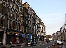
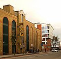
Category:Farringdon Road
Jump to navigation
Jump to search
street in the London Boroughs of Camden and Islington | |||||
| Upload media | |||||
| Instance of | |||||
|---|---|---|---|---|---|
| Location |
| ||||
| Connects with | |||||
| Different from | |||||
 | |||||
Subcategories
This category has the following 6 subcategories, out of 6 total.
Media in category "Farringdon Road"
The following 68 files are in this category, out of 68 total.
-
79 Farringdon Road, London, June 2023.jpg 3,456 × 4,608; 2.65 MB
-
88-94 Farringdon Road, Clerkenwell, June 2022.jpg 4,032 × 3,024; 3.46 MB
-
94 Farringdon Road, Clerkenwell, June 2022.jpg 4,032 × 3,024; 3.87 MB
-
A201, Farringdon Rd - geograph.org.uk - 4287070.jpg 640 × 430; 77 KB
-
Betsey Trotwood pub, Farringdon Road, London - DSC08172.JPG 3,648 × 2,736; 3.49 MB
-
Betsey Trotwood, Clerkenwell, EC1 (2487256440).jpg 960 × 1,280; 366 KB
-
Car park building, Farringdon Road, EC1 - geograph.org.uk - 4750006.jpg 1,606 × 1,554; 797 KB
-
Cattle trough on the Ray Street Bridge, Farringdon, March 2022.jpg 4,032 × 3,024; 5.39 MB
-
Cattle trough, Farringdon Lane - geograph.org.uk - 2508544.jpg 640 × 474; 216 KB
-
Clerkenwell, Farringdon Road - geograph.org.uk - 4506102.jpg 640 × 481; 310 KB
-
Commercial buildings on Farringdon Road - geograph.org.uk - 2857967.jpg 1,024 × 768; 179 KB
-
Corporation Buildings, Farringdon Road.jpg 1,024 × 647; 220 KB
-
Detail of 25-27 Farringon Road - geograph.org.uk - 2508299.jpg 474 × 640; 234 KB
-
Dwellings for the poor. Wellcome L0004817.jpg 1,226 × 1,582; 1.11 MB
-
Eagle, Clerkenwell, EC1 (2587948043).jpg 3,776 × 2,520; 3.81 MB
-
Farringdon Rd, London, looking south - geograph.org.uk - 1366257.jpg 640 × 480; 100 KB
-
Farringdon Road - geograph.org.uk - 3158596.jpg 522 × 640; 140 KB
-
Farringdon Road - geograph.org.uk - 3158718.jpg 640 × 480; 128 KB
-
Farringdon Road - geograph.org.uk - 4772717.jpg 640 × 427; 89 KB
-
Farringdon Road - geograph.org.uk - 679514.jpg 640 × 464; 160 KB
-
Farringdon Road at the junction of Rosebery Avenue - geograph.org.uk - 3105374.jpg 4,608 × 3,456; 4.77 MB
-
Farringdon Road from Holborn Viaduct - 38192137701.jpg 3,072 × 2,304; 1.4 MB
-
Farringdon Road from Holborn Viaduct.jpg 3,072 × 2,304; 1.44 MB
-
Farringdon Road heading north - geograph.org.uk - 5749780.jpg 640 × 480; 119 KB
-
Farringdon Road heading north - geograph.org.uk - 5749786.jpg 640 × 480; 117 KB
-
Farringdon Road heading north - geograph.org.uk - 5749881.jpg 640 × 480; 112 KB
-
Farringdon Road heading north - geograph.org.uk - 5749886.jpg 640 × 480; 110 KB
-
Farringdon Road, Clerkenwell - geograph.org.uk - 3105249.jpg 2,048 × 1,536; 1.52 MB
-
Farringdon Road, Clerkenwell - geograph.org.uk - 3105384.jpg 2,048 × 1,458; 459 KB
-
Farringdon Road, Clerkenwell - geograph.org.uk - 975274.jpg 480 × 639; 115 KB
-
Farringdon Road, London EC1 - geograph.org.uk - 5657828.jpg 640 × 454; 164 KB
-
Farringdon Road, London EC1M - geograph.org.uk - 1222664.jpg 640 × 480; 93 KB
-
Farringdon Road.jpg 471 × 539; 219 KB
-
Finsbury, Farringdon Road - geograph.org.uk - 4506082.jpg 640 × 480; 267 KB
-
Former Post Office, Faringdon Road. EC1.jpg 2,133 × 1,600; 490 KB
-
Fully Nude Tables Dancers Venus 2005.jpg 2,560 × 1,920; 2.79 MB
-
Ghost, Farringdon, EC1 (3779148340).jpg 2,370 × 3,555; 3.39 MB
-
Havana Bar Latin Square, Farringdon, EC1 (2804291678).jpg 960 × 1,280; 365 KB
-
Holborn Viaduct from Farringdon Road - geograph.org.uk - 4506117.jpg 640 × 480; 306 KB
-
London EC1, Farringdon Road - geograph.org.uk - 2325483.jpg 3,456 × 2,304; 5.92 MB
-
London EC1, The 'Betsey Trotwood', Farringdon Road - geograph.org.uk - 2325493.jpg 3,456 × 2,304; 5.21 MB
-
Plaque marking historic site, Clerkenwell - geograph.org.uk - 2053630.jpg 1,536 × 2,048; 1.49 MB
-
Post boxes, Former Farringdon Road Branch post Office March 2011.jpg 2,133 × 1,600; 427 KB
-
Stakingen, SFA022820531.jpg 3,544 × 2,536; 1.35 MB
-
The Eagle, EC1.jpg 2,054 × 1,539; 796 KB
-
The Eagle, Farringdon Rd, London - geograph.org.uk - 2570715.jpg 3,296 × 2,472; 1.85 MB
-
The Eagle, Farringdon Road - geograph.org.uk - 2259330.jpg 640 × 480; 116 KB
-
The Quality Chop House, Farringdon.jpg 4,032 × 3,024; 4.35 MB
-
The Zeppelin Building, Farringdon Rd, London - geograph.org.uk - 2570672.jpg 3,296 × 2,472; 1.74 MB
-
Traffic Lights, Farringdon Road, EC1 - geograph.org.uk - 825231.jpg 640 × 480; 136 KB
-
View down Farringdon Road, London, June 2023 (1).jpg 4,032 × 3,024; 4.58 MB
-
View down Farringdon Road, London, June 2023 (2).jpg 3,024 × 4,032; 3.51 MB
-
Zeppelin bombing plaque 2005.jpg 2,300 × 1,775; 1.65 MB
-
Zeppelin Building plaque.JPG 3,648 × 2,736; 3.96 MB
-
Zeppelin Building, Drill Hall entrance.JPG 3,648 × 2,736; 3.86 MB
-
Zeppelin Building, London.JPG 3,648 × 2,736; 4.25 MB
-
Zeppelin raid commemorated, Farringdon Road - geograph.org.uk - 2234946.jpg 1,024 × 768; 107 KB
-
Zeppelin Raid plaque, 61 Farringdon Road, London, England, IMG 5217 edit.jpg 4,096 × 3,072; 7.37 MB


