Category:Farranfore
Jump to navigation
Jump to search
English: Farranfore is a village in County Kerry, Ireland. It lies on the N22 road approximately midway between Tralee (17 km) and Killarney (15km) and on the railway line connecting those two towns.
Gaeilge: Sráidbhaile in Éirinn is ea an Fearann Fuar. Tá an sráidbhaile suite in iardheisceart na tíre i gContae Chiarraí idir Trá Lí agus Cill Airne. Tá Aerfort Chiarraí suite san Fhearann Fuar.
Русский: Фарранфор — деревня в графстве Керри, Ирландия. Расположена на юго-западе страны в 17 км от города Трали на шоссе национального значения N22.
village in County Kerry, Ireland  | |||||
| Upload media | |||||
| Instance of | |||||
|---|---|---|---|---|---|
| Location | County Kerry, Munster, Ireland | ||||
 | |||||
Subcategories
This category has the following 2 subcategories, out of 2 total.
F
- Farranfore railway station (8 F)
K
Media in category "Farranfore"
The following 31 files are in this category, out of 31 total.
-
 Approaching Farranfore - geograph.org.uk - 6315194.jpg 800 × 601; 723 KB
-
 Departing Farranfore - geograph.org.uk - 5573266.jpg 4,000 × 3,000; 3.62 MB
-
 Driveway near Ballybrack - geograph.org.uk - 1324476.jpg 640 × 480; 56 KB
-
 Driveway near Leamnaguila - geograph.org.uk - 1324501.jpg 640 × 480; 123 KB
-
 Farm track off the N23, Farranfore - geograph.org.uk - 4686053.jpg 640 × 427; 65 KB
-
 Farm track off the N23, Farranfore - geograph.org.uk - 5942224.jpg 2,000 × 1,509; 789 KB
-
 Farmland near Ballybrack - geograph.org.uk - 1324480.jpg 640 × 480; 78 KB
-

-
 Farranfore - geograph.org.uk - 6315189.jpg 800 × 601; 656 KB
-
 Farranfore Level Crossing - geograph.org.uk - 6315177.jpg 800 × 533; 540 KB
-
 Farranfore Main Street - geograph.org.uk - 6315184.jpg 800 × 601; 573 KB
-
 Farranfore station - geograph.org.uk - 3654866.jpg 3,360 × 2,244; 4.7 MB
-
 Farranfore station building - geograph.org.uk - 5573263.jpg 4,000 × 2,857; 3.29 MB
-
 Farranfore Station in the rain - geograph.org.uk - 6423573.jpg 1,024 × 768; 137 KB
-
 Farranfore, County Kerry. - geograph.org.uk - 1527740.jpg 640 × 360; 59 KB
-
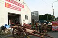
 Herlihy's Bar, Farranfore - geograph.org.uk - 5812480.jpg 1,024 × 768; 130 KB
-

-
 Main Street, Farranfore - geograph.org.uk - 6315181.jpg 800 × 533; 537 KB
-
 N22 approaching Farranfore - geograph.org.uk - 6315192.jpg 800 × 533; 538 KB
-
 N23 approaching Kerry Airport - geograph.org.uk - 6315163.jpg 800 × 533; 585 KB
-
 N23 north of Farranfore - geograph.org.uk - 6315167.jpg 800 × 533; 534 KB
-

-
-
 Pharmacy by the N22 at Farranfore - geograph.org.uk - 4686074.jpg 640 × 427; 65 KB
-
 Ruined building near Farranfore Station - geograph.org.uk - 5942219.jpg 2,000 × 1,500; 1.06 MB
-
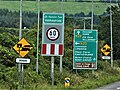 Signs-1070497, Farranfore, Co. Kerry, Ireland.jpg 4,896 × 3,672; 4.43 MB
-
 Skoda dealership, Farranfore - geograph.org.uk - 4686240.jpg 640 × 241; 36 KB
-
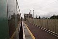
 The footbridge, Farranfore railway station - geograph.org.uk - 5812468.jpg 1,024 × 768; 165 KB
-
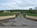
 The road to Killarney - geograph.org.uk - 1324488.jpg 640 × 480; 80 KB
-
 Farranfore, Co. Kerry - geograph.org.uk - 372444.jpg 640 × 425; 122 KB
-


