Category:Farms in the Metropolitan Borough of Kirklees
Jump to navigation
Jump to search
Subcategories
This category has the following 9 subcategories, out of 9 total.
H
- Heights Farm, Kirklees (5 F)
- Hey Beck Farm (2 F)
- Heywoods Farm, Slaithwaite (4 F)
- Hunsworth Lodge Farm (3 F)
L
- Leys Farm, Longwood (5 F)
O
- O'Cot (6 F)
P
- Padanaram Farm (2 F)
Media in category "Farms in the Metropolitan Borough of Kirklees"
The following 41 files are in this category, out of 41 total.
-

-
 A path leading to Gosling Green Farm - geograph.org.uk - 2987220.jpg 800 × 600; 123 KB
-
 A62 looking south - geograph.org.uk - 2881705.jpg 4,272 × 2,848; 3.6 MB
-

-
 Approaching The Lumb - geograph.org.uk - 4379425.jpg 4,857 × 3,439; 3.69 MB
-
 Approaching weather front - geograph.org.uk - 5260532.jpg 1,024 × 768; 92 KB
-
 Bank House Farm - geograph.org.uk - 2923664.jpg 1,024 × 768; 143 KB
-
 Barrett, Slaithwaite Sun Side - geograph.org.uk - 3215198.jpg 2,000 × 1,500; 1,010 KB
-

-
 Blake Clough Farm - geograph.org.uk - 2562025.jpg 3,872 × 2,592; 4.63 MB
-
 Boggard Ing Farm - geograph.org.uk - 2755596.jpg 1,024 × 768; 140 KB
-
 Brookfield Farm, Scholes - geograph.org.uk - 378907.jpg 640 × 439; 98 KB
-
 Church Royd Farm, Whitley Lower - cowshed - geograph.org.uk - 5260477.jpg 1,024 × 768; 132 KB
-
 Church Royd Farm, Whitley Lower - geograph.org.uk - 5260476.jpg 1,024 × 768; 122 KB
-
 Cut benchmark at Delight Farm, Scammonden - geograph.org.uk - 2781745.jpg 3,072 × 2,304; 1.46 MB
-
 Holmroyd Wood, near Oldfield - geograph.org.uk - 1260410.jpg 640 × 442; 136 KB
-
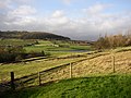
 Kirklees Way at Sunnybank Farm - geograph.org.uk - 6054808.jpg 1,600 × 1,064; 964 KB
-

-
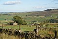
 Longwood valley - geograph.org.uk - 289529.jpg 640 × 480; 105 KB
-
 Maple Farm, Houses Hill - geograph.org.uk - 901860.jpg 640 × 480; 88 KB
-
 Marsh Farm - South View Road - geograph.org.uk - 492298.jpg 640 × 461; 61 KB
-
 Marsh Farm, Shepley - geograph.org.uk - 3220556.jpg 2,048 × 1,536; 743 KB
-
 Meltham Road, Lingards - geograph.org.uk - 3600252.jpg 2,000 × 1,175; 561 KB
-
 Mock Hall Farm, Leeds Road - geograph.org.uk - 6347897.jpg 2,000 × 1,287; 1.2 MB
-
 Moor Royd, near Upper Denby - geograph.org.uk - 99617.jpg 640 × 426; 120 KB
-
 Moss Edge, Cartworth - geograph.org.uk - 932593.jpg 640 × 471; 54 KB
-
 Moss, Crimea Lane - geograph.org.uk - 3606223.jpg 2,000 × 1,476; 872 KB
-

-
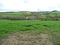
 Path to Clayton Hall Farm - geograph.org.uk - 191527.jpg 640 × 480; 105 KB
-
 Ponker Farm - Skelmanthorpe - geograph.org.uk - 498276.jpg 640 × 428; 166 KB
-
 Ready for milking - geograph.org.uk - 546020.jpg 640 × 480; 89 KB
-
 Riley Lane, Kirkburton - geograph.org.uk - 395397.jpg 640 × 483; 79 KB
-
 Sledgate Lane and Foxstone Edge Farm, Lingards - geograph.org.uk - 4700204.jpg 2,048 × 1,536; 788 KB
-
 Sledgate Lane and ruined farmstead, Lingards - geograph.org.uk - 4700161.jpg 2,048 × 1,536; 999 KB
-
 Stile on Colne Valley Circular Walk at Heywoods Farm - geograph.org.uk - 3628402.jpg 2,000 × 1,475; 1.37 MB
-

-
 Thurgory Lane approaching Copriding Farm - geograph.org.uk - 3711274.jpg 1,600 × 1,200; 703 KB
-
 Thurgory Lane, Lepton - geograph.org.uk - 558864.jpg 640 × 480; 110 KB
-

-
 Unusual fence, Leys Farm, Longwood - geograph.org.uk - 465029.jpg 640 × 480; 84 KB
-
 View from Pole Hill (4400854193).jpg 2,474 × 1,629; 2.91 MB


.jpg)