Category:Farms in the Metropolitan Borough of Bolton
Jump to navigation
Jump to search
Subcategories
This category has only the following subcategory.
F
Media in category "Farms in the Metropolitan Borough of Bolton"
The following 61 files are in this category, out of 61 total.
-
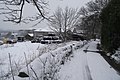
 Ashes Farm - geograph.org.uk - 107020.jpg 640 × 480; 88 KB
-
 Back Gates Farm, Over Hulton - geograph.org.uk - 103881.jpg 640 × 480; 106 KB
-
 Bowstone Hill Farm - geograph.org.uk - 1897232.jpg 3,872 × 2,499; 3.49 MB
-
 Brookfold Farm on Brookfold Lane, Harwood - geograph.org.uk - 3304026.jpg 1,024 × 682; 607 KB
-
 Brookfold Farm, Harwood - geograph.org.uk - 118287.jpg 640 × 480; 118 KB
-
 Brookfold Farmhouse - geograph.org.uk - 2337010.jpg 2,362 × 1,702; 1.91 MB
-
 Buffs Farm - geograph.org.uk - 1264627.jpg 640 × 480; 74 KB
-
 Buffs Farm - geograph.org.uk - 2069194.jpg 3,872 × 2,485; 3.33 MB
-
 Burns Animal Food Manufacturer - geograph.org.uk - 104040.jpg 640 × 480; 80 KB
-
 Chadwick's Close Farm - geograph.org.uk - 2351820.jpg 4,000 × 3,000; 4.99 MB
-
 Clifton House Farm - geograph.org.uk - 1775427.jpg 2,816 × 2,112; 1.37 MB
-
 Crompton's Farm - geograph.org.uk - 2363456.jpg 3,598 × 2,598; 3.44 MB
-
 Cubbins Farm - geograph.org.uk - 2747234.jpg 3,872 × 2,592; 4.46 MB
-
 Cubbins Farm, Dunscar - geograph.org.uk - 3373865.jpg 1,024 × 616; 415 KB
-
 Entrance to Bryan Hey Farm - geograph.org.uk - 2618543.jpg 4,000 × 3,000; 4.8 MB
-
 Farm Buildings At Harricroft Farm.jpg 4,032 × 3,024; 4 MB
-
 Farm outside Egerton (geograph 2859065).jpg 3,596 × 2,396; 2.92 MB
-
 Farm, Affetside - geograph.org.uk - 470105.jpg 640 × 480; 46 KB
-
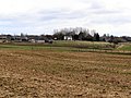 Farmland - geograph.org.uk - 1709164.jpg 1,024 × 768; 307 KB
-
 Five Acre Farm - geograph.org.uk - 1709173.jpg 1,024 × 768; 231 KB
-
 Gilligant's Farm - geograph.org.uk - 4864100.jpg 640 × 480; 478 KB
-
 Gilligant's Farm - geograph.org.uk - 4865275.jpg 640 × 481; 457 KB
-
 Gilligants Farm - geograph.org.uk - 116153.jpg 640 × 480; 107 KB
-
 Grazing, Atkinson's Farm - geograph.org.uk - 3375606.jpg 640 × 480; 51 KB
-
 Greenside Farm - geograph.org.uk - 1753531.jpg 2,816 × 2,112; 1.39 MB
-
 Harricroft Farm - geograph.org.uk - 119352.jpg 640 × 480; 149 KB
-
 Hill End Farm - geograph.org.uk - 119399.jpg 640 × 480; 96 KB
-
 Holden's Farm - geograph.org.uk - 2350473.jpg 3,148 × 2,268; 4.05 MB
-
 Holden's Farm - geograph.org.uk - 2712232.jpg 3,872 × 2,592; 2.77 MB
-
 Holts Fold Farm - geograph.org.uk - 2178645.jpg 800 × 600; 199 KB
-
 Holts Fold Farm - geograph.org.uk - 2178650.jpg 800 × 600; 290 KB
-
 Hooper Green Farm from Platt Lane - geograph.org.uk - 2724808.jpg 3,899 × 2,333; 4.38 MB
-
 Hooper Green farm, Westhoughton - geograph.org.uk - 103875.jpg 640 × 480; 76 KB
-
 Howarth's Farm, Affetside - geograph.org.uk - 470094.jpg 640 × 480; 97 KB
-
 Hoyles Fold Farm - geograph.org.uk - 119389.jpg 640 × 480; 100 KB
-
 Little Stanrose Farm - geograph.org.uk - 2859041.jpg 2,667 × 1,997; 2.36 MB
-
 Moss Hall Farm - geograph.org.uk - 4656628.jpg 6,000 × 4,000; 5.13 MB
-
 Nab Gate farm - geograph.org.uk - 118273.jpg 640 × 480; 112 KB
-
 New Butterworth's Farm - geograph.org.uk - 3250198.jpg 640 × 480; 438 KB
-
 New Butterworths Farm - geograph.org.uk - 1264672.jpg 640 × 480; 69 KB
-
 Newholme Farm - geograph.org.uk - 1709160.jpg 640 × 480; 111 KB
-
 Old Ned's Farm - geograph.org.uk - 119394.jpg 640 × 480; 117 KB
-
 Seddon Fold Farm - geograph.org.uk - 2224663.jpg 800 × 600; 296 KB
-
 Seddon Fold Farm - geograph.org.uk - 2224672.jpg 800 × 600; 281 KB
-
 Seddon Fold Farm - geograph.org.uk - 2224686.jpg 800 × 600; 237 KB
-
 Seddon's Fold - geograph.org.uk - 2163659.jpg 800 × 600; 313 KB
-
 Smith Fold Farm - geograph.org.uk - 4869909.jpg 5,170 × 2,630; 1.98 MB
-
 Sunny Brow Farm from the M61 - geograph.org.uk - 2631128.jpg 800 × 600; 187 KB
-
 Taylor farm - geograph.org.uk - 113284.jpg 640 × 480; 96 KB
-
 Top o' th' Height Farm - geograph.org.uk - 4785737.jpg 4,393 × 2,596; 2.97 MB
-
 Top o'th Cow farm - geograph.org.uk - 96820.jpg 640 × 480; 118 KB
-
 Top O'Th' Height Farm - geograph.org.uk - 2219116.jpg 800 × 600; 279 KB
-
 Townleys Farm - geograph.org.uk - 2219005.jpg 1,280 × 960; 694 KB
-
 Townleys Farm - geograph.org.uk - 5608912.jpg 5,202 × 3,465; 3.97 MB
-
 Track to Holden's Farm - geograph.org.uk - 2712228.jpg 3,872 × 2,592; 4.23 MB
-
 Umberton's Farm - geograph.org.uk - 2732870.jpg 3,872 × 2,592; 3.42 MB
-
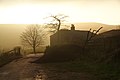
 West Pennine evening - geograph.org.uk - 2712370.jpg 3,872 × 2,592; 2.92 MB
-
 Whittle Hill Farm, Eferton - geograph.org.uk - 3250197.jpg 640 × 480; 418 KB
-
 Whittle Hill Farm, Egerton - geograph.org.uk - 4679223.jpg 1,600 × 1,200; 377 KB
-
 Yate Fold Farm - geograph.org.uk - 2600882.jpg 3,872 × 2,592; 3.99 MB
-
 Yew Tree Farm - geograph.org.uk - 42442.jpg 640 × 480; 141 KB


.jpg)


