Category:Farms in South Ayrshire
Jump to navigation
Jump to search
Council areas (municipalities) of Scotland: Aberdeen · Aberdeenshire · Angus · Argyll and Bute · Clackmannanshire · Dumfries and Galloway · Dundee · East Ayrshire · East Dunbartonshire · East Lothian · East Renfrewshire · Edinburgh · Falkirk · Fife · Glasgow · Highland · Inverclyde · Midlothian · Moray · North Ayrshire · North Lanarkshire · Outer Hebrides · Orkney Islands · Perth and Kinross · Renfrewshire · Scottish Borders · Shetland Islands · South Ayrshire · South Lanarkshire · Stirling · West Dunbartonshire · West Lothian
Subcategories
This category has the following 8 subcategories, out of 8 total.
B
- Broadhirst Farm (6 F)
C
- Cloyntie (10 F)
F
- Farm buildings in South Ayrshire (10 F)
- Farmhouses in South Ayrshire (10 F)
M
- Mount Oliphant Farm (4 F)
O
- Old Auchans Farm (8 F)
S
- Shalloch on Minnoch (farm) (17 F)
T
- Tarfessock (farm) (9 F)
Media in category "Farms in South Ayrshire"
The following 200 files are in this category, out of 427 total.
(previous page) (next page)-
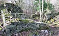
 Auchans Mains ruins, Dundonald.JPG 4,602 × 3,448; 9.24 MB
-
 B743 and Easter Smithstone Farm - geograph.org.uk - 421207.jpg 640 × 480; 93 KB
-
 Beef Cattle - geograph.org.uk - 261889.jpg 640 × 480; 143 KB
-
 Behind the Cemetery - geograph.org.uk - 258345.jpg 640 × 480; 138 KB
-
 Black Glen - geograph.org.uk - 264562.jpg 640 × 480; 73 KB
-

-
 Broadhirst Farm ruins - gable ends.JPG 2,288 × 1,712; 1.29 MB
-
 Broadhirst Farm ruins.JPG 2,288 × 1,712; 1.37 MB
-
 Broadhirst Farm steading ruins.JPG 2,288 × 1,712; 1.36 MB
-
 Broomhill Farm Near Dundonald - geograph.org.uk - 325028.jpg 640 × 478; 137 KB
-
 Cairnston Farm.JPG 2,288 × 1,712; 1.37 MB
-
 Clevens Loch, Langholm Farm.JPG 2,288 × 1,712; 1.25 MB
-
 Corphin Farm - geograph.org.uk - 847589.jpg 640 × 456; 67 KB
-
 Craig Farm - geograph.org.uk - 803603.jpg 491 × 600; 71 KB
-
 Crooks - geograph.org.uk - 324447.jpg 640 × 478; 153 KB
-
 Daldorch Farm - geograph.org.uk - 573951.jpg 640 × 457; 84 KB
-
 Dog Training - geograph.org.uk - 258354.jpg 640 × 471; 118 KB
-
 Drumshang Farm, Dunure, South Ayrshie.jpg 4,806 × 2,163; 1.72 MB
-
 Dunure Mains Farm and Culzean Mill, South Ayrshire.jpg 4,896 × 2,752; 4.76 MB
-
 Dunure Mains Farm, South Ayrshire.jpg 4,896 × 2,752; 4.35 MB
-
 Dyke Farm - geograph.org.uk - 324989.jpg 640 × 478; 154 KB
-
 Easter Smithstone farm - geograph.org.uk - 733793.jpg 640 × 480; 95 KB
-
 Farden Farm - geograph.org.uk - 1101015.jpg 640 × 426; 109 KB
-
 Fardenreoch, Pinwherry - geograph.org.uk - 263137.jpg 640 × 480; 58 KB
-
 Farm Diversification - geograph.org.uk - 329393.jpg 640 × 480; 94 KB
-
 Farmland near Crosshill - geograph.org.uk - 258342.jpg 640 × 480; 131 KB
-
 Fort Acres Farm, Symington, East Ayrshire.JPG 4,081 × 2,442; 3.73 MB
-
 Grazing Cattle - geograph.org.uk - 258347.jpg 640 × 480; 110 KB
-
 Greenan Farm - geograph.org.uk - 249795.jpg 640 × 480; 123 KB
-
 Greenan Farm, near Ayr - geograph.org.uk - 249790.jpg 640 × 480; 151 KB
-
 Knockendale - geograph.org.uk - 324444.jpg 640 × 478; 163 KB
-
 Knockgardner - geograph.org.uk - 264586.jpg 640 × 480; 60 KB
-
 Langholm Farm - geograph.org.uk - 325084.jpg 640 × 478; 154 KB
-
 Loaded - geograph.org.uk - 381965.jpg 640 × 480; 84 KB
-
 Looking towards Corwar Mains - geograph.org.uk - 89042.jpg 640 × 427; 88 KB
-
 Low Midton Farm - geograph.org.uk - 775871.jpg 640 × 418; 56 KB
-
 Monktonhead Farm,.JPG 2,288 × 1,712; 1.18 MB
-
 Mossgiel in 1786 from the North-East. South Ayrshire.jpg 3,354 × 2,171; 2.36 MB
-
 Mound of Beets - geograph.org.uk - 381971.jpg 480 × 640; 164 KB
-
 Netherton Farm - geograph.org.uk - 382055.jpg 640 × 480; 66 KB
-
 Newfield Mains - date stone on dovecot.JPG 1,144 × 1,523; 1.07 MB
-
 Newfield Mains - pend and dovecot.JPG 1,535 × 2,136; 1.87 MB
-
 Newfield Mains - south range.JPG 2,242 × 1,650; 2.05 MB
-
 October Crop - geograph.org.uk - 261881.jpg 640 × 480; 189 KB
-
 Old Auchans Farm fireside feature.JPG 4,608 × 3,456; 3.6 MB
-
 Old Auchans Farm frontage, Dundonald.JPG 3,346 × 3,172; 6.52 MB
-
 Old Auchans Farm's ruined byre, Dundonald.JPG 4,077 × 2,485; 6.23 MB
-
 Old Auchans Farm, Dundonald.JPG 3,579 × 2,524; 5.62 MB
-
 Old Auchans Farm, frontal view.JPG 4,452 × 2,634; 8.03 MB
-
 Old Auchans Farm, internal communication feature.JPG 3,074 × 3,002; 4.36 MB
-
 Old Auchans Farm, internal features, Dundonald.JPG 4,200 × 2,387; 5.64 MB
-
 Old Auchans Farm, internal through wall communication feature.JPG 3,074 × 2,899; 4.35 MB
-
 Ponies at Ballochbroe - geograph.org.uk - 243555.jpg 640 × 469; 130 KB
-
 Raithhill Farm from Whitehill, South Ayrshire, Scotland.jpg 4,896 × 2,501; 2.47 MB
-
 Red Trailer - geograph.org.uk - 381978.jpg 640 × 480; 90 KB
-
 Redcraig Farm - geograph.org.uk - 297898.jpg 640 × 426; 78 KB
-
 Rolling Farmland - geograph.org.uk - 400358.jpg 640 × 480; 138 KB
-
 Sandhill Farm from near Bowmanston Farm.jpg 1,673 × 1,324; 1.22 MB
-
 Sheep farming - geograph.org.uk - 297892.jpg 640 × 426; 43 KB
-
 South Craig Farm - geograph.org.uk - 382407.jpg 640 × 480; 80 KB
-
 Templeton Farm - geograph.org.uk - 325063.jpg 640 × 478; 140 KB
-
 Tenshillingland - geograph.org.uk - 182063.jpg 640 × 480; 57 KB
-
 The road to Knockskae - geograph.org.uk - 756912.jpg 640 × 480; 80 KB
-
 Torr - geograph.org.uk - 382046.jpg 640 × 480; 133 KB
-
 Towards Laigh Grange - geograph.org.uk - 309042.jpg 640 × 465; 160 KB
-
 Towards South Craig Farm - geograph.org.uk - 822052.jpg 640 × 480; 113 KB
-
 Winter view from Drumfairn - geograph.org.uk - 226565.jpg 640 × 480; 133 KB
-
 A view towards Castlehill Farm - geograph.org.uk - 1105878.jpg 640 × 428; 62 KB
-

-
 Above Croy Bay - geograph.org.uk - 305851.jpg 640 × 435; 135 KB
-
 Across Glenalmond Glen - geograph.org.uk - 623049.jpg 640 × 480; 66 KB
-
 Across The Burn - geograph.org.uk - 587103.jpg 640 × 459; 129 KB
-
 Across The Field - geograph.org.uk - 648977.jpg 640 × 480; 85 KB
-
 After The Rain - geograph.org.uk - 624877.jpg 450 × 600; 51 KB
-
 Almont, near Pinwherry - geograph.org.uk - 263123.jpg 640 × 480; 60 KB
-
 Along the Burn - geograph.org.uk - 372633.jpg 640 × 426; 152 KB
-
 Annfield Burn - geograph.org.uk - 178758.jpg 640 × 480; 70 KB
-
 Approaching The Gate - geograph.org.uk - 1101010.jpg 640 × 445; 130 KB
-
 Arran View - geograph.org.uk - 610031.jpg 640 × 434; 80 KB
-
 At The Mainholm Smallholdings - geograph.org.uk - 579063.jpg 640 × 480; 87 KB
-
 Attiquin Farm - geograph.org.uk - 239193.jpg 640 × 429; 111 KB
-
 Auchincruive - geograph.org.uk - 344552.jpg 640 × 480; 71 KB
-
 Ayrshire farmland - geograph.org.uk - 806842.jpg 427 × 640; 144 KB
-
 Baillieston - geograph.org.uk - 297977.jpg 640 × 478; 182 KB
-
 Baing Farm - geograph.org.uk - 416750.jpg 640 × 480; 142 KB
-
 Baing Farm and Craig Hill - geograph.org.uk - 261868.jpg 640 × 480; 172 KB
-
 Balcletchie - geograph.org.uk - 269583.jpg 640 × 480; 85 KB
-
 Balig Farm and Cottage - geograph.org.uk - 372687.jpg 640 × 480; 133 KB
-
 Balligmorrie in the Stinchar valley - geograph.org.uk - 330952.jpg 640 × 480; 69 KB
-
 Ballochmorrie Farm - geograph.org.uk - 217863.jpg 640 × 480; 185 KB
-
 Barbae Farm - geograph.org.uk - 464059.jpg 640 × 480; 150 KB
-
 Barclaugh Farm in Winter - geograph.org.uk - 355510.jpg 640 × 480; 110 KB
-
 Barclay Farm - geograph.org.uk - 619039.jpg 640 × 480; 71 KB
-
 Barcully Farm - geograph.org.uk - 631582.jpg 640 × 480; 64 KB
-
 Barcully Fields - geograph.org.uk - 631589.jpg 640 × 460; 76 KB
-
 Bargenoch Farm - geograph.org.uk - 686115.jpg 640 × 480; 71 KB
-
 Barlaugh Farm - geograph.org.uk - 244239.jpg 640 × 480; 93 KB
-
 Barneil Farm - geograph.org.uk - 821956.jpg 469 × 600; 61 KB
-
 Barnford Farm view - geograph.org.uk - 286757.jpg 640 × 470; 125 KB
-
 Barwheys near Mossblown, Ayrshire - geograph.org.uk - 61634.jpg 640 × 424; 62 KB
-
 Beautiful North Carrick - geograph.org.uk - 309051.jpg 640 × 480; 122 KB
-
 Belhamie - geograph.org.uk - 333577.jpg 640 × 480; 66 KB
-
 Bellamore Farm - geograph.org.uk - 464073.jpg 640 × 480; 122 KB
-
 Bennan Stud, near Straiton - geograph.org.uk - 264611.jpg 640 × 480; 75 KB
-
 Beoch - geograph.org.uk - 372636.jpg 640 × 461; 172 KB
-
 Birniehill - geograph.org.uk - 365304.jpg 640 × 443; 142 KB
-
 Blair Farm - geograph.org.uk - 464286.jpg 640 × 480; 127 KB
-
 Blair House and Farm - geograph.org.uk - 354793.jpg 640 × 480; 95 KB
-
 Boghead Farm - geograph.org.uk - 297878.jpg 640 × 478; 137 KB
-
 Bogside - geograph.org.uk - 179303.jpg 640 × 480; 59 KB
-
 Bogside Farm - geograph.org.uk - 686093.jpg 640 × 480; 70 KB
-
 Bogside Farm - geograph.org.uk - 686374.jpg 640 × 480; 55 KB
-
 Boreland - geograph.org.uk - 464350.jpg 640 × 480; 120 KB
-
 Bourtreebush Farm - geograph.org.uk - 340033.jpg 640 × 411; 78 KB
-
 Brae Farm - geograph.org.uk - 483964.jpg 640 × 480; 57 KB
-
 Brae Farm - geograph.org.uk - 483965.jpg 640 × 480; 75 KB
-
 Bridgend Farm - geograph.org.uk - 728877.jpg 640 × 480; 69 KB
-
 Broadshean - geograph.org.uk - 231340.jpg 640 × 480; 119 KB
-
 Broadyards Farm - geograph.org.uk - 292520.jpg 640 × 480; 179 KB
-
 Broomberry Farm - geograph.org.uk - 327704.jpg 640 × 480; 87 KB
-
 Brownhill and Fields - geograph.org.uk - 297957.jpg 640 × 478; 151 KB
-
 Burnbank Farm - geograph.org.uk - 286108.jpg 640 × 480; 125 KB
-
 Burnmouth Farm - geograph.org.uk - 249233.jpg 640 × 426; 76 KB
-
 Burnton Farmhouse - geograph.org.uk - 631583.jpg 640 × 480; 104 KB
-
 Burton Farm - geograph.org.uk - 372690.jpg 640 × 461; 120 KB
-
 By Brockloch Burn - geograph.org.uk - 630293.jpg 640 × 474; 82 KB
-
 By the Low Road - geograph.org.uk - 244244.jpg 640 × 466; 156 KB
-
 Cairnhill Farm - geograph.org.uk - 472251.jpg 640 × 447; 120 KB
-
 Cairnlea farm - geograph.org.uk - 554253.jpg 640 × 480; 164 KB
-
 Carcluie Farm - geograph.org.uk - 327648.jpg 640 × 441; 89 KB
-
 Carrick Hills - footpath to Dunure - geograph.org.uk - 233491.jpg 640 × 376; 92 KB
-

-
 Catcraig - geograph.org.uk - 292509.jpg 640 × 480; 166 KB
-
 Cattle at Tranew - geograph.org.uk - 296170.jpg 640 × 436; 84 KB
-
 Cattle Market, Whitefordhill - geograph.org.uk - 178751.jpg 640 × 480; 40 KB
-
 Cattle troughs near Dailly - geograph.org.uk - 264632.jpg 640 × 480; 92 KB
-
 Chapelton Farm - geograph.org.uk - 230374.jpg 640 × 442; 144 KB
-
 Clifftop Fields at Drumshang - geograph.org.uk - 332952.jpg 640 × 463; 115 KB
-
 Clyde Farmland - geograph.org.uk - 625695.jpg 640 × 480; 63 KB
-
 Clyde Farmland View - geograph.org.uk - 521260.jpg 640 × 436; 91 KB
-
 Clyde View - geograph.org.uk - 464275.jpg 640 × 454; 77 KB
-
 Coastal Farmland - geograph.org.uk - 372696.jpg 640 × 443; 95 KB
-
 Coastal Fields - geograph.org.uk - 616079.jpg 439 × 600; 69 KB
-
 Commonside Farm - geograph.org.uk - 351249.jpg 640 × 480; 102 KB
-
 Corseclays Farm, near Ballantrae - geograph.org.uk - 331957.jpg 640 × 480; 60 KB
-
 Corton Farm - geograph.org.uk - 325872.jpg 640 × 456; 104 KB
-
 Coylton View from Sundrum - geograph.org.uk - 397540.jpg 640 × 480; 152 KB
-
 Craig Farm - geograph.org.uk - 505192.jpg 450 × 600; 61 KB
-
 Craigenton Farm - geograph.org.uk - 462325.jpg 640 × 480; 135 KB
-
 Craiksland Farm - geograph.org.uk - 178848.jpg 640 × 480; 94 KB
-
 Crofthead on B744 - geograph.org.uk - 295375.jpg 640 × 478; 167 KB
-
 Cultezeoun Farm - geograph.org.uk - 254330.jpg 640 × 480; 118 KB
-
 Cultezeoun Farm - geograph.org.uk - 593492.jpg 640 × 407; 57 KB
-
 Dairy cattle at Attiquin - geograph.org.uk - 239201.jpg 640 × 480; 121 KB
-
 Dairying at Barrhill, Ayr - geograph.org.uk - 258030.jpg 640 × 480; 119 KB
-
 Dalcrest - geograph.org.uk - 291389.jpg 640 × 480; 161 KB
-
 Daldowie Farm - geograph.org.uk - 618457.jpg 640 × 480; 74 KB
-
 Dalquat Farm - geograph.org.uk - 365314.jpg 640 × 437; 102 KB
-
 Dalrymple Wood and Woodland Farm - geograph.org.uk - 286773.jpg 640 × 480; 114 KB
-
 Damp Grazing Land - geograph.org.uk - 354842.jpg 505 × 640; 126 KB
-
 Delamford Cottage and Farm - geograph.org.uk - 232557.jpg 640 × 419; 131 KB
-
 Delamford Farm View - geograph.org.uk - 625718.jpg 640 × 480; 54 KB
-
 Dobbingstone Farm - geograph.org.uk - 233148.jpg 640 × 403; 85 KB
-
 Docherniel Farm - geograph.org.uk - 464067.jpg 640 × 480; 114 KB
-
 Doon Valley Farmlands - geograph.org.uk - 286765.jpg 640 × 468; 106 KB
-
 Doonholm Farm - geograph.org.uk - 257880.jpg 640 × 480; 151 KB
-
 Doura - geograph.org.uk - 257170.jpg 640 × 396; 101 KB
-
 Doura - geograph.org.uk - 257173.jpg 640 × 412; 77 KB
-
 Dowhill by A77 - geograph.org.uk - 217845.jpg 640 × 480; 156 KB
-
 Down To The Burn - geograph.org.uk - 610062.jpg 640 × 423; 66 KB
-
 Drumbuie Farm - geograph.org.uk - 281166.jpg 640 × 480; 135 KB
-
 Drumbuie Farm - geograph.org.uk - 281170.jpg 640 × 480; 141 KB
-
 Drummuck View - geograph.org.uk - 625671.jpg 640 × 420; 59 KB
-
 Drumshang Farm - geograph.org.uk - 332959.jpg 640 × 480; 92 KB
-
 Dunure Mains - geograph.org.uk - 332968.jpg 640 × 480; 161 KB
-
 Dupin Farm - geograph.org.uk - 711679.jpg 640 × 479; 141 KB
-
 Dyke, near Straiton - geograph.org.uk - 335405.jpg 640 × 480; 88 KB
-
 East Sanquhar Farm - geograph.org.uk - 250045.jpg 640 × 480; 134 KB
-
 East Threave - geograph.org.uk - 461796.jpg 640 × 480; 146 KB
-
 Eldrick Farm - geograph.org.uk - 464356.jpg 640 × 480; 87 KB
-
 Fairwells Farm - geograph.org.uk - 339999.jpg 640 × 480; 59 KB
-
 Farmland at Mochrum - geograph.org.uk - 328659.jpg 640 × 480; 112 KB
-

-
 Farmland at Walston, near Ayr. - geograph.org.uk - 61622.jpg 640 × 424; 66 KB
-
 Farmland By The Way - geograph.org.uk - 579060.jpg 640 × 444; 103 KB
-
 Farmland near Stair, Ayrshire - geograph.org.uk - 61619.jpg 640 × 424; 109 KB
-
 Farmland near Straiton - geograph.org.uk - 402120.jpg 640 × 480; 70 KB
-
 Farmland View - geograph.org.uk - 309064.jpg 640 × 480; 117 KB
-
 Farmland View - geograph.org.uk - 354797.jpg 640 × 480; 115 KB
-
 Farmland View - geograph.org.uk - 405830.jpg 640 × 480; 218 KB
-
 Farmland View - geograph.org.uk - 471045.jpg 640 × 480; 98 KB
-
 Farmland View - geograph.org.uk - 521256.jpg 640 × 480; 123 KB
-
 Farmland View - geograph.org.uk - 579038.jpg 640 × 478; 141 KB
-
 Farmland View - geograph.org.uk - 587107.jpg 640 × 480; 85 KB
-
 Farmland view - geograph.org.uk - 610069.jpg 640 × 480; 76 KB
-
 Farmland View - geograph.org.uk - 623052.jpg 450 × 600; 92 KB
-
 Farmland View - geograph.org.uk - 623068.jpg 640 × 480; 64 KB
-
 Farmland View - geograph.org.uk - 624875.jpg 640 × 430; 60 KB
-
 Farmland View - geograph.org.uk - 625680.jpg 640 × 450; 48 KB
-
 Farmland View - geograph.org.uk - 625708.jpg 640 × 480; 61 KB


