Category:Farmhouses in Cheshire
Jump to navigation
Jump to search
Ceremonial counties of England: Bedfordshire · Berkshire · Buckinghamshire · Cambridgeshire · Cheshire · Cornwall · Cumbria · Derbyshire · Devon · Dorset · Durham · East Riding of Yorkshire · East Sussex · Essex · Gloucestershire · Greater London · Greater Manchester · Hampshire · Herefordshire · Hertfordshire · Kent · Lancashire · Leicestershire · Lincolnshire · Merseyside · Norfolk · North Yorkshire · Northamptonshire · Northumberland · Nottinghamshire · Oxfordshire · Rutland · Shropshire · Somerset · South Yorkshire · Staffordshire · Suffolk · Surrey · Tyne and Wear · Warwickshire · West Midlands · West Sussex · West Yorkshire · Wiltshire · Worcestershire
City-counties: Bristol ·
Former historic counties:
Other former counties:
City-counties: Bristol ·
Former historic counties:
Other former counties:

Subcategories
This category has the following 3 subcategories, out of 3 total.
H
- Holcroft Hall (5 F)
Media in category "Farmhouses in Cheshire"
The following 200 files are in this category, out of 260 total.
(previous page) (next page)-
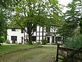
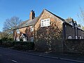
 "Brook Farm" , Handforth - geograph.org.uk - 343494.jpg 640 × 480; 119 KB
-
 Abandoned farmhouse - geograph.org.uk - 5778318.jpg 2,272 × 1,704; 1.19 MB
-

-
 Arleyview Farm, High Legh - geograph.org.uk - 394200.jpg 614 × 460; 334 KB
-
 Arthill Farm - geograph.org.uk - 4611784.jpg 1,200 × 900; 189 KB
-
 Ashbank Farmhouse Geograph-4291903-by-Colin-Park.jpg 1,024 × 768; 227 KB
-
 Ashton Hall Farm2.jpg 1,024 × 768; 245 KB
-
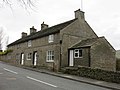
 Aston House Farm - geograph.org.uk - 338354.jpg 640 × 442; 154 KB
-
 Aston House Farm.jpg 1,000 × 615; 268 KB
-
 Austerson Church House Farm.jpg 640 × 480; 55 KB
-
 Bache House Farmhouse 01.jpg 4,000 × 3,000; 5.08 MB
-
 Bache House Farmhouse 02.jpg 4,000 × 3,000; 4.96 MB
-
 Back Lane Farm near Tilstone Fearnal - geograph.org.uk - 5911758.jpg 4,000 × 3,000; 4.1 MB
-
 Bank Farmhouse nr Hassall Green.jpg 1,800 × 1,350; 560 KB
-
 Barhill Development Farm - geograph.org.uk - 193653.jpg 640 × 471; 121 KB
-
 Barlow House Farm, near Wilmslow, Cheshire (geograph 2249652).jpg 3,709 × 2,694; 3.84 MB
-
 Barthomley - Mill Farm.jpg 640 × 480; 70 KB
-
 Bartington Hall Farmhouse.jpg 1,800 × 1,350; 697 KB
-
 Barton Farmhouse.jpg 1,800 × 1,350; 1.98 MB
-
 Baytree House, Eaton.jpg 1,800 × 1,350; 743 KB
-
 Castlegate Farm, Beeston - geograph.org.uk - 206314.jpg 640 × 484; 155 KB
-
 Birch Heath Farmhouse nr Tarporley.jpg 1,800 × 1,350; 580 KB
-
 Birtles Farm - geograph.org.uk - 4869017.jpg 3,462 × 2,635; 2.01 MB
-
 Blake House Farm, Blakeley Lane, Mobberley - geograph.org.uk - 2344394.jpg 4,000 × 3,000; 4.21 MB
-
 Blakeley Farm, Blakeley Lane, Mobberley - geograph.org.uk - 2344370.jpg 4,000 × 3,000; 4.03 MB
-
 Bollington Hall Farm House.jpg 640 × 454; 89 KB
-
 Bollington Hall Farm.jpg 4,000 × 3,000; 6.04 MB
-
 Boothbank Farmhouse.jpg 4,000 × 3,000; 1.91 MB
-
 Boults Green Farmhouse, Bechton.jpg 4,000 × 3,000; 1.67 MB
-
 Bradford Lodge, Alderley Edge.jpg 4,000 × 3,000; 4.62 MB
-
 Breach House Farm, Mobberley - geograph.org.uk - 2365578.jpg 4,000 × 3,000; 6.45 MB
-
 Bredbury and Romiley - Chadkirk Farm (geograph 2232579).jpg 3,008 × 2,000; 1.52 MB
-
 Brick House Farm, Arclid - geograph.org.uk - 4146656.jpg 640 × 480; 340 KB
-
 Brick House Farm, Hulme Walfield 01.jpg 4,000 × 3,000; 1.38 MB
-
 Brick House Farm, Hulme Walfield 02.jpg 4,000 × 3,000; 1.86 MB
-
 Brickhouse Farm - geograph.org.uk - 1068049.jpg 640 × 480; 114 KB
-
 Brickhouses Farm (geograph 2027118).jpg 640 × 480; 118 KB
-
 Brindley Hall Farm - geograph.org.uk - 850785.jpg 640 × 434; 154 KB
-
 Brindley Lea Hall, Brindley.jpg 1,000 × 649; 334 KB
-
 Brines Farmhouse, Disley.JPG 1,200 × 900; 238 KB
-
 Brook Farm, Gauntons Bank - geograph.org.uk - 189363.jpg 640 × 606; 126 KB
-
 Brook Farmhouse, Bunbury 01.jpg 4,000 × 3,000; 2.61 MB
-
 Brook Farmhouse, Bunbury 02.jpg 4,000 × 3,000; 4.32 MB
-
 Brook House Farmhouse, Poynton.jpg 4,000 × 3,000; 2.08 MB
-
 Brookfield Farm, Weston Road - geograph.org.uk - 624709.jpg 640 × 480; 60 KB
-
 Brookhouse farm - geograph.org.uk - 126117.jpg 640 × 480; 54 KB
-
 Brookside Farm - geograph.org.uk - 4273.jpg 640 × 476; 272 KB
-
 Brookside Farmhouse, Goostrey.jpg 4,000 × 3,000; 6.1 MB
-
 Broomfield (House) Farm - geograph.org.uk - 107252.jpg 640 × 480; 153 KB
-
 Brown House, Rainow.JPG 1,800 × 1,350; 602 KB
-
 Brown Moss Farm.jpg 3,456 × 2,304; 4.66 MB
-
 Burleyhurst Farm near Morley Green, Cheshire - geograph.org.uk - 2323677.jpg 3,883 × 2,912; 4.09 MB
-
 Burnt Mill House at Hale Bank - geograph.org.uk - 226551.jpg 640 × 480; 118 KB
-
 Cavendish Farm House.jpg 2,532 × 1,867; 956 KB
-
 Cavendish Farm, Weston Village - geograph.org.uk - 490021.jpg 640 × 480; 87 KB
-
 Chapel House Farm, Macclesfield Farm - geograph.org.uk - 695050.jpg 640 × 426; 99 KB
-
 Charles Head Farm (geograph 2817872).jpg 3,872 × 2,592; 5.33 MB
-
 Church Farm House, Acton, Cheshire.jpg 1,800 × 1,350; 540 KB
-
 Church Farmhouse, Bunbury.jpg 1,800 × 1,350; 611 KB
-
 Clayton Fold Farmhouse.JPG 1,800 × 1,200; 425 KB
-
 Cliff Farmhouse, Lyme Handley.JPG 1,800 × 1,200; 415 KB
-
 Coddington - Old Beachin Farm - geograph.org.uk - 220734.jpg 614 × 465; 246 KB
-
 Cold Arbour Farmhouse, Tytherington, Cheshire.jpg 4,288 × 2,848; 6.38 MB
-
 Converted farmhouse, near Paddockhill, Cheshire - geograph.org.uk - 2249610.jpg 3,984 × 2,988; 3.84 MB
-
 Coppock House, Mobberley.jpg 4,000 × 3,000; 5.38 MB
-
 Cornfield Farm, Lyme Handley.JPG 1,800 × 1,200; 329 KB
-
 Cottages, Shotwick - DSC06447.JPG 3,648 × 2,736; 3.49 MB
-
 Crabmill Farmhouse, Ravensmoor.jpg 4,000 × 3,000; 5.17 MB
-
 Crabmill Old Farmhouse.jpg 4,000 × 3,000; 4.97 MB
-
 Cross Farmhouse, Nether Alderley.jpg 4,000 × 3,000; 6 MB
-
 Cross Farmhouse, Styal.jpg 4,103 × 3,138; 1.56 MB
-
 Dales Farmhouse Kettleshulme Geograph-4287305-by-Dave-Dunford.jpg 1,800 × 1,350; 324 KB
-
 Damhead House, Mobberley.jpg 4,000 × 3,000; 1.49 MB
-
 Daresbury Black Jane Farm.jpg 2,544 × 1,859; 1.05 MB
-
 Darley Hall, Little Budworth - geograph.org.uk - 178400.jpg 640 × 427; 80 KB
-
 Dingle Farmhouse, Sandbach.JPG 1,200 × 900; 253 KB
-
 Dunham Hall, Dunham-on-the-Hill, Cheshire.JPG 1,200 × 900; 176 KB
-
 Eardswick Hall, Minshull Vernon - geograph.org.uk - 1191851.jpg 640 × 507; 151 KB
-
 Eardswick Hall, Minshull Vernon.jpg 4,000 × 3,000; 6.24 MB
-
 Farm for sale - Davenport Lane - Mobberley - geograph.org.uk - 2346438.jpg 3,828 × 2,871; 5.25 MB
-
 Farm on Davenport Lane near Mobberley - geograph.org.uk - 2348858.jpg 3,803 × 2,835; 5.77 MB
-
 Fern Lee Farm, Higher Sutton.jpg 4,000 × 3,000; 1.15 MB
-
 Frodsham - Brook Farm - geograph.org.uk - 250849.jpg 640 × 480; 261 KB
-
 Fulhurst Hall 01.jpg 4,000 × 3,000; 5.15 MB
-
 Fulhurst Hall 02.jpg 4,000 × 3,000; 5.11 MB
-
 Fulhurst Hall 03.jpg 4,000 × 3,000; 4.84 MB
-
 Gates Farm Cholmondeston.jpg 1,200 × 862; 559 KB
-
 GLEBE FARMHOUSE.JPG 3,416 × 2,277; 6.51 MB
-
 Grange Farmhouse, Mobberley 01.jpg 4,000 × 3,000; 5.02 MB
-
 Grange Farmhouse, Mobberley 02.jpg 4,000 × 3,000; 5.18 MB
-
 Green Farmhouse near Lyme Park.jpg 3,456 × 2,304; 585 KB
-
 Greendale Farm Mottram St Andrew, Yew Tree under which The Rostrum Club was Founded.jpg 4,032 × 2,782; 2.37 MB
-
 Hagg Bank Farm, Disley.JPG 800 × 1,200; 198 KB
-
 Hall o' the Heath Farm, Haslington - geograph.org.uk - 189792.jpg 640 × 480; 75 KB
-
 Harestead Farm, Lyme Handley.JPG 853 × 1,280; 242 KB
-
 Haycroft, Spurstow.jpg 1,800 × 1,350; 743 KB
-
 Higher Doles Farmhouse.jpg 4,000 × 3,000; 6.24 MB
-
 Higher Farmhouse, Barton, Cheshire.jpg 1,800 × 1,350; 1.5 MB
-
 Hollins Farm, nr Macclesfield.jpg 4,000 × 3,000; 5.01 MB
-
 Hollins Farmhouse.jpg 4,000 × 3,000; 1.4 MB
-
 Holly Bank Farm, Marton (distant).jpg 4,000 × 3,000; 4.93 MB
-
 Bridge Farm, Holmes Chapel - geograph.org.uk - 829886.jpg 640 × 432; 82 KB
-
 Horns Farmhouse, Dunham-on-the-Hill, Cheshire.JPG 1,200 × 900; 172 KB
-
 Hough Green Farmhouse.jpg 4,000 × 3,000; 2.16 MB
-
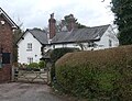
 Houses in Shotwick - geograph.org.uk - 203126.jpg 640 × 480; 97 KB
-
 Hunters Pool Farm, Mottram St Andrew - geograph.org.uk - 158298.jpg 640 × 480; 126 KB
-
 Laburnum Farmhouse, Ness.jpg 1,800 × 1,350; 358 KB
-
 Lane Ends Farm, Higher Disley.JPG 1,200 × 900; 211 KB
-
 Lane Head Farmhouse.JPG 1,200 × 900; 162 KB
-
 Laurel Farm, Elton - geograph.org.uk - 422561.jpg 640 × 480; 97 KB
-
 Lea Green Hall - geograph.org.uk - 575316.jpg 640 × 481; 80 KB
-
 Lee Green Hall, Church Minshull.jpg 1,800 × 1,350; 399 KB
-
 Litley Farm - geograph.org.uk - 1522451.jpg 640 × 480; 220 KB
-
 Little Barrow Hall.jpg 1,200 × 900; 233 KB
-
 Lower House Farm, Whitchurch - geograph.org.uk - 213710.jpg 640 × 480; 66 KB
-
 Lower House Farmhouse, Eaton.jpg 1,800 × 1,350; 1.63 MB
-
 Lowerhill Farmhouse.jpg 800 × 533; 182 KB
-
 Mablins Lane Farm - geograph.org.uk - 1047119.jpg 640 × 480; 61 KB
-
 Madams Farm, Acton.jpg 1,000 × 647; 303 KB
-
 Maltkiln Farm, Plumley.jpg 1,800 × 1,350; 625 KB
-
 Manor Farm Hapsford.JPG 4,000 × 3,000; 4.53 MB
-
 Manor Farm House.jpg 2,508 × 1,623; 1,009 KB
-
 Manor Farm, Dunham-on-the-Hill, Cheshire 01.JPG 1,200 × 900; 198 KB
-
 Manor Farm, Hankelow.jpg 3,535 × 2,424; 1.89 MB
-
 Manor Farm, Warford, Cheshire - geograph.org.uk - 2326879.jpg 3,749 × 2,881; 4.01 MB
-
 Manor Farmhouse, Englesea Brook 01.jpg 4,000 × 3,000; 4.73 MB
-
 Manor Farmhouse, Englesea Brook 02.jpg 4,000 × 3,000; 4.74 MB
-
 Manor Farmhouse, Swettenham.jpg 4,000 × 3,000; 1.14 MB
-
 Mellock Farm, Little Neston.JPG 4,320 × 3,240; 3.14 MB
-
 Mereview Farm, Pickmere.jpg 4,000 × 3,000; 4.71 MB
-
 Mickley Hall trig point, Broomhall.jpg 800 × 533; 220 KB
-
 Millhey Farmhouse, Barton, Cheshire.jpg 4,000 × 3,000; 5.92 MB
-
 Milton Green fm.jpg 7,296 × 5,472; 13.18 MB
-
 Moathouse Farm, Beeston.jpg 1,800 × 1,350; 409 KB
-
 Mottram Hall Farmhouse.jpg 1,200 × 900; 278 KB
-
 Mottram St. Andrew, Woodside Farm - geograph.org.uk - 263019.jpg 640 × 480; 164 KB
-
 Mouldsworth Hall - geograph.org.uk - 423275.jpg 640 × 480; 110 KB
-
 New Manor Farm moated site 01.jpg 4,000 × 3,000; 4.02 MB
-
 New Manor Farm moated site 02.jpg 4,000 × 3,000; 4.95 MB
-
 New Manor Farm moated site 03.jpg 4,000 × 3,000; 4.83 MB
-
 Newton Hall - geograph.org.uk - 90284.jpg 640 × 406; 112 KB
-
 Newton Hall Farmhouse, Mottram St Andrew.jpg 5,184 × 3,456; 3.81 MB
-
 Nut Tree Farmhouse, Nether Alderley 01.jpg 4,000 × 3,000; 1.99 MB
-
 Nut Tree Farmhouse, Nether Alderley 02.jpg 4,000 × 3,000; 5.99 MB
-
 Oak Farm, Marton.jpg 4,000 × 3,000; 4.7 MB
-
 Oak Farnhouse, Haughton.jpg 4,000 × 3,000; 3.17 MB
-
 Oak Tree Farmhouse, Eaton.jpg 1,800 × 1,390; 695 KB
-
 Old Hall Farmhouse, Barthomley.jpg 640 × 480; 96 KB
-
 Old Hall Farmhouse, Thelwall.jpg 1,800 × 1,350; 642 KB
-
 Park House Farm, Brereton.jpg 2,577 × 2,024; 740 KB
-
 Pear Tree Farm, Dunham-on-the-Hill, Cheshire.JPG 1,200 × 900; 173 KB
-
 Pear Tree Farmhouse, Stoneley Green.jpg 4,000 × 3,000; 4.92 MB
-
 Peartree Farm, Spurstow - geograph.org.uk - 276573.jpg 640 × 427; 119 KB
-
 Pewit Hall, Hunsterson.jpg 640 × 480; 78 KB
-
 Pickmere Farm, Pickmere.jpg 1,800 × 1,350; 462 KB
-
 Pickmere Farm.jpg 4,000 × 3,000; 4.85 MB
-
 Poole House Farm Poolehill.jpg 1,200 × 947; 538 KB
-
 Pott Lords Farmhouse, Higher Sutton 02.jpg 4,000 × 3,000; 4.59 MB
-
 Pott Lords Farmhouse, Higher Sutton.jpg 4,000 × 3,000; 4.77 MB
-
 Priestland, Bunbury.jpg 1,800 × 1,350; 689 KB
-
 Pursa Farmhouse.jpg 3,120 × 4,160; 3.57 MB
-
 Red Moor Farm.jpg 3,456 × 2,304; 2.86 MB
-
 Ridge Hall Farm, Higher Sutton.jpg 4,000 × 3,000; 1.47 MB
-
 Rock Farm, Elton - geograph.org.uk - 1610170.jpg 640 × 480; 80 KB
-
 Rock Farmhouse.jpg 1,800 × 1,350; 416 KB
-
 Rode Hall Farm 01.jpg 4,000 × 3,000; 709 KB
-
 Rode Hall Farm 02.jpg 4,000 × 3,000; 4.56 MB
-
 Rose Farm, Barton, Cheshire.jpg 1,800 × 1,350; 1.42 MB
-
 Saddlebole Farm, Alderley Edge.jpg 1,800 × 1,350; 426 KB
-
 Saltersley Hall Farm (geograph 5621888).jpg 5,376 × 3,024; 3.05 MB
-
 Shotwick 1.JPG 3,648 × 2,736; 3.62 MB
-
 Sign outside Newholme Farm - geograph.org.uk - 227010.jpg 467 × 640; 180 KB
-
 Smithy Farm, Eccleston.jpg 1,800 × 1,350; 484 KB
-
 Smithy Farmhouse, Dunham-on-the-Hill.jpg 1,200 × 900; 199 KB
-
 Sound Oak Farm - geograph.org.uk - 126304.jpg 640 × 480; 47 KB
-
 Sound Oak Farm2.jpg 1,000 × 727; 315 KB
-
 Springe Lane Hall.jpg 4,078 × 3,104; 1.97 MB
-
 Spurstow Lower Hall - geograph.org.uk - 151531.jpg 640 × 480; 92 KB
-
 Summer Close Farm, Rainow.JPG 1,800 × 1,350; 511 KB
-
 Sutton Hall Farmhouse.jpg 3,072 × 2,304; 3.59 MB
-
 Swanbach Farm - geograph.org.uk - 5000477.jpg 1,064 × 1,600; 452 KB
-
 Swanwick Hall, Goostrey.jpg 2,117 × 1,511; 1.33 MB
-
 Swinford Mill Farm, Barrow - geograph.org.uk - 129200.jpg 640 × 480; 145 KB
-
 The Firs, Aston by Budworth - geograph.org.uk - 394255.jpg 640 × 480; 68 KB
-
 Thorneycroft Farmhouse, Kettleshulme.jpg 5,184 × 3,456; 4.69 MB
-
 Thornton-le-Moors, Cheshire (8).JPG 4,320 × 3,240; 3.57 MB
-
 Thornton-le-Moors, Cheshire (9).JPG 4,320 × 3,240; 4.64 MB
-
 Toad Hole Farm - geograph.org.uk - 228981.jpg 640 × 480; 54 KB
-
 Tower Hill Farm, Rainow.jpg 3,456 × 2,304; 2.66 MB
-
 Tower Hill Farm.jpg 952 × 695; 168 KB
-
 Town Farm, Dunham-on-the-Hill, Cheshire.JPG 1,200 × 900; 159 KB
-
 Townfield Farm - geograph.org.uk - 293038.jpg 640 × 471; 96 KB
-
 Tudor Rose Farmhouse, Wrenbury.jpg 4,000 × 3,000; 5.07 MB
-
 Turner House Farmhouse, Mottram St Andrew.jpg 3,783 × 2,837; 3.67 MB
-
 Vicarage Farmhouse, Shotwick.jpg 640 × 480; 92 KB
-
 Village Farmhouse, Church Minshull.jpg 4,000 × 3,000; 1.35 MB
-
 Walton Farmhouse, Nether Alderley.jpg 3,456 × 2,304; 3.32 MB
-
 Well House Farm, Kettleshulme Geograph-4287345-by-Dave-Dunford.jpg 1,800 × 1,200; 423 KB
-
 West End Farmhouse, Aston-by-Wrenbury.jpg 1,800 × 1,350; 480 KB
-
 Westcot Farmhouse - geograph.org.uk - 2179800.jpg 1,024 × 768; 150 KB


.jpg)


.jpg)


.jpg)


_Farm_-_geograph.org.uk_-_107252.jpg)


.jpg)


.jpg)


.jpg)


.JPG)
.JPG)


