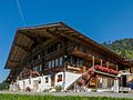
Category:Farmhouse Hasli, Frutigen
Jump to navigation
Jump to search
| Object location | | View all coordinates using: OpenStreetMap |
|---|
building in Frutigen in the canton of Bern, Switzerland .jpg) | |||||
| Upload media | |||||
| Instance of | |||||
|---|---|---|---|---|---|
| Part of | |||||
| Location | Frutigen, Frutigen-Niedersimmental administrative district, Oberland administrative region, Bern, Switzerland | ||||
| Street address |
| ||||
| Heritage designation | |||||
| Inception |
| ||||
 | |||||
Media in category "Farmhouse Hasli, Frutigen"
The following 2 files are in this category, out of 2 total.
-
 Frutigen Hasli (3).jpg 4,320 × 3,240; 7.94 MB
-
 Frutigen Hasli (4).jpg 3,587 × 2,690; 683 KB
.jpg)