Category:Farmhouse, Sur le Cratan 13, Les Breuleux
Jump to navigation
Jump to search
| Object location | | View all coordinates using: OpenStreetMap |
|---|
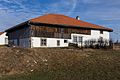
rural building in Les Breuleux in the canton of Jura, Switzerland  | |||||
| Upload media | |||||
| Instance of | |||||
|---|---|---|---|---|---|
| Part of | |||||
| Location | Les Breuleux, Franches-Montagnes District, Jura, Switzerland | ||||
| Street address |
| ||||
| Heritage designation | |||||
 | |||||
Media in category "Farmhouse, Sur le Cratan 13, Les Breuleux"
This category contains only the following file.
-
 2016-Les-Breuleux-Sur-le-cratan-13.jpg 1,920 × 1,280; 2.91 MB