Category:Farmhouse, Stöckli 203, Oberbalm
Jump to navigation
Jump to search
| Object location | | View all coordinates using: OpenStreetMap |
|---|
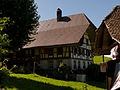
rural building in Oberbalm in the canton of Bern, Switzerland  | |||||
| Upload media | |||||
| Instance of | |||||
|---|---|---|---|---|---|
| Part of | |||||
| Location | Oberbalm, Bern-Mittelland administrative district, Bernese Mittelland administrative region, Bern, Switzerland | ||||
| Street address |
| ||||
| Heritage designation | |||||
| Inception |
| ||||
 | |||||
Media in category "Farmhouse, Stöckli 203, Oberbalm"
The following 3 files are in this category, out of 3 total.
-
 Oberbalm Stöckli Bauernhaus.jpg 4,320 × 3,240; 2.18 MB
-
 Oberbalm Stöckli gut bewacht.jpg 4,320 × 3,240; 2.12 MB
-
 Oberbalm Stöckli Übersicht.jpg 4,133 × 3,100; 2.22 MB

