Category:Farmhouse, La Bosse 38, Le Bémont
Jump to navigation
Jump to search
| Object location | | View all coordinates using: OpenStreetMap |
|---|
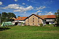
rural building in the hamlet La Bosse in Le Bémont in the canton of Jura, Switzerland  | |||||
| Upload media | |||||
| Instance of | |||||
|---|---|---|---|---|---|
| Part of | |||||
| Location | La Bosse, Le Bémont, Franches-Montagnes District, Jura, Switzerland | ||||
| Street address |
| ||||
| Heritage designation |
| ||||
 | |||||
Media in category "Farmhouse, La Bosse 38, Le Bémont"
The following 2 files are in this category, out of 2 total.
-
 Farmhouse 2.jpg 720 × 396; 83 KB
-
 Le Bémont Ferme.jpg 4,288 × 2,848; 2.99 MB
