Category:Fareham
Jump to navigation
Jump to search
market town on Portsmouth Harbour, England  | |||||
| Upload media | |||||
| Instance of | |||||
|---|---|---|---|---|---|
| Location | Fareham, Hampshire, South East England, England | ||||
| Population |
| ||||
| Different from | |||||
 | |||||
Subcategories
This category has the following 16 subcategories, out of 16 total.
- Sculptures in Fareham (17 F)
B
E
F
- Fareham Fire Station (9 F)
G
- Grade II listed walls in Fareham (22 F)
H
S
T
V
- Views of Fareham (8 F)
W
Media in category "Fareham"
The following 200 files are in this category, out of 315 total.
(previous page) (next page)-
 "The Miniatures", Gordon Road - geograph.org.uk - 615971.jpg 640 × 480; 51 KB
-

-
-

-
-

-

-

-

-
 A lot of allotments in Fareham - geograph.org.uk - 1226623.jpg 640 × 480; 70 KB
-
 A pleasant view. - panoramio.jpg 3,907 × 2,137; 2.63 MB
-
 A Tower Crane.jpeg 1,024 × 768; 472 KB
-
 AFC Portchester's Wicor Recreation Ground 2018.jpg 3,648 × 2,736; 2.2 MB
-
 Albany Business Centre on the A32 - geograph.org.uk - 458299.jpg 640 × 427; 126 KB
-
 Aldi car park just off West Street - geograph.org.uk - 1496544.jpg 640 × 480; 42 KB
-
 All Time Grate Main Stage at Wickham Festival.jpg 3,264 × 1,840; 1.72 MB
-
 Alley leading to Osborn Road - geograph.org.uk - 615941.jpg 640 × 480; 81 KB
-
 Ancient Brick Wall - Fareham - geograph.org.uk - 1092577.jpg 640 × 480; 95 KB
-
 Anjou Crescent, Fareham - geograph.org.uk - 1202284.jpg 640 × 360; 66 KB
-
 Anjou Crescent, Fareham - geograph.org.uk - 1202291.jpg 640 × 360; 74 KB
-
 Antonio's in Fareham town centre - geograph.org.uk - 1511310.jpg 480 × 640; 75 KB
-

-
-

-
 Avenue of trees - near Ridge Farm - geograph.org.uk - 89643.jpg 480 × 640; 167 KB
-

-
 Bench by public garden in Gordon Road - geograph.org.uk - 615938.jpg 640 × 480; 89 KB
-
 Block of Flats, Greyshott Ave - Fareham - geograph.org.uk - 756853.jpg 640 × 514; 118 KB
-
 Bowling alley in Fareham - geograph.org.uk - 1476418.jpg 640 × 480; 55 KB
-
 Bridge over A road near High Street - geograph.org.uk - 616512.jpg 640 × 480; 66 KB
-
 Burpham House Fareham.jpg 5,489 × 3,659; 11.62 MB
-
 Burridge, the post office - geograph.org.uk - 625919.jpg 640 × 480; 104 KB
-
 Bus stop in Wet Street - geograph.org.uk - 616639.jpg 640 × 480; 65 KB
-
 Cams Bay - geograph.org.uk - 464817.jpg 640 × 480; 125 KB
-
-
 Cedar Court - geograph.org.uk - 616613.jpg 640 × 480; 64 KB
-
 Chicago Rock Café behind West Street - geograph.org.uk - 1504941.jpg 640 × 480; 86 KB
-
 Church Path- Fareham - geograph.org.uk - 1365328.jpg 640 × 592; 122 KB
-
 Clinic in West Street - geograph.org.uk - 1496553.jpg 480 × 640; 54 KB
-
 Clock in Portchester Precinct - geograph.org.uk - 731412.jpg 640 × 480; 88 KB
-

-
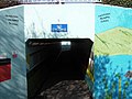
 Colourful subway in Bath Lane (1) - geograph.org.uk - 1216430.jpg 640 × 480; 72 KB
-
 Colourful subway in Bath Lane (2) - geograph.org.uk - 1216450.jpg 640 × 480; 58 KB
-
 Colourful subway in Bath Lane (3) - geograph.org.uk - 1216476.jpg 640 × 480; 62 KB
-
 Colourful subway in Bath Lane (4) - geograph.org.uk - 1216499.jpg 640 × 480; 96 KB
-
 Colourful subway in Bath Lane (5) - geograph.org.uk - 1216518.jpg 640 × 480; 81 KB
-
-
 Community Hospital - Locks Heath (geograph 2358579).jpg 640 × 427; 68 KB
-
 Connexions in West Street - geograph.org.uk - 1503378.jpg 480 × 640; 68 KB
-
 Contrasting homes in the High Street - geograph.org.uk - 616499.jpg 640 × 480; 55 KB
-
 Converted Maltings - Wallington - geograph.org.uk - 763963.jpg 640 × 480; 94 KB
-
 Court Building - Fareham - geograph.org.uk - 789237.jpg 640 × 398; 48 KB
-
 David winter in West Street - geograph.org.uk - 1496503.jpg 640 × 480; 97 KB
-
 Dead End - Fareham - geograph.org.uk - 838249.jpg 640 × 480; 70 KB
-
 Dead trees, Bunny Meadows, Warsash - geograph.org.uk - 710552.jpg 640 × 480; 109 KB
-
 Delme place.JPG 2,560 × 1,920; 2.32 MB
-
 Demolition of Car Park-FAREHAM - geograph.org.uk - 690250.jpg 640 × 374; 91 KB
-
 Demolition of Pub - Fareham - geograph.org.uk - 873589.jpg 640 × 480; 70 KB
-
 Dentists in West Street - geograph.org.uk - 1504851.jpg 480 × 640; 67 KB
-
 Derelict Cottage at Park Lane, Fareham (May 2019).jpg 3,000 × 1,800; 2.82 MB
-
-
 Echinocorys Scutata Shell Fossils, Cumberland House Natural History Museum.jpg 3,614 × 2,409; 7.44 MB
-
-
 Electronic sign in Gosport Road - geograph.org.uk - 1590576.jpg 640 × 480; 63 KB
-

-
 Ernest Jones in Fareham town centre - geograph.org.uk - 1504946.jpg 480 × 640; 60 KB
-
 Eye Sore at Wallington Village - geograph.org.uk - 747842.jpg 640 × 480; 60 KB
-
 Falklands Arch - geograph.org.uk - 616667.jpg 640 × 480; 75 KB
-
 Fareham - 168, Castle Street - 20220916134236.jpg 4,395 × 2,930; 9.96 MB
-
 Fareham - Dovercroft - 20220916134143.jpg 3,288 × 4,603; 10.93 MB
-
 Fareham - First 53505 (14928744839).jpg 3,888 × 2,592; 3.9 MB
-
 Fareham - Hampshire dot.png 417 × 599; 122 KB
-
 Fareham - Myrtle Cottage - 20220916133242.jpg 3,366 × 3,366; 8.39 MB
-
 Fareham - Wisteria Cottage - 20220916133429.jpg 4,712 × 3,366; 16.19 MB
-
-
 Fareham 2006 election map.png 680 × 480; 56 KB
-
 Fareham 2008 election map.png 680 × 480; 54 KB
-
 Fareham Borough Council 2024.svg 512 × 263; 7 KB
-

-
 Fareham Bowling Club - geograph.org.uk - 734801.jpg 640 × 334; 64 KB
-
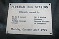
 Fareham Bus Station - geograph.org.uk - 616718.jpg 640 × 480; 52 KB
-
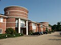
 Fareham Civic Centre, Civic Way, Fareham (May 2019).JPG 1,600 × 1,800; 1.08 MB
-
 Fareham Civic Offices - geograph.org.uk - 616701.jpg 640 × 480; 66 KB
-
 Fareham College - geograph.org.uk - 863178.jpg 640 × 487; 78 KB
-
 Fareham Common beside the M27 - geograph.org.uk - 973241.jpg 640 × 480; 146 KB
-
 Fareham Creek - geograph.org.uk - 1236324.jpg 640 × 428; 112 KB
-
 Fareham Hand Car Wash, Queens Road, Fareham (May 2019).JPG 2,800 × 1,600; 1.59 MB
-
 Fareham Leisure Centre - geograph.org.uk - 615968.jpg 640 × 480; 44 KB
-
 Fareham Library - geograph.org.uk - 616696.jpg 640 × 480; 78 KB
-
 Fareham Library, off Osborn Road, Fareham (May 2019).JPG 3,000 × 2,000; 1.75 MB
-
 Fareham lines 1841.png 1,036 × 1,034; 76 KB
-
 Fareham lines 1848.png 1,036 × 1,034; 89 KB
-
 Fareham lines 1866.png 1,036 × 1,034; 99 KB
-
 Fareham lines 1894.png 1,036 × 1,034; 110 KB
-
 Fareham lines 1904.png 1,036 × 1,034; 117 KB
-
 Fareham Magistrates Court - geograph.org.uk - 617971.jpg 640 × 480; 50 KB
-
 Fareham Police Station - geograph.org.uk - 616671.jpg 640 × 480; 49 KB
-
 Fareham Register Office - geograph.org.uk - 615913.jpg 640 × 480; 63 KB
-
 Fareham Registry Office, Osborn Road South, Fareham (May 2019).JPG 2,800 × 1,600; 1.48 MB
-
 Fareham Road - geograph.org.uk - 1273816.jpg 640 × 480; 76 KB
-
 Fareham Road Dental Practice - geograph.org.uk - 1762677.jpg 640 × 428; 67 KB
-
 Fareham UK local election 2006 map.svg 1,385 × 1,226; 373 KB
-
 Fareham Youth Centre - geograph.org.uk - 617979.jpg 640 × 480; 63 KB
-
 FarehamConstituency.svg 300 × 270; 103 KB
-
 FarehamShoppingCentre2Dec2006.jpg 2,272 × 1,704; 2.12 MB
-
 Farmers Market-Fareham - geograph.org.uk - 708207.jpg 640 × 399; 79 KB
-
 Farmland, South of Fareham - geograph.org.uk - 297940.jpg 640 × 480; 289 KB
-
 Fastway in West Street - geograph.org.uk - 1503318.jpg 480 × 640; 45 KB
-

-
 Firework display at Cams Alders(1) - geograph.org.uk - 1072043.jpg 7,198 × 4,577; 1.99 MB
-
 Firework display at Cams Alders(2) - geograph.org.uk - 1072051.jpg 640 × 409; 35 KB
-
 Firework display at Cams Alders(3) - geograph.org.uk - 1072065.jpg 7,198 × 4,494; 2.94 MB
-
 Firework display at Cams Alders(4) - geograph.org.uk - 1072074.jpg 640 × 409; 45 KB
-
 Football Club - Fareham - geograph.org.uk - 927076.jpg 640 × 480; 71 KB
-

-
 Footbridge in Wallington - geograph.org.uk - 1607290.jpg 640 × 480; 84 KB
-

-

-
 Footpath to NatWest Call Centre - geograph.org.uk - 616529.jpg 640 × 480; 101 KB
-
 Fort Wallington 1 - geograph.org.uk - 763968.jpg 640 × 480; 88 KB
-
 Fort Wallington 2 - geograph.org.uk - 763970.jpg 640 × 480; 61 KB
-
 GMK Ltd, Bear House.JPG 3,008 × 2,000; 2.46 MB
-
 Gordon Road. - Fareham - geograph.org.uk - 863230.jpg 640 × 480; 83 KB
-
 Grove Care Group in West Street - geograph.org.uk - 1503340.jpg 469 × 640; 70 KB
-

-
 Helicopter passing over Wicor Rec - geograph.org.uk - 2691912.jpg 640 × 480; 41 KB
-
 HMS Daedalus (RNAS Lee-on-Solent) 781 Sq, SAR Flight Building (34832590094).jpg 2,815 × 1,877; 3.75 MB
-
 HMS Daedalus (RNAS Lee-on-Solent) 781 Sq, SAR ramp and hangars (35633891846).jpg 2,776 × 1,851; 5.72 MB
-
 Holy Trinity Car Park - geograph.org.uk - 617947.jpg 640 × 480; 57 KB
-
 Houses in Western Road - geograph.org.uk - 1511592.jpg 640 × 480; 76 KB
-
 Industrial Units at 280 and 282 West Street, Fareham (May 2019).JPG 2,800 × 1,400; 1.44 MB
-
 Leisure Centre-Fareham - geograph.org.uk - 734794.jpg 640 × 373; 43 KB
-
 Locks Heath Ladies FC.jpg 720 × 482; 97 KB
-
 Looking at Fareham from Whitedell Lane - geograph.org.uk - 1282372.jpg 640 × 427; 165 KB
-

-

-

-

-
 Lovely brick house in Western Road - geograph.org.uk - 616734.jpg 640 × 480; 85 KB
-
 Lower Brownwich Farm, Fareham - geograph.org.uk - 814343.jpg 640 × 480; 99 KB
-

-
 Masonic Hall, Queens Road, Fareham (May 2019).JPG 3,000 × 1,500; 1.71 MB
-
 Meon valley rly.png 848 × 1,519; 81 KB
-
 Mid November 2011- Wicor Rec (6) - geograph.org.uk - 2690315.jpg 640 × 480; 73 KB
-

-
 Mitre Court - Fareham - geograph.org.uk - 927117.jpg 640 × 480; 71 KB
-
 Mobile Libraries - Fareham - geograph.org.uk - 845097.jpg 640 × 480; 90 KB
-
 MOD Lambretta.jpg 375 × 500; 214 KB
-

-
 More recent housing - geograph.org.uk - 230142.jpg 640 × 480; 52 KB
-
 New Accommodation - Fareham - geograph.org.uk - 1094008.jpg 640 × 480; 72 KB
-
 New Apartments - Fareham - geograph.org.uk - 760241.jpg 640 × 460; 87 KB
-

-
 New Housing - geograph.org.uk - 230612.jpg 640 × 480; 57 KB
-
 NHS Dental Access Centre - Fareham - geograph.org.uk - 1092584.jpg 640 × 480; 95 KB
-
 NHS dentists at Church Place - geograph.org.uk - 616531.jpg 640 × 480; 87 KB
-
 Nightclub near Bus Station - geograph.org.uk - 616705.jpg 640 × 480; 86 KB
-
 Oasis of calm in Fareham - geograph.org.uk - 615926.jpg 640 × 480; 77 KB
-
 Offices of Fareham Community Action - geograph.org.uk - 617974.jpg 640 × 480; 52 KB
-
 Old Bridge-wallington - geograph.org.uk - 748008.jpg 640 × 480; 109 KB
-
 Old cottages-Wallington, near Fareham - geograph.org.uk - 747834.jpg 640 × 480; 82 KB
-

-
 Park Gate Primary School - geograph.org.uk - 610169.jpg 640 × 480; 48 KB
-
 Path to Town Centre - Fareham - geograph.org.uk - 863232.jpg 640 × 480; 85 KB
-

-
 Path towards North Fareham Farm - geograph.org.uk - 973309.jpg 640 × 480; 181 KB
-
 Patriotic flats in Trinity Street - geograph.org.uk - 617962.jpg 640 × 480; 76 KB
-
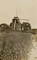 Peel Common Mill, Fareham.jpg 896 × 1,464; 183 KB
-
 Phonebox outside Shopping Mall - geograph.org.uk - 615908.jpg 640 × 480; 87 KB
-
 Play Area - Fareham - geograph.org.uk - 838234.jpg 640 × 480; 106 KB
-
 Play Area outside Shopping Mall - geograph.org.uk - 615901.jpg 640 × 480; 76 KB
-
 Play Ground-Portchester - geograph.org.uk - 742579.jpg 640 × 408; 75 KB
-
 Portchester - Cams Bay - geograph.org.uk - 2489711.jpg 640 × 480; 75 KB
-
 Postbox in Gordon Road - geograph.org.uk - 616030.jpg 640 × 480; 90 KB
-
 Prague Junction former night club - geograph.org.uk - 615984.jpg 640 × 480; 58 KB
-
 Public toilets behind Wilkinsons - geograph.org.uk - 1504936.jpg 640 × 480; 81 KB
-
 Railway bridge in Palmerston Drive - geograph.org.uk - 1635060.jpg 640 × 480; 81 KB
-
 Railway bridge in Redlands Lane - geograph.org.uk - 1635068.jpg 640 × 480; 77 KB
-
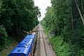
 Railway Cutting - Fareham - geograph.org.uk - 789267.jpg 640 × 439; 101 KB
-
 Rainbow Centre - Fareham - geograph.org.uk - 927101.jpg 640 × 480; 62 KB
-
 Rear of Fareham Shopping Centre, Fareham (May 2019).JPG 2,800 × 1,800; 1.58 MB
-

-
 Redlands Lane - geograph.org.uk - 1518641.jpg 640 × 428; 48 KB
-
 Registry Office-Fareham - geograph.org.uk - 702295.jpg 640 × 423; 85 KB
-
 Renovations underway at Domino's - geograph.org.uk - 1503442.jpg 480 × 640; 56 KB
-
 Repairs underway in Queen's Road - geograph.org.uk - 1511626.jpg 640 × 480; 75 KB
-
 Retirement Apartments - Fareham - geograph.org.uk - 863227.jpg 640 × 480; 67 KB
-
 River Wallington in Fareham.jpg 1,672 × 962; 337 KB
-
 RJG in East Street - geograph.org.uk - 1511370.jpg 480 × 640; 88 KB
-
 Rodney Strong Russian River Valley Pinot Noir.jpg 2,448 × 3,264; 2.89 MB
-

-
 Rugby Club Building - Fareham - geograph.org.uk - 927085.jpg 640 × 480; 70 KB
-
 Saxon Cremation Urn.jpg 5,184 × 3,456; 5.93 MB
-
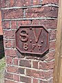 Service Value Plaque 8 Ft.jpg 3,456 × 4,608; 8.55 MB
-
 Skate Park and Play Ground-Fareham - geograph.org.uk - 742015.jpg 640 × 402; 83 KB
-
 Soton - fareham - 1889.png 1,257 × 1,036; 100 KB
-
 Southampton to Fareham Railway Line - geograph.org.uk - 459726.jpg 640 × 427; 166 KB
-
 St John Ambulance Hall, Queens Road, Fareham (May 2019).JPG 2,800 × 1,600; 1.92 MB
-
 Station Approach Car Park, Fareham.jpg 3,456 × 4,608; 5.98 MB
-
 Subway beneath A27 at Segensworth - geograph.org.uk - 459695.jpg 640 × 427; 221 KB


_-_geograph.org.uk_-_2690829.jpg)
_-_geograph.org.uk_-_2690831.jpg)
_-_geograph.org.uk_-_2691809.jpg)
_-_geograph.org.uk_-_2691898.jpg)
_-_geograph.org.uk_-_2691900.jpg)
_-_geograph.org.uk_-_2691949.jpg)


_-_geograph.org.uk_-_1216430.jpg)
_-_geograph.org.uk_-_1216450.jpg)
_-_geograph.org.uk_-_1216476.jpg)
_-_geograph.org.uk_-_1216499.jpg)
_-_geograph.org.uk_-_1216518.jpg)

.jpg)


.jpg)


.jpg)


.JPG)


.JPG)


.JPG)


.JPG)


_-_geograph.org.uk_-_1072043.jpg)
_-_geograph.org.uk_-_1072051.jpg)
_-_geograph.org.uk_-_1072065.jpg)
_-_geograph.org.uk_-_1072074.jpg)


_781_Sq,_SAR_Flight_Building_(34832590094).jpg)
_781_Sq,_SAR_ramp_and_hangars_(35633891846).jpg)


.JPG)


_-_geograph.org.uk_-_1341881.jpg)
_-_geograph.org.uk_-_1341889.jpg)


.JPG)
.JPG)

_-_geograph.org.uk_-_2690315.jpg)


_Industrial_Estate_-_geograph.org.uk_-_459664.jpg)


.JPG)


.JPG)

