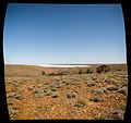
Category:Far North
Jump to navigation
Jump to search
large region in northern South Australia | |||||
| Upload media | |||||
| Instance of | |||||
|---|---|---|---|---|---|
| Location | South Australia, AUS | ||||
 | |||||
Subcategories
This category has the following 20 subcategories, out of 20 total.
A
- Algebuckina Bridge (10 F)
- Anna Creek Station (5 F)
B
D
E
F
L
M
- Marree Man (6 F)
O
- Oodnadatta Track (47 F)
- Operation Buffalo (1956) (11 F)
- Operation Totem (2 F)
P
- Plaques in Far North (3 F)
R
T
W
Media in category "Far North"
The following 41 files are in this category, out of 41 total.
-
Andamooka Homestead 1895.jpg 700 × 480; 20 KB
-
Anna Creek Painted Hills.jpg 1,024 × 683; 128 KB
-
Australian wild melons and bluebush grasslands, Lake Gairdner National Park, South Australia.jpg 3,435 × 5,158; 18.71 MB
-
Birdsville DSC02988 SA (38274169246).jpg 5,008 × 3,756; 4.81 MB
-
BoreTrack.jpg 855 × 1,278; 138 KB
-
Camel Muster On APY Lands Australia.jpg 1,024 × 683; 454 KB
-
Classic Andamooka - Flickr - mikecogh.jpg 1,600 × 1,147; 849 KB
-
Clayton Station DSC03014 SA (38329118701).jpg 2,455 × 1,841; 1.4 MB
-
Distant view of Farina ca 1880 (SLSA B 9329) (Samuel White Sweet).jpg 922 × 434; 416 KB
-
Dry Plantation - panoramio.jpg 2,848 × 2,136; 2.76 MB
-
Endless Stations 20 - Salt Pan.jpg 5,120 × 2,060; 8.06 MB
-
Endless Stations 21 - Desert Stop.jpg 5,120 × 3,344; 12.18 MB
-
Endless Stations 22 - Salt Lake.jpg 3,195 × 3,000; 9.43 MB
-
Endless Stations 24 - Into The Outback or Crows in the Scrub.jpg 5,120 × 3,046; 14.69 MB
-
Guten morgen Afrika! (4754136720).jpg 1,200 × 800; 709 KB
-
Heading out to inland sea.jpg 3,000 × 4,000; 3.47 MB
-
Hommage a SENDE Daniel, le Chercheur du monde rural.pdf 1,239 × 1,752, 2 pages; 81 KB
-
Lake Gairdner Natl. Park banner.jpg 4,114 × 588; 2.3 MB
-
Lake Hart Salt Lake South Australia.jpg 4,000 × 3,000; 4.49 MB
-
Land Cruiser HZJ-105.jpg 3,016 × 2,008; 8.11 MB
-
Map of the Far North region of South Australia (no placenames).png 1,796 × 2,289; 3.22 MB
-
Mintabie painted desert (3738906428).jpg 3,648 × 2,736; 1.75 MB
-
Mintabie's old mine shafts (3738112921).jpg 3,648 × 2,736; 1.74 MB
-
Paralana Springs - panoramio.jpg 2,760 × 4,912; 7 MB
-
Pohled na Island Lagoon ze silnice Stuart HWY - panoramio.jpg 2,048 × 1,536; 1.36 MB
-
Radiumridgemine arkaroola.JPG 2,304 × 3,072; 3.15 MB
-
Red dune, yellow ochre flat - panoramio.jpg 3,179 × 2,336; 2.21 MB
-
Salt lake sighing - panoramio.jpg 2,000 × 1,473; 977 KB
-
Salt pan and bluebush in Lake Gairdner National Park, South Australia.jpg 5,016 × 3,344; 16.44 MB
-
Simpson DSC02919 SA (38195707576).jpg 5,020 × 3,764; 4.84 MB
-
Simpson DSC02923 SA (38195705216).jpg 5,132 × 3,848; 4.7 MB
-
South Australia Outback (2093321668).jpg 800 × 429; 40 KB
-
Strezlecki Desert SA - panoramio.jpg 4,912 × 3,264; 5.59 MB
-
Strezleki Desert - panoramio.jpg 1,879 × 1,008; 882 KB
-
Sturt's desert pea (Swainsona formosa) in Lake Gairdner National Park.jpg 3,021 × 2,014; 3.6 MB
-
Sunset along Hwy A87 N into the Red Centre - (13113070625).jpg 5,616 × 3,744; 19.1 MB
-
Sunset along Hwy A87 N into the Red Centre - (13113349924).jpg 5,565 × 3,710; 6.03 MB
-
Агата Волкова.jpg 3,968 × 3,408; 5.73 MB


