Category:Famartin's December 2011 photos
Jump to navigation
Jump to search
Media in category "Famartin's December 2011 photos"
The following 89 files are in this category, out of 89 total.
-
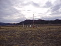
 2011-12-14 Eureka Airport ASOS viewed from the east-northeast.JPG 3,264 × 2,448; 1.96 MB
-
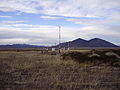
 2011-12-14 Eureka Airport ASOS viewed from the east-southeast.JPG 3,264 × 2,448; 1.96 MB
-
 2011-12-14 Eureka Airport ASOS viewed from the east.JPG 3,264 × 2,448; 2.05 MB
-
 2011-12-14 Eureka Airport ASOS viewed from the north-northeast.JPG 3,264 × 2,448; 1.97 MB
-
 2011-12-14 Eureka Airport ASOS viewed from the north-northwest.JPG 3,264 × 2,448; 1.97 MB
-
 2011-12-14 Eureka Airport ASOS viewed from the north.JPG 3,264 × 2,448; 2 MB
-
 2011-12-14 Eureka Airport ASOS viewed from the northeast.JPG 3,264 × 2,448; 1.97 MB
-
 2011-12-14 Eureka Airport ASOS viewed from the northwest.JPG 3,264 × 2,448; 1.95 MB
-

-
 2011-12-14 Eureka Airport ASOS viewed from the south-southwest.JPG 3,264 × 2,448; 1.99 MB
-
 2011-12-14 Eureka Airport ASOS viewed from the south.JPG 3,264 × 2,448; 2 MB
-

-
 2011-12-14 Eureka Airport ASOS viewed from the southwest.JPG 3,264 × 2,448; 2.01 MB
-
 2011-12-14 Eureka Airport ASOS viewed from the west 2.JPG 3,264 × 2,448; 1.98 MB
-
 2011-12-14 Eureka Airport ASOS viewed from the west-northwest.JPG 3,264 × 2,448; 1.99 MB
-
 2011-12-14 Eureka Airport ASOS viewed from the west-southwest 2.JPG 3,264 × 2,448; 1.99 MB
-
 2011-12-14 Eureka Airport ASOS viewed from the west-southwest.JPG 3,264 × 2,448; 2.02 MB
-
 2011-12-14 Eureka Airport ASOS viewed from the west.JPG 3,264 × 2,448; 1.92 MB
-
 2011-12-14 Tonopah Airport ASOS automatic heated tipping bucket precipitation gauge.JPG 3,264 × 2,448; 2.03 MB
-
 2011-12-14 Tonopah Airport ASOS viewed from the east-northeast 1.JPG 3,264 × 2,448; 2.05 MB
-
 2011-12-14 Tonopah Airport ASOS viewed from the east-northeast 2.JPG 3,264 × 2,448; 1.98 MB
-
 2011-12-14 Tonopah Airport ASOS viewed from the east-southeast 1.JPG 3,264 × 2,448; 2 MB
-
 2011-12-14 Tonopah Airport ASOS viewed from the east-southeast 2.JPG 3,264 × 2,448; 1.97 MB
-
 2011-12-14 Tonopah Airport ASOS viewed from the east.JPG 3,264 × 2,448; 1.98 MB
-
 2011-12-14 Tonopah Airport ASOS viewed from the north-northeast.JPG 3,264 × 2,448; 2.03 MB
-
 2011-12-14 Tonopah Airport ASOS viewed from the north-northwest.JPG 3,264 × 2,448; 2.01 MB
-
 2011-12-14 Tonopah Airport ASOS viewed from the north.JPG 3,264 × 2,448; 1.98 MB
-
 2011-12-14 Tonopah Airport ASOS viewed from the northeast.JPG 3,264 × 2,448; 2 MB
-
 2011-12-14 Tonopah Airport ASOS viewed from the northwest.JPG 3,264 × 2,448; 1.98 MB
-
 2011-12-14 Tonopah Airport ASOS viewed from the south 1.JPG 3,264 × 2,448; 1.99 MB
-
 2011-12-14 Tonopah Airport ASOS viewed from the south 2.JPG 3,264 × 2,448; 1.98 MB
-
 2011-12-14 Tonopah Airport ASOS viewed from the south-southeast.JPG 3,264 × 2,448; 2.03 MB
-
 2011-12-14 Tonopah Airport ASOS viewed from the south-southwest.JPG 3,264 × 2,448; 2 MB
-
 2011-12-14 Tonopah Airport ASOS viewed from the southeast 1.JPG 3,264 × 2,448; 2.05 MB
-
 2011-12-14 Tonopah Airport ASOS viewed from the southeast 2.JPG 3,264 × 2,448; 2.01 MB
-
 2011-12-14 Tonopah Airport ASOS viewed from the southwest.JPG 3,264 × 2,448; 1.99 MB
-
 2011-12-14 Tonopah Airport ASOS viewed from the west-northwest.JPG 3,264 × 2,448; 1.99 MB
-
 2011-12-14 Tonopah Airport ASOS viewed from the west-southwest.JPG 3,264 × 2,448; 2.02 MB
-
 2011-12-14 Tonopah Airport ASOS viewed from the west.JPG 3,264 × 2,448; 2.04 MB
-
 2011-12-30 Ely Airport ASOS viewed from the east-northeast.JPG 3,264 × 2,448; 1.95 MB
-
 2011-12-30 Ely Airport ASOS viewed from the east-southeast.JPG 3,264 × 2,448; 1.97 MB
-
 2011-12-30 Ely Airport ASOS viewed from the east.JPG 3,264 × 2,448; 2.01 MB
-
 2011-12-30 Ely Airport ASOS viewed from the north-northeast.JPG 3,264 × 2,448; 2 MB
-
 2011-12-30 Ely Airport ASOS viewed from the north-northwest.JPG 3,264 × 2,448; 2 MB
-
 2011-12-30 Ely Airport ASOS viewed from the north.JPG 3,264 × 2,448; 2 MB
-
 2011-12-30 Ely Airport ASOS viewed from the northeast.JPG 3,264 × 2,448; 1.96 MB
-
 2011-12-30 Ely Airport ASOS viewed from the northwest.JPG 3,264 × 2,448; 1.98 MB
-
 2011-12-30 Ely Airport ASOS viewed from the south 2.JPG 3,264 × 2,448; 2.02 MB
-
 2011-12-30 Ely Airport ASOS viewed from the south-southeast 2.JPG 3,264 × 2,448; 2.01 MB
-
 2011-12-30 Ely Airport ASOS viewed from the south-southeast.JPG 3,264 × 2,448; 1.97 MB
-
 2011-12-30 Ely Airport ASOS viewed from the south-southwest.JPG 3,264 × 2,448; 2 MB
-
 2011-12-30 Ely Airport ASOS viewed from the south.JPG 3,264 × 2,448; 2.02 MB
-
 2011-12-30 Ely Airport ASOS viewed from the southeast.JPG 3,264 × 2,448; 1.97 MB
-
 2011-12-30 Ely Airport ASOS viewed from the southwest.JPG 3,264 × 2,448; 2.01 MB
-
 2011-12-30 Ely Airport ASOS viewed from the west-northwest.JPG 3,264 × 2,448; 2.01 MB
-
 2011-12-30 Ely Airport ASOS viewed from the west-southwest.JPG 3,264 × 2,448; 1.98 MB
-
 2011-12-30 Ely Airport ASOS viewed from the west.JPG 3,264 × 2,448; 2 MB
-
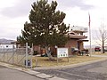
 2011-12-30 Former Ely Airport National Weather Service Office viewed from the south.JPG 3,264 × 2,448; 2.07 MB
-
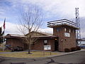
 2011-12-30 Former Ely Airport National Weather Service Office viewed from the west.JPG 3,264 × 2,448; 1.99 MB
-

-
-

-
-
 2011-12-30 Winnemucca Airport ASOS AWPAG precipitation gauge label.JPG 3,264 × 2,448; 1.92 MB
-
 2011-12-30 Winnemucca Airport ASOS CL-31 ceilometer label.JPG 3,264 × 2,448; 1.93 MB
-
 2011-12-30 Winnemucca Airport ASOS DTS-1 dewpoint temperature system label.JPG 3,264 × 2,448; 1.91 MB
-
 2011-12-30 Winnemucca Airport ASOS freezing rain (icing) sensor label.JPG 3,264 × 2,448; 1.84 MB
-
 2011-12-30 Winnemucca Airport ASOS HO-1088 hygrothermometer label.JPG 3,264 × 2,448; 1.78 MB
-
 2011-12-30 Winnemucca Airport ASOS TSS-924 thunderstorm sensor label.JPG 3,264 × 2,448; 1.75 MB
-
 2011-12-30 Winnemucca Airport ASOS viewed from the east-northeast.JPG 3,264 × 2,448; 1.99 MB
-
 2011-12-30 Winnemucca Airport ASOS viewed from the east-southeast.JPG 3,264 × 2,448; 1.93 MB
-
 2011-12-30 Winnemucca Airport ASOS viewed from the east.JPG 3,264 × 2,448; 1.99 MB
-
 2011-12-30 Winnemucca Airport ASOS viewed from the north-northeast.JPG 3,264 × 2,448; 1.99 MB
-
 2011-12-30 Winnemucca Airport ASOS viewed from the north-northwest.JPG 3,264 × 2,448; 2.02 MB
-
 2011-12-30 Winnemucca Airport ASOS viewed from the north.JPG 3,264 × 2,448; 1.99 MB
-
 2011-12-30 Winnemucca Airport ASOS viewed from the northeast.JPG 3,264 × 2,448; 1.94 MB
-
 2011-12-30 Winnemucca Airport ASOS viewed from the northwest.JPG 3,264 × 2,448; 1.95 MB
-
 2011-12-30 Winnemucca Airport ASOS viewed from the south 2.JPG 3,264 × 2,448; 1.98 MB
-
 2011-12-30 Winnemucca Airport ASOS viewed from the south-southeast.JPG 3,264 × 2,448; 1.94 MB
-
 2011-12-30 Winnemucca Airport ASOS viewed from the south-southwest 1.JPG 3,264 × 2,448; 2.01 MB
-
 2011-12-30 Winnemucca Airport ASOS viewed from the south-southwest 2.JPG 3,264 × 2,448; 1.99 MB
-
 2011-12-30 Winnemucca Airport ASOS viewed from the south.JPG 3,264 × 2,448; 2.01 MB
-
 2011-12-30 Winnemucca Airport ASOS viewed from the southeast.JPG 3,264 × 2,448; 1.98 MB
-
 2011-12-30 Winnemucca Airport ASOS viewed from the southwest.JPG 3,264 × 2,448; 1.94 MB
-
 2011-12-30 Winnemucca Airport ASOS viewed from the west-northwest 1.JPG 3,264 × 2,448; 1.99 MB
-
 2011-12-30 Winnemucca Airport ASOS viewed from the west-northwest 2.JPG 3,264 × 2,448; 1.97 MB
-
 2011-12-30 Winnemucca Airport ASOS viewed from the west-southwest.JPG 3,264 × 2,448; 2.03 MB
-
 2011-12-30 Winnemucca Airport ASOS viewed from the west.JPG 3,264 × 2,448; 2.02 MB
-
 2011-12-30 Winnemucca Airport ASOS visibility sensor label.JPG 3,264 × 2,448; 1.82 MB


_viewed_from_the_northeast.JPG)
_viewed_from_the_northwest.JPG)
_viewed_from_the_southeast.JPG)
_viewed_from_the_southwest.JPG)


_sensor_label.JPG)


