Category:Fallowfield Loop cycle route
Jump to navigation
Jump to search
shared-use path around the south of Manchester, England  | |||||
| Upload media | |||||
| Instance of | |||||
|---|---|---|---|---|---|
| Location | Manchester, Greater Manchester, North West England, England | ||||
| Replaces | |||||
| |||||
Subcategories
This category has only the following subcategory.
L
Pages in category "Fallowfield Loop cycle route"
This category contains only the following page.
Media in category "Fallowfield Loop cycle route"
The following 37 files are in this category, out of 37 total.
-

-
 A signpost on the Fallowfield Loop near Nelstrop Road (8513119887).jpg 2,736 × 3,648; 5.01 MB
-
-
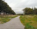
 Cycle route on a former railway - geograph.org.uk - 4518560.jpg 6,000 × 4,000; 5.98 MB
-
 Cycleway - geograph.org.uk - 2757105.jpg 640 × 480; 624 KB
-
 Errwood Road Bridge - geograph.org.uk - 2941034.jpg 1,024 × 768; 285 KB
-
 Fallowfield Loop (8541036270).jpg 2,048 × 1,536; 1,005 KB
-
 Fallowfield Loop (9884203675).jpg 4,320 × 3,240; 5.46 MB
-
 Fallowfield Loop - geograph.org.uk - 4445358.jpg 5,143 × 3,429; 1.71 MB
-
 Fallowfield Loop - geograph.org.uk - 4445361.jpg 5,184 × 3,456; 2.04 MB
-
 Fallowfield Loop - Sustrans mural on the Wellington Road bridge (9757355045).jpg 4,320 × 3,240; 5.92 MB
-

-
 Fallowfield Loop barrier (8539993069).jpg 3,648 × 2,736; 6.23 MB
-
 Fallowfield Loop blackberry pickers (9884390936).jpg 4,320 × 3,240; 5.49 MB
-
 Fallowfield Loop cycle route 18 37 36 206000.jpeg 3,264 × 2,448; 3.43 MB
-
 Fallowfield Loop cycle route 18 38 08 781000.jpeg 3,264 × 2,448; 3.02 MB
-
 Fallowfield Loop cycle route 18 38 37 476000.jpeg 3,264 × 2,448; 3.35 MB
-
 Fallowfield Loop cycle route 18 39 09 697000.jpeg 3,264 × 2,448; 2.96 MB
-
 Fallowfield Loop cycle route 18 39 38 791000.jpeg 3,264 × 2,448; 3.43 MB
-
 Fallowfield Loop cycle route 18 40 11 585000.jpeg 3,264 × 2,448; 3.18 MB
-
 Fallowfield Loop cycle route 18 40 42 781000.jpeg 3,264 × 2,448; 2.9 MB
-
 Fallowfield Loop cycle route.jpeg 3,264 × 2,448; 3.02 MB
-
 Fallowfield Loop Lindlewood Lane bridge.jpg 1,024 × 768; 325 KB
-

-

-
 Fallowfield Loop old woman sculpture (8199415725).jpg 3,648 × 2,736; 5.94 MB
-
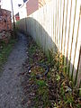
 Footpath to Fairfield - geograph.org.uk - 1504802.jpg 640 × 510; 123 KB
-

-
 Hyde Road, Gorton from Fallowfield Loop Line bridge (towards Debdale Park and Denton).jpg 5,184 × 3,888; 1.35 MB
-

-
 Path down to the Fallowfield Loop - geograph.org.uk - 6372466.jpg 5,597 × 3,731; 4.42 MB
-
 The "Man Woman Child" sculptures by Rachel Ramchurn on the Fallowfield Loop (8200756250).jpg 3,648 × 2,736; 5.84 MB
-
 The Debdale Park access point onto the Fallowfield Loop (8508873738).jpg 3,648 × 2,736; 5.91 MB
-
 The eastern end of the Fallowfield Loop near Fairfield Station (8501193137).jpg 2,736 × 3,648; 4.28 MB
-
 The Fallowfield Loop - geograph.org.uk - 5573580.jpg 1,280 × 960; 1.13 MB
-
 The Thirlmere Aqueduct passing over the Fallowfield Loop (8514240210).jpg 3,648 × 2,736; 5.51 MB
-
 Two for Joy - geograph.org.uk - 1159286.jpg 640 × 430; 107 KB
.jpg)
.jpg)


.jpg)
.jpg)


.jpg)
.jpg)
.jpg)


_-_geograph.org.uk_-_3215462.jpg)
.jpg)

.jpg)
.jpg)


.jpg)
.jpg)
.jpg)

.jpg)

.jpg)