Category:Fala, Midlothian
Jump to navigation
Jump to search
hamlet in the south-eastern corner of Midlothian, Scotland, UK | |||||
| Upload media | |||||
| Instance of | |||||
|---|---|---|---|---|---|
| Part of |
| ||||
| Location |
| ||||
 | |||||
English: Fala, is a parish and hamlet in the south-eastern corner of Midlothian, Scotland, and about 15 miles from Edinburgh.
Subcategories
This category has the following 7 subcategories, out of 7 total.
Media in category "Fala, Midlothian"
The following 45 files are in this category, out of 45 total.
-
A beech shelter belt - geograph.org.uk - 1187055.jpg 427 × 640; 123 KB
-
A country road. - geograph.org.uk - 1002008.jpg 640 × 480; 75 KB
-
A dry valley - geograph.org.uk - 540749.jpg 640 × 480; 68 KB
-
Beside the Dean Burn - geograph.org.uk - 175710.jpg 640 × 487; 83 KB
-
Billboard, A68 - geograph.org.uk - 541663.jpg 640 × 480; 69 KB
-
Costerton Ford - geograph.org.uk - 82967.jpg 640 × 480; 112 KB
-
Costerton Mains - geograph.org.uk - 82964.jpg 640 × 459; 85 KB
-
Dean Burn - geograph.org.uk - 558502.jpg 640 × 480; 95 KB
-
Dread words, Fala - geograph.org.uk - 83055.jpg 640 × 480; 116 KB
-
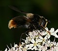
Eriozona syrphoides (male) (6073231019).jpg 1,461 × 1,290; 549 KB
-
Eriozona syrphoides (male) (6073235553).jpg 1,084 × 926; 383 KB
-
Eriozona syrphoides (male) (6073772964).jpg 1,524 × 1,209; 654 KB
-
Eriozona syrphoides (male) (6073774044).jpg 1,428 × 1,146; 564 KB
-
Eriozona syrphoides (male) (6073775592).jpg 1,192 × 942; 415 KB
-
Eriozona syrphoides (male) (6073778034).jpg 2,124 × 1,782; 1.15 MB
-
Eriozona syrphoides (male) (6073779902).jpg 1,916 × 1,932; 1.24 MB
-
Fala - geograph.org.uk - 83051.jpg 640 × 422; 59 KB
-
Fala - geograph.org.uk - 83053.jpg 640 × 429; 64 KB
-
Fala Cemetery - geograph.org.uk - 1187038.jpg 640 × 427; 130 KB
-
Fala Dam - geograph.org.uk - 82958.jpg 639 × 461; 101 KB
-
Fala Mill, towards Fala Dam.jpg 640 × 480; 119 KB
-
Farm Buildings at Blackshiels - geograph.org.uk - 1029845.jpg 640 × 480; 56 KB
-
Farmland at Fala Hall - geograph.org.uk - 1198579.jpg 427 × 640; 155 KB
-
Field margin near Watergate Toll. - geograph.org.uk - 83060.jpg 640 × 480; 119 KB
-
Fields, Fala - geograph.org.uk - 547899.jpg 640 × 480; 68 KB
-
Fly sp - Flickr - S. Rae.jpg 928 × 656; 272 KB
-
Former drive^ - geograph.org.uk - 547897.jpg 480 × 640; 123 KB
-
Frostineb road. - geograph.org.uk - 137155.jpg 640 × 480; 63 KB
-
Juniperlea - geograph.org.uk - 548887.jpg 640 × 480; 70 KB
-
Linn Dean - geograph.org.uk - 1067948.jpg 640 × 480; 92 KB
-
Melanostoma or Platycheirus male - Flickr - S. Rae.jpg 1,596 × 1,156; 661 KB
-
My Grandfather's Bakery - geograph.org.uk - 477137.jpg 640 × 480; 88 KB
-
Old drifts, Fala. - geograph.org.uk - 137151.jpg 640 × 480; 50 KB
-
Ordnance Survey Sheet NT 45 (36 45) Soutra, Published 1950.jpg 7,481 × 8,792; 5.18 MB
-
Partridge Burn. - geograph.org.uk - 137158.jpg 480 × 640; 106 KB
-
Rhinanthus minor (Yellow Rattle) - Flickr - S. Rae (1).jpg 1,856 × 1,480; 814 KB
-
Rhinanthus minor (Yellow Rattle) - Flickr - S. Rae.jpg 1,752 × 1,596; 845 KB
-
Roadside flowers - geograph.org.uk - 540753.jpg 480 × 640; 140 KB
-
Rooks and stubble, Fala. - geograph.org.uk - 83048.jpg 640 × 417; 56 KB
-
Sheep, Costerton. - geograph.org.uk - 82966.jpg 640 × 480; 128 KB
-
Stubble off the Salter's Road. - geograph.org.uk - 82963.jpg 640 × 480; 101 KB
-
Stubble, Fala. - geograph.org.uk - 83058.jpg 640 × 480; 79 KB
-
The village of Fala - geograph.org.uk - 1187047.jpg 640 × 427; 132 KB


