Category:Fair Snape Fell
Jump to navigation
Jump to search
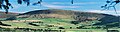
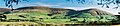
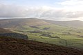
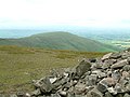
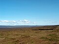
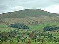
English: Fair Snape Fell is one of the larger hills in the Forest of Bowland in Lancashire, England. It occupies a position in the very south of the main range of fells, alongside and just to the north of Parlick, joined by a ridge. The main paths approach the summit from Parlick in the south, Saddle Fell in the east and Bleasdale in the west, the Saddle Fell approach being as boggy as the hills to the north. The summit is covered in grass and peat groughs. A trig point and large cairn occupy the top of the western escarpment, with the highest point being about 700 metres (half a mile) to the northeast. (→Fair Snape Fell)
mountain in the United Kingdom  | |||||
| Upload media | |||||
| Instance of | |||||
|---|---|---|---|---|---|
| Part of | |||||
| Location | Forest of Bowland, Lancaster, Lancashire, North West England, England | ||||
| Mountain range | |||||
| Elevation above sea level |
| ||||
| Parent peak | |||||
 | |||||
Media in category "Fair Snape Fell"
The following 32 files are in this category, out of 32 total.
-
 Across Blindhurst Fell from Parlick - geograph.org.uk - 1081962.jpg 640 × 480; 78 KB
-
 Blindhurst Farm, Bowland - geograph.org.uk - 13048.jpg 640 × 480; 74 KB
-
 Cairn and shelter Fair Snape Fell - geograph.org.uk - 964541.jpg 640 × 415; 84 KB
-
 Cairn and Shelter, Fair Snape Fell - geograph.org.uk - 886694.jpg 640 × 480; 48 KB
-
 Cairn on Fair Snape Fell - geograph.org.uk - 1081968.jpg 640 × 480; 56 KB
-
 Fair Snape Fell - geograph.org.uk - 83786.jpg 640 × 480; 78 KB
-
 Fair Snape Fell 234-35.jpg 1,754 × 465; 331 KB
-
 Fair Snape Fell and Parlick 235-2.jpg 1,348 × 294; 113 KB
-
 FairSnapeFell.jpg 640 × 426; 115 KB
-
 Footbridge near Upper Brock Mill - geograph.org.uk - 12247.jpg 640 × 480; 107 KB
-

-
 Parlick from Fair Snape Fell 7948.jpg 640 × 480; 104 KB
-
 Parlick Grid.gif 1,000 × 1,000; 87 KB
-
 Parlick Pike from Fairsnape Cairn - geograph.org.uk - 1065261.jpg 640 × 480; 75 KB
-
 Stile, fence on Parlick - geograph.org.uk - 991448.jpg 640 × 432; 90 KB
-
 The top of Fairsnape Fell - geograph.org.uk - 1713367.jpg 2,272 × 1,712; 883 KB
-
 The trig point on Fairsnape Fell - geograph.org.uk - 1713238.jpg 2,272 × 1,712; 835 KB
-
 Towards Fairsnape - geograph.org.uk - 1451192.jpg 640 × 480; 67 KB
-
 Trig Point on Fair Snape Fell, 1673' - geograph.org.uk - 1126336.jpg 640 × 480; 73 KB
-
 View from Beacon Fell.jpg 640 × 391; 41 KB
-

-
 Blindhurst Fell and Parlick - geograph.org.uk - 359535.jpg 640 × 425; 218 KB
-
 Blindhurst Fell, Bowland - geograph.org.uk - 13055.jpg 640 × 480; 81 KB
-
 Country Road - geograph.org.uk - 122508.jpg 640 × 480; 106 KB
-
 Fair Snape - geograph.org.uk - 415787.jpg 500 × 335; 131 KB
-
 Fosters Wood - geograph.org.uk - 148109.jpg 640 × 480; 88 KB
-
 Holme House Farm, Bleasdale - geograph.org.uk - 72188.jpg 640 × 480; 80 KB
-
 On Holme House Fell - geograph.org.uk - 148403.jpg 640 × 480; 63 KB
-
 Parlick Pike from Beacon Fell - geograph.org.uk - 111275.jpg 640 × 480; 74 KB
-
 Small Disused Quarry, Beacon Fell - geograph.org.uk - 111279.jpg 640 × 480; 161 KB
-
 Trig Point Hazelhurst fell - geograph.org.uk - 72472.jpg 640 × 480; 112 KB
-
 View to Parlick Pike from Beacon Hill - geograph.org.uk - 342018.jpg 640 × 476; 48 KB


