Category:Factory chimneys in West Yorkshire
Jump to navigation
Jump to search
Subcategories
This category has the following 7 subcategories, out of 7 total.
Media in category "Factory chimneys in West Yorkshire"
The following 52 files are in this category, out of 52 total.
-
 Aire ^ Calder Navigation - geograph.org.uk - 4656685.jpg 640 × 480; 65 KB
-
 Albion Mills, Brook Lane, Golcar - geograph.org.uk - 406581.jpg 480 × 640; 69 KB
-
 Brickworks Chimney - geograph.org.uk - 366371.jpg 480 × 640; 72 KB
-
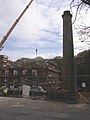
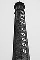 Chimney at Shaw Lodge Mills (8154684621).jpg 2,432 × 3,648; 3.42 MB
-
 Chimney of Firth House Mill, Steel Lane, Barkisland (8290980127).jpg 2,222 × 3,148; 5.59 MB
-
 Chimney of Lumb Mill, Colden Clough - geograph.org.uk - 1161248.jpg 640 × 480; 267 KB
-
 Chimneys, Cinderhills Fireclay Works (16489840267).jpg 2,032 × 3,048; 5.04 MB
-
 Clouds over Calverley (3010526983).jpg 2,166 × 1,444; 1.92 MB
-
 Cooper Bridge, River Calder - geograph.org.uk - 789435.jpg 640 × 405; 73 KB
-

-

-
 Disused Mill - Coney Street - geograph.org.uk - 977210.jpg 640 × 499; 218 KB
-
 Dockfield Mills (8385007080).jpg 2,070 × 2,674; 5.15 MB
-
 Dockfield Mills 1 (3899852131).jpg 1,854 × 3,176; 1.92 MB
-
 Firth House Mills - geograph.org.uk - 52501.jpg 480 × 640; 113 KB
-
 Former Mill near Hallas Bridge - geograph.org.uk - 1377227.jpg 640 × 480; 171 KB
-
 Former pottery on Coal Lane - geograph.org.uk - 1027719.jpg 640 × 480; 214 KB
-
-
 Hole Bottom Lane and 'The' chimney - geograph.org.uk - 656912.jpg 640 × 542; 71 KB
-
 Huddersfield Narrow Canal, Slaithwaite (28710893591).jpg 3,000 × 4,000; 9.1 MB
-
 Jubilee Gardens ^2 - geograph.org.uk - 3759112.jpg 768 × 1,024; 407 KB
-
 Jubilee Mill - geograph.org.uk - 1268465.jpg 640 × 480; 58 KB
-
 Jumble Hole Mill (3600614557).jpg 2,324 × 1,825; 3.42 MB
-

-
 Land Mill - geograph.org.uk - 326704.jpg 480 × 640; 200 KB
-
 Ling Bob Mill - geograph.org.uk - 1592036.jpg 640 × 480; 58 KB
-
 Mill Chimney - geograph.org.uk - 1154737.jpg 640 × 480; 94 KB
-
 Mill Chimneys, Walsden - geograph.org.uk - 1228751.jpg 480 × 640; 51 KB
-
 Mill on the hill (3907278200).jpg 2,454 × 1,636; 3.56 MB
-
 Oats Royd Mill - geograph.org.uk - 1127005.jpg 640 × 480; 57 KB
-
 Oats Royd Mill, Chimney - geograph.org.uk - 1127004.jpg 480 × 640; 65 KB
-
 Oats Royd Mill, Luddenden Dean - geograph.org.uk - 363915.jpg 640 × 474; 96 KB
-
 Old chimney Hebden Bridge - geograph.org.uk - 641699.jpg 426 × 640; 71 KB
-

-
-
 Railway bridge over Burnley Road - geograph.org.uk - 1077247.jpg 640 × 480; 70 KB
-

-
 Reflections in the River Calder at Ravensthorpe Bridge (5503089183).jpg 2,700 × 3,492; 5.86 MB
-
 River Calder - Cooper Bridge Road - geograph.org.uk - 762555.jpg 640 × 480; 46 KB
-
 River Calder - geograph.org.uk - 1058590.jpg 640 × 480; 183 KB
-
 River Calder - geograph.org.uk - 1079265.jpg 640 × 480; 85 KB
-
 River Calder - geograph.org.uk - 1083898.jpg 640 × 480; 62 KB
-
 River Calder - geograph.org.uk - 703174.jpg 640 × 427; 61 KB
-

-
 River Calder - Stubbing Holme Road - geograph.org.uk - 1141330.jpg 640 × 480; 235 KB
-
 River Calder from Town Hall Street - geograph.org.uk - 824267.jpg 640 × 480; 45 KB
-
 River Calder, Wakefield - geograph.org.uk - 926690.jpg 640 × 480; 42 KB
-
 Spire and Chimney (7972220004).jpg 3,000 × 4,000; 8.7 MB
-
 Sykes Mill, Leeming - geograph.org.uk - 898805.jpg 640 × 415; 89 KB
-
 Sykes Mill, Leeming - geograph.org.uk - 898828.jpg 415 × 640; 62 KB
-
 Under the Bridge (5487080602).jpg 2,600 × 3,342; 5.66 MB
-
 View from Crooked Lane (4831053305).jpg 2,389 × 1,593; 3.66 MB


.jpg)
.jpg)

.jpg)
.jpg)


.jpg)
.jpg)


.jpg)


.jpg)


.jpg)


.jpg)


.jpg)


.jpg)
.jpg)