Category:FFH-Gebiet Stoltera bei Rostock
Jump to navigation
Jump to search
| Diese Kategorie repräsentiert ein Schutzgebiet nach Naturschutzrecht in Deutschland. |
|---|
| Diese Kategorie wurde nach einem klaren Schema angelegt, sie sollte nicht verschoben, gelöscht oder umkategorisiert werden. Sie ist unter anderem in dieser Uploadkarte hinterlegt. Beschreibung und Hintergründe auf der Seite des Wikiprojekts |
| Foto zu Wiki Loves Earth hochladen! - Seite von Wiki Loves Earth Deutschland |
protected area in the European Union defined by the habitats directive in Mecklenburg-Vorpommern, Germany | |||||
| Upload media | |||||
| Instance of | |||||
|---|---|---|---|---|---|
| Location |
| ||||
| Applies to jurisdiction | |||||
| Located in or next to body of water | |||||
| Inception |
| ||||
| Area |
| ||||
 | |||||
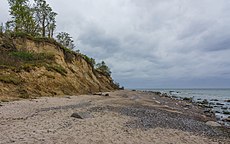
The Stoltera is a strip of land along the coast of the Baltic Sea in Germany.
For more information, see de:Stoltera.
Subcategories
This category has the following 2 subcategories, out of 2 total.
N
- Naturschutzgebiet Stoltera (148 F)
S
Pages in category "FFH-Gebiet Stoltera bei Rostock"
This category contains only the following page.
S
Media in category "FFH-Gebiet Stoltera bei Rostock"
The following 20 files are in this category, out of 20 total.
-
2014 Wilhelmshöhe auf Stoltera bei Warnemünde (top-right).jpg 975 × 969; 279 KB
-
2014 Wilhelmshöhe auf Stoltera bei Warnemünde.jpg 5,120 × 3,413; 3.69 MB
-
2014-06-17T11-38-15 DSC 0840.jpg 4,860 × 3,240; 4.4 MB
-
2016 Wilhelmshöhe Tafel Kliff an der Stoltera.jpg 3,851 × 2,571; 6.77 MB
-
Baum am Stoltera-Kliff.jpg 4,592 × 3,056; 6.78 MB
-
Findling und Geröll.jpg 2,576 × 1,932; 1.53 MB
-
Ostsee. Landzunge zwischen Warnemünde und Heiligendamm.JPG 2,816 × 1,880; 3.04 MB
-
Ostseeküstenradweg bei Warnemünde.JPG 480 × 360; 104 KB
-
Rostock die Hafeneinfaht.JPG 3,302 × 1,278; 2.21 MB
-
Steilküste Stoltera 1.jpg 800 × 600; 217 KB
-
Steilküste Stoltera 2.JPG 800 × 600; 202 KB
-
Steilküste Stoltera 3.JPG 800 × 600; 181 KB
-
Steilküste Stoltera 4.JPG 800 × 600; 284 KB
-
Steilküste Stoltera.jpg 2,736 × 3,648; 5.53 MB
-
Steilufer zwischen Warnemünde und Heiligendamm 2.JPG 2,816 × 1,880; 3.45 MB
-
Steilufer zwischen Warnemünde und Heiligendamm 3.JPG 2,816 × 1,880; 3.3 MB
-
Stoltera Bodenerosion.jpg 5,472 × 3,080; 4.27 MB
-
Stoltera Seeschwalbennester.jpg 4,151 × 2,336; 2.23 MB
-
Stoltera Steilküste.jpg 5,449 × 3,067; 2.7 MB
-
Warnemuende.jpg 1,360 × 1,024; 312 KB


