Category:FFH-Gebiet Mittleres Altmühltal mit Wellheimer Trockental und Schambachtal
Jump to navigation
Jump to search
| Diese Kategorie repräsentiert ein Schutzgebiet nach Naturschutzrecht in Deutschland. |
|---|
| This category was created according to a clear scheme; it should not be moved, deleted or recategorized. It is stored in of this upload map, among other places. Description and background on the Wiki project page |
| Upload photo to Wiki Loves Earth! - Wiki Loves Earth Germany page |
protected area in the European Union defined by the habitats directive in Bayern, Germany  | |||||
| Upload media | |||||
| Instance of | |||||
|---|---|---|---|---|---|
| Location | |||||
| Applies to jurisdiction | |||||
| Inception |
| ||||
| Area |
| ||||
 | |||||
Deutsch: FFH-Gebiet Mittleres Altmühltal mit Wellheimer Trockental und Schambachtal (7132-371) in Bayern
Subcategories
This category has the following 19 subcategories, out of 19 total.
A
B
D
- Dohlenfelsen Konstein (14 F)
F
- Felsgruppe bei Aicha (1 F)
K
- Karstquelle Almosmühle (1 F)
M
- Malmschichten am Arzberg (12 F)
N
S
- Schlossberg Arnsberg (11 F)
T
W
Media in category "FFH-Gebiet Mittleres Altmühltal mit Wellheimer Trockental und Schambachtal"
The following 14 files are in this category, out of 14 total.
-
 2015 Hang bei Obereichstätt 01.jpg 5,184 × 3,456; 4.06 MB
-
 2018 Pappenheim 02.jpg 3,661 × 2,441; 3.38 MB
-
 2018 Pappenheim 03.jpg 3,888 × 2,592; 3.61 MB
-
 Ackerhornkraut Arzberg 01.JPG 3,872 × 2,592; 5.34 MB
-
 Altmühltal-Panoramaweg Obereichstätt.jpg 4,592 × 3,056; 9.11 MB
-
 Arnsberger Schambachtal (6).JPG 2,048 × 1,536; 545 KB
-

-
 Echte Sternmiere Arzberg.JPG 3,872 × 2,592; 6 MB
-

-
 Knackerdbeere Arzberg.JPG 3,872 × 2,592; 5.66 MB
-
 Lerchensporn Arzberg.JPG 3,872 × 2,592; 7.24 MB
-
 Libellen bei der Paarung.jpg 5,976 × 3,984; 5.33 MB
-
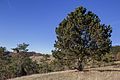
 Obereichstätt 01.jpg 5,138 × 3,425; 4.09 MB
-
 Zypressenwolfsmilch Arzberg.JPG 3,872 × 2,592; 5.36 MB


.JPG)


