Category:FFH-Gebiet Kempter Wald mit Oberem Rottachtal
Jump to navigation
Jump to search
| Diese Kategorie repräsentiert ein Schutzgebiet nach Naturschutzrecht in Deutschland. |
|---|
| Diese Kategorie wurde nach einem klaren Schema angelegt, sie sollte nicht verschoben, gelöscht oder umkategorisiert werden. Sie ist unter anderem in dieser Uploadkarte hinterlegt. Beschreibung und Hintergründe auf der Seite des Wikiprojekts |
| Foto zu Wiki Loves Earth hochladen! - Seite von Wiki Loves Earth Deutschland |
Natura2000 site in Germany  | |||||
| Upload media | |||||
| Instance of |
| ||||
|---|---|---|---|---|---|
| Named after |
| ||||
| Location |
| ||||
| Applies to jurisdiction | |||||
| Located in or next to body of water | |||||
| Inception |
| ||||
| Area |
| ||||
 | |||||
Deutsch: FFH-Gebiet „Kempter Wald mit Oberem Rottachtal“ (8228-301) in den Landkreisen Oberallgäu und Ostallgäu, Schwaben.
Subcategories
This category has the following 3 subcategories, out of 3 total.
Media in category "FFH-Gebiet Kempter Wald mit Oberem Rottachtal"
The following 11 files are in this category, out of 11 total.
-
 Baltenstein 03.jpg 3,000 × 4,000; 2.89 MB
-
 Baltenstein 06.jpg 4,000 × 3,000; 3.09 MB
-
 Baltenstein Bannholztobel.jpg 3,000 × 4,000; 2.31 MB
-
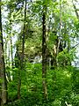
 Burg und Findling Baltenstein.jpg 2,408 × 1,605; 1.96 MB
-
 Durach - Tobias - Kapelle v W, Kempter Wald.JPG 1,920 × 1,080; 1,022 KB
-
 Durach oberhalb Tobias.jpg 3,558 × 2,512; 1.67 MB
-
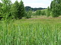 Oberes Rottachtal.JPG 2,048 × 1,536; 2.39 MB
-
 Rottach (Oberlauf).JPG 2,048 × 1,536; 2.67 MB
-
 Rottach bei Greifenmühle.JPG 2,048 × 1,536; 2.55 MB
-
 Ruine Baltenstein GO-5.jpg 1,944 × 2,592; 2.12 MB
-
 Ruine Baltenstein GO-7.jpg 2,592 × 1,944; 2.01 MB


.JPG)


