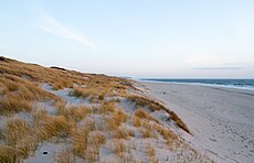
Category:FFH-Gebiet Dünen- und Heidelandschaften Nord-Sylt
Jump to navigation
Jump to search
| Diese Kategorie repräsentiert ein Schutzgebiet nach Naturschutzrecht in Deutschland. |
|---|
| Diese Kategorie wurde nach einem klaren Schema angelegt, sie sollte nicht verschoben, gelöscht oder umkategorisiert werden. Sie ist unter anderem in dieser Uploadkarte hinterlegt. Beschreibung und Hintergründe auf der Seite des Wikiprojekts |
| Foto zu Wiki Loves Earth hochladen! - Seite von Wiki Loves Earth Deutschland |
protected area in the European Union defined by the habitats directive in Schleswig-Holstein, Germany | |||||
| Upload media | |||||
| Instance of |
| ||||
|---|---|---|---|---|---|
| Location |
| ||||
| Applies to jurisdiction | |||||
| Inception |
| ||||
| Area |
| ||||
 | |||||
Diese Kategorie enthält ausschließlich Medien des FFH-Gebietes Dünen- und Heidelandschaften Nord-Sylt
Media in category "FFH-Gebiet Dünen- und Heidelandschaften Nord-Sylt"
The following 61 files are in this category, out of 61 total.
-
13-09-29-nordfriesisches-wattenmeer-RalfR-27.jpg 4,185 × 1,682; 3.25 MB
-
13-09-29-nordfriesisches-wattenmeer-RalfR-29.jpg 4,288 × 2,279; 6.03 MB
-
13-09-29-Rømø Sylt Jorsand-N3S 9248.jpg 2,765 × 1,671; 1.56 MB
-
13-09-29-Sylt Jorsand-N3S 9266.jpg 2,630 × 1,628; 1.54 MB
-
Aerial photograph 400D 2012 05 05 8253 DxO.jpg 3,888 × 2,592; 1.86 MB
-
Aerial photograph 8149 DxO.jpg 5,184 × 3,456; 3.77 MB
-
Aerial photograph 8150 DxO.jpg 5,184 × 3,456; 3.52 MB
-
Aerial photograph 8153 DxO.jpg 5,184 × 3,456; 3.4 MB
-
Aerial photograph 8154 DxO.jpg 5,184 × 3,456; 3.7 MB
-
Aerial photograph 8155 DxO.jpg 5,184 × 3,456; 3.39 MB
-
Armeria maritima im Naturschutzgebiet Nord-Sylt.jpg 6,463 × 4,176; 3.53 MB
-
AW Quermarkenfeuer am Roten Kliff Sylt 01.jpg 5,855 × 3,896; 11.17 MB
-
Blick nach Osten über den Ellenbogen.JPG 3,452 × 2,312; 2.23 MB
-
Die Sylter Halbinsel Ellenbogen mit dem Leuchtturm List Ost.jpg 4,241 × 1,834; 5.3 MB
-
Dünen Sylt.JPG 2,048 × 1,536; 1.28 MB
-
Ellenbogen, List auf Sylt (IMG 20220313 114051).jpg 4,140 × 3,065; 9.19 MB
-
FFH-Gebiet Dünen- und Heidelandschaften Nord-Sylt GBU.jpg 1,365 × 906; 59 KB
-
FFH-Gebiet Dünen- und Heidelandschaften Nord-Sylt LRK.jpg 1,365 × 909; 61 KB
-
FFH-Gebiet Dünen- und Heidelandschaften Nord-Sylt LRT.jpg 1,368 × 909; 102 KB
-
Flown Sand Sylt.jpg 4,896 × 3,264; 8.81 MB
-
Kampen Sylt 1656.jpg 4,032 × 3,024; 5.01 MB
-
Kampen Sylt Naturschutzgebiet 1657.jpg 4,032 × 3,024; 4.76 MB
-
Klappholttal.jpg 7,309 × 1,644; 1.86 MB
-
Küstenschutz Kampen Wattseite.jpg 2,761 × 3,682; 4.92 MB
-
Leuchtturm auf Sylt (27320970819).jpg 6,000 × 4,000; 12.64 MB
-
List auf Sylt Luftbild.jpg 4,000 × 2,667; 13.24 MB
-
Lister Ellenbogen.jpg 2,400 × 1,600; 884 KB
-
Lister Wanderdünen auf Sylt.jpg 2,592 × 1,944; 2.1 MB
-
Listland.jpg 9,295 × 2,000; 14.63 MB
-
Luftaufnahmen Nordseekueste 2013-09 by-RaBoe 152.jpg 2,500 × 1,660; 2.57 MB
-
Luftaufnahmen Nordseekueste 2013-09 by-RaBoe 153.jpg 2,500 × 1,660; 2.21 MB
-
Luftaufnahmen Nordseekueste 2013-09 by-RaBoe 154.jpg 2,500 × 1,660; 2.96 MB
-
Luftaufnahmen Nordseekueste 2013-09 by-RaBoe 155.jpg 2,500 × 1,660; 2.71 MB
-
Luftaufnahmen Nordseekueste 2013-09 by-RaBoe 156.jpg 2,500 × 1,659; 2.6 MB
-
Luftaufnahmen Nordseekueste 2013-09 by-RaBoe 157.jpg 2,500 × 1,659; 2.59 MB
-
Luftaufnahmen Nordseekueste 2013-09 by-RaBoe 158.jpg 2,500 × 1,659; 2.67 MB
-
Luftaufnahmen Nordseekueste 2013-09 by-RaBoe 159.jpg 2,500 × 1,659; 2.6 MB
-
Luftaufnahmen Nordseekueste 2013-09 by-RaBoe 160.jpg 2,500 × 1,660; 2.58 MB
-
Luftaufnahmen Nordseekueste 2013-09 by-RaBoe 161.jpg 2,500 × 1,659; 2.27 MB
-
Luftaufnahmen Nordseekueste 2013-09 by-RaBoe 162.jpg 2,500 × 1,659; 2.33 MB
-
Luftaufnahmen Nordseekueste 2013-09 by-RaBoe 164.jpg 2,500 × 1,660; 2.57 MB
-
Luftaufnahmen Nordseekueste 2013-09 by-RaBoe 165.jpg 2,500 × 1,660; 2.65 MB
-
Luftaufnahmen Nordseekueste 2013-09 by-RaBoe 172.jpg 2,500 × 1,660; 2.82 MB
-
Luftaufnahmen Nordseekueste 2013-09 by-RaBoe 173.jpg 2,500 × 1,659; 2.89 MB
-
NSG Nord-Sylt.JPG 4,320 × 3,240; 3.86 MB
-
Panorama Ellenbogen (Sylt).jpg 11,683 × 2,000; 18.14 MB
-
Quermarkenfeuer Rotes Kliff.jpg 4,000 × 3,000; 3.38 MB
-
Sonnenaufgang im Klappholttal.jpg 2,400 × 1,600; 826 KB
-
Strandrestaurant Plage 1 Sylt (27320981709).jpg 6,000 × 4,000; 12.87 MB
-
Sylt Ellenbogen Panorama (24237211087).jpg 9,709 × 3,687; 20.34 MB
-
Sylt Leuchtturm Rotes Kliff.jpg 3,000 × 4,000; 3.29 MB
-
Sylter Ellenbogen.jpg 2,400 × 1,600; 580 KB
-
Sylts blaue stunde.jpg 2,400 × 1,541; 813 KB
-
Syltter Fruehlingsgruß.jpg 2,400 × 1,600; 670 KB
-
Tafel am Quermarkenfeuer Rotes Kliff.jpg 3,000 × 4,000; 3.52 MB
-
Wadden Sea National Park Wikivoyage Banner.jpg 2,630 × 383; 407 KB
-
Wanderdüne auf Sylt (38388311114).jpg 6,000 × 4,000; 11.84 MB
-
Wanderdüne Listland Sylt.jpg 2,032 × 1,354; 2.49 MB
-
Wanderdüne Listland2 Sylt.jpg 2,032 × 1,354; 2.2 MB
-
Wanderdüne Sylt (24237362057).jpg 6,000 × 4,000; 10.76 MB
-
West coast Ellenbogen, Sylt, Germany.jpg 2,835 × 1,758; 4.31 MB


