Category:Extinct aves distribution maps
Jump to navigation
Jump to search
Subcategories
This category has only the following subcategory.
Media in category "Extinct aves distribution maps"
The following 14 files are in this category, out of 14 total.
-
 Anas oustaleti distri map.png 1,192 × 1,016; 58 KB
-
 Anhinga pannonica distribution.PNG 3,000 × 2,924; 584 KB
-
 Ara tricolor range map without borders.png 250 × 115; 18 KB
-
 Ara tricolor range map.png 250 × 115; 4 KB
-
 Dodo Range Mauritius.svg 4,500 × 2,234; 3.91 MB
-
 DodoRangeMauritius.gif 248 × 113; 4 KB
-
 Eleutherornis find locations.png 1,413 × 1,152; 158 KB
-
 GreatAukMap.svg 625 × 480; 224 KB
-
 Map depicting Mancallinae fossil localities.jpg 1,514 × 1,060; 58 KB
-
 Nordinseltakahe.gif 439 × 509; 28 KB
-
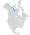 Numenius borealis breed map.svg 1,712 × 1,992; 339 KB
-
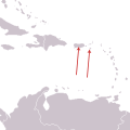
 Numenius borealis nonbreed map.svg 380 × 600; 205 KB
-
 Podiceps andinus map.svg 1,379 × 1,864; 362 KB
-
 Saint-Croix-Macaw-Dist.svg 300 × 300; 15 KB


