Category:Evington
Jump to navigation
Jump to search
English: Evington is an area in eastern Leicester, England. It used to be a small village centred around Main Street and the Anglican church of St Denys but was close enough to Leicester to become one of the outer suburbs in the 1930s. (→Evington)
suburb of Leicester, England, UK | |||||
| Upload media | |||||
| Instance of | |||||
|---|---|---|---|---|---|
| Location | City of Leicester, Leicestershire, East Midlands, England | ||||
 | |||||
Subcategories
This category has the following 5 subcategories, out of 5 total.
C
- Evington Chapel (2 F)
E
- Church of St Denys, Evington (3 F)
- Evington Arboretum (1 F)
- Evington War Memorial (2 F)
P
- Evington Park (11 F)
Media in category "Evington"
The following 81 files are in this category, out of 81 total.
-
 A soggy Piggy's Hollow - geograph.org.uk - 3811441.jpg 1,337 × 1,600; 755 KB
-
 Bluebells along Shady Lane - geograph.org.uk - 2950244.jpg 3,253 × 2,325; 2.97 MB
-
 Buses on Downing Drive, Evington - geograph.org.uk - 6486631.jpg 1,024 × 728; 155 KB
-
 Church of God, Evington Meeting Place, Leicester - geograph.org.uk - 6635541.jpg 3,776 × 2,520; 1.39 MB
-
 Evington Brook at Shady Lane Arboretum - geograph.org.uk - 3811369.jpg 1,600 × 1,200; 884 KB
-
 Evington Chapel, Evington - geograph.org.uk - 6245538.jpg 3,776 × 2,520; 3.84 MB
-
 Evington Lane (33123243910).jpg 1,920 × 2,560; 2.34 MB
-
 Evington Lane (33507005505).jpg 2,560 × 1,920; 2.39 MB
-
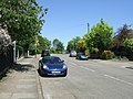
 Evington Lane (B667) heading east - geograph.org.uk - 2962842.jpg 640 × 480; 82 KB
-
 Evington Lane - geograph.org.uk - 4766010.jpg 800 × 600; 92 KB
-
 Evington Lane in Leicester - geograph.org.uk - 6403998.jpg 800 × 528; 169 KB
-
 Evington Lane, Evington, Leicester - geograph.org.uk - 455110.jpg 610 × 640; 131 KB
-
 Evington Lane, Leicester - geograph.org.uk - 5819558.jpg 1,600 × 900; 451 KB
-
 Evington Lane. Leicester - geograph.org.uk - 5819555.jpg 1,600 × 900; 446 KB
-
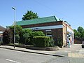
 Evington Leisure Centre - geograph.org.uk - 4473397.jpg 640 × 480; 160 KB
-
 Evington Library (33507006575).jpg 2,560 × 1,920; 2.19 MB
-
 Evington Library.JPG 2,592 × 1,944; 1.15 MB
-
 Evington Village Hall.JPG 2,592 × 1,944; 1.3 MB
-
 EvingtonVillageGreen2011.JPG 2,592 × 1,944; 2.11 MB
-
 Footbridge across Evington Brook - geograph.org.uk - 3811362.jpg 1,600 × 1,150; 618 KB
-
 Footpath through Evington Park - geograph.org.uk - 5117919.jpg 2,000 × 1,500; 385 KB
-
 Gisbourne Court (33507003075).jpg 2,560 × 1,920; 2.16 MB
-
 Gurudwara Guru Tegh Bahudar Sahib, Evington, Leicester.jpg 3,892 × 2,605; 6.81 MB
-
 Headland Road in Evington, Leicester - geograph.org.uk - 6408063.jpg 800 × 481; 116 KB
-
 Headland Road in Evington, Leicester - geograph.org.uk - 6408075.jpg 800 × 800; 228 KB
-
 Highfields from Evington, Leicester.jpg 3,892 × 2,605; 6.81 MB
-
 House on Evington Lane - geograph.org.uk - 2962839.jpg 640 × 480; 81 KB
-
 Houses along Stoughton Lane - geograph.org.uk - 2950252.jpg 2,085 × 1,665; 1.36 MB
-
 Houses on Wakerley Road, Evington - geograph.org.uk - 6612505.jpg 1,890 × 1,234; 1.05 MB
-
 Information board at Shady Lane Arboretum - geograph.org.uk - 3811350.jpg 1,600 × 1,240; 732 KB
-
 Ingarsby Drive, Evington - geograph.org.uk - 2962858.jpg 640 × 480; 80 KB
-
 Leesville Road Baptist Church - panoramio.jpg 1,976 × 1,154; 515 KB
-
 Leicester (Evington) Cedars - geograph.org.uk - 2899205.jpg 639 × 440; 84 KB
-
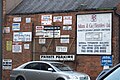 Leicester textile company signs.jpg 2,353 × 1,570; 2.53 MB
-
 LeicesterEvingtonWard.svg 2,000 × 2,308; 288 KB
-
 Linden Drive in Evington, Leicester - geograph.org.uk - 6408082.jpg 800 × 487; 123 KB
-
 Mature Trees, Coleman Road. - geograph.org.uk - 736539.jpg 480 × 640; 122 KB
-
 Muddy path in Shady Lane Arboretum - geograph.org.uk - 3811331.jpg 1,600 × 1,200; 873 KB
-
 Path along Shady Lane - geograph.org.uk - 2950210.jpg 3,264 × 2,448; 3.68 MB
-
 Piggy's Hollow - geograph.org.uk - 2326348.jpg 3,228 × 1,918; 2.82 MB
-
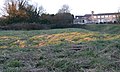 Piggy's Hollow - geograph.org.uk - 2326356.jpg 3,193 × 1,913; 2.76 MB
-
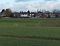 Playing fields near Judgemeadow Community College - geograph.org.uk - 3811539.jpg 1,600 × 1,233; 374 KB
-
 School Lane Evington.JPG 2,592 × 1,944; 1.41 MB
-
 School Lane, Evington near Leicester - geograph.org.uk - 107599.jpg 640 × 427; 134 KB
-
 Shady Lane Arboretum - geograph.org.uk - 3811328.jpg 1,600 × 1,203; 670 KB
-
 Shady Lane, Evington, Leicester - geograph.org.uk - 455136.jpg 614 × 640; 151 KB
-
 Small supermarket, Evington - geograph.org.uk - 2962844.jpg 640 × 480; 82 KB
-
 Spencefield Lane, Leicester - geograph.org.uk - 2473590.jpg 640 × 480; 150 KB
-
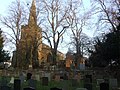 St Denys church - geograph.org.uk - 4765987.jpg 800 × 600; 137 KB
-
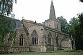 St Denys church, Evington - geograph.org.uk - 3217504.jpg 1,600 × 1,067; 369 KB
-
 St Denys Church, Evington - geograph.org.uk - 4005433.jpg 640 × 480; 89 KB
-
 St Denys Road, Evington - geograph.org.uk - 2962846.jpg 640 × 480; 93 KB
-
 St Denys, Evington - geograph.org.uk - 2473595.jpg 640 × 480; 145 KB
-
 St Saviour's Road Factor, Evington.jpg 2,605 × 3,892; 6.49 MB
-
 St Saviour's Road textile factory, Leicester.jpg 3,892 × 2,605; 6.16 MB
-
 St. Denys Church, Evington - geograph.org.uk - 2326360.jpg 2,177 × 2,310; 2.16 MB
-
 Stoughton Drive, Evington, Leicester - geograph.org.uk - 455096.jpg 556 × 640; 102 KB
-
 Stoughton Drive, Evington, Leicester - geograph.org.uk - 455107.jpg 640 × 449; 83 KB
-
 Stoughton Lane in Evington - geograph.org.uk - 3811482.jpg 1,600 × 1,254; 677 KB
-
 Terraced houses, Evington, Leicester.jpg 3,892 × 2,605; 4.74 MB
-
 The Arboretum on Shady Lane - geograph.org.uk - 2950217.jpg 3,264 × 2,448; 3.47 MB
-
 The Cedars Evington.JPG 2,592 × 1,944; 884 KB
-
 The Common, Cordery Road - geograph.org.uk - 2473543.jpg 640 × 480; 96 KB
-
 The Hollow Evington.JPG 2,592 × 1,944; 2.43 MB
-

-
 Trees at the Shady Lane Arboretum - geograph.org.uk - 3811384.jpg 1,600 × 1,109; 785 KB
-
 War Memorial, Evington - geograph.org.uk - 4005432.jpg 640 × 482; 95 KB
-
 Coleman Road, Leicester. - geograph.org.uk - 736554.jpg 640 × 480; 92 KB
-
 Evington Lane, Evington, Leicester - geograph.org.uk - 455114.jpg 610 × 640; 125 KB
-
 Evington Swimming Pool - geograph.org.uk - 107588.jpg 640 × 427; 131 KB
-
 Gartree Road near Leicester Airport - geograph.org.uk - 456223.jpg 480 × 640; 127 KB
-
 Glen Road roundabout - geograph.org.uk - 499577.jpg 640 × 450; 80 KB
-
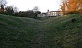
 Moat - geograph.org.uk - 455137.jpg 480 × 640; 160 KB
-
 Public Footpath - geograph.org.uk - 499781.jpg 640 × 480; 129 KB
-
 Public Footpath near Glen Gorse - geograph.org.uk - 499772.jpg 640 × 480; 126 KB
-
 Shady Lane, Evington - geograph.org.uk - 107637.jpg 640 × 427; 158 KB
-
 Stoughton Lane, Evington, Leicester - geograph.org.uk - 455133.jpg 480 × 640; 114 KB
-
 The Cedars, Evington - geograph.org.uk - 455123.jpg 640 × 355; 87 KB
-
 The Vindaloo Evington - geograph.org.uk - 240295.jpg 640 × 480; 63 KB
-
 Uplands Road, Oadby - geograph.org.uk - 457193.jpg 640 × 338; 83 KB
-
 Woodland in Evington - geograph.org.uk - 107604.jpg 640 × 427; 218 KB


.jpg)
.jpg)
_heading_east_-_geograph.org.uk_-_2962842.jpg)


.jpg)


.jpg)


_Cedars_-_geograph.org.uk_-_2899205.jpg)


