Category:Evesbatch
Jump to navigation
Jump to search
village and civil parish in Herefordshire, England  | |||||
| Upload media | |||||
| Instance of | |||||
|---|---|---|---|---|---|
| Location | Herefordshire, West Midlands, England | ||||
| Population |
| ||||
 | |||||
Polski: Evesbatch – wieś i civil parish w Anglii, w hrabstwie Herefordshire. W 2001 civil parish liczyła 63 mieszkańców. Evesbatch jest wspomniana w Domesday Book (1086) jako Sbech. (→Evesbatch)

Subcategories
This category has the following 3 subcategories, out of 3 total.
Media in category "Evesbatch"
The following 37 files are in this category, out of 37 total.
-

-
 Armorial Bearings of the DOBYNS (d'Aubyn) family of Evesbatch, Herefordshire.png 1,200 × 1,200; 916 KB
-
 Armorial Bearings of the MORTON family of Evesbatch, Herefordshire.png 1,200 × 1,200; 1.25 MB
-
 Armorial Bearings of the YATE family of Evesbatch, Herefordshire.png 1,200 × 1,200; 865 KB
-
 Delayed harvest - geograph.org.uk - 947358.jpg 640 × 480; 95 KB
-
 Evesbatch - Green Lane junction - geograph.org.uk - 947361.jpg 640 × 480; 114 KB
-
 Evesbatch junction, A4103 - geograph.org.uk - 947387.jpg 640 × 480; 85 KB
-
 Farm campsite at Ridgeway Cross - geograph.org.uk - 5845573.jpg 533 × 800; 91 KB
-
 Fields, Evebatch - geograph.org.uk - 6401497.jpg 1,024 × 683; 214 KB
-
 Floor Monument inside St. Andrew's Church (Nave ^ Evesbatch) - geograph.org.uk - 6369494.jpg 2,736 × 3,648; 2.63 MB
-
 Footpath at Evesbatch - geograph.org.uk - 2855478.jpg 1,024 × 680; 273 KB
-
 Green Lane, Evesbatch - geograph.org.uk - 947373.jpg 480 × 640; 113 KB
-
 Hillside near Cradley Hall Farm - geograph.org.uk - 947374.jpg 640 × 480; 67 KB
-
 Hook Lane, Evesbatch - geograph.org.uk - 6400903.jpg 1,024 × 683; 263 KB
-
 Hook Lane, Evesbatch - geograph.org.uk - 947352.jpg 640 × 480; 65 KB
-
 Hop field by Pool Farm - geograph.org.uk - 4639883.jpg 1,500 × 1,000; 1.42 MB
-
 Inside St. Andrew's Church (Bell Tower ^ Evesbatch) - geograph.org.uk - 6369507.jpg 3,648 × 2,736; 3.25 MB
-
 Letterbox in Evesbatch - geograph.org.uk - 2855476.jpg 680 × 1,024; 229 KB
-
 Lone sheep - geograph.org.uk - 947395.jpg 640 × 480; 82 KB
-
 Long Barns (Evesbatch) - geograph.org.uk - 6369529.jpg 3,648 × 2,736; 4.57 MB
-
 Meadow by the River Leadon - geograph.org.uk - 5123785.jpg 1,024 × 768; 267 KB
-
 Off Green Lane, Evesbatch - geograph.org.uk - 6400898.jpg 1,024 × 683; 247 KB
-
 Paddock at The Brook - geograph.org.uk - 947405.jpg 640 × 480; 104 KB
-
 Private road to Evesbatch and Leadon Court - geograph.org.uk - 5145200.jpg 1,024 × 768; 263 KB
-
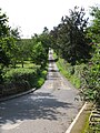
 Road to Evesbatch - geograph.org.uk - 2850988.jpg 1,024 × 680; 294 KB
-
 Rolling countryside - geograph.org.uk - 860844.jpg 640 × 480; 90 KB
-

-
 Something's missing - geograph.org.uk - 947369.jpg 640 × 480; 118 KB
-
 Streamside field - geograph.org.uk - 947378.jpg 480 × 640; 81 KB
-
 The churchyard path, Evesbatch - geograph.org.uk - 5145215.jpg 1,024 × 768; 213 KB
-
 Track at Evesbatch - geograph.org.uk - 2855480.jpg 680 × 1,024; 271 KB
-
 Track at Evesbatch - geograph.org.uk - 5123787.jpg 1,024 × 768; 295 KB
-
 Tree-lined track in Evesbatch - geograph.org.uk - 2850987.jpg 680 × 1,024; 356 KB
-
 View to the Malvern Hills - geograph.org.uk - 2855496.jpg 1,024 × 680; 229 KB
-
 Brook House - geograph.org.uk - 102043.jpg 640 × 479; 148 KB
-

-
 Fields of Pool Farm, Evesbatch - geograph.org.uk - 102060.jpg 640 × 479; 86 KB

_family_of_Evesbatch,_Herefordshire.png)


_-_geograph.org.uk_-_6369494.jpg)


_-_geograph.org.uk_-_6369507.jpg)


_-_geograph.org.uk_-_6369529.jpg)


