Category:Everton, Bedfordshire
Jump to navigation
Jump to search
village and civil parish in Bedfordshire, England .jpg) | |||||
| Upload media | |||||
| Instance of | |||||
|---|---|---|---|---|---|
| Location | Central Bedfordshire, Bedfordshire, East of England, England | ||||
| Population |
| ||||
| Different from | |||||
 | |||||
English: Everton is a small village in north Bedfordshire, England. Everton has no shop but is home to a pub and local church. There is a large recreation ground which contains both full-sized and five-a-side football pitches, a basketball net, and a fenced in play area.
Subcategories
This category has the following 2 subcategories, out of 2 total.
M
W
- Woodbury Hall (1 F)
Media in category "Everton, Bedfordshire"
The following 118 files are in this category, out of 118 total.
-
 50 Miles From London - geograph.org.uk - 5525445.jpg 683 × 1,024; 209 KB
-
 Abandoned roadway to Woodbury Home Farm - geograph.org.uk - 6211274.jpg 1,024 × 768; 300 KB
-
 Approaching the Roman road - geograph.org.uk - 6212235.jpg 1,024 × 768; 202 KB
-
 Avenue to Woodbury Hall - geograph.org.uk - 6211295.jpg 1,024 × 768; 301 KB
-
 Baling by the East Coast Main Line - geograph.org.uk - 4187556.jpg 640 × 430; 48 KB
-
 Banks of horsetail - geograph.org.uk - 5819342.jpg 4,608 × 3,456; 7.35 MB
-
 Barley field and Gibraltar Farm - geograph.org.uk - 6212240.jpg 1,024 × 768; 125 KB
-
 Barley field and Gibraltar Farm - geograph.org.uk - 6212243.jpg 1,024 × 768; 148 KB
-
 Barley field below Woodbury Home Farm - geograph.org.uk - 6209177.jpg 1,024 × 768; 231 KB
-
 Barley field below Woodbury Home Farm - geograph.org.uk - 6211183.jpg 1,024 × 768; 171 KB
-
 Barns on the road to Fernbury Farm - geograph.org.uk - 5802055.jpg 5,202 × 3,465; 3.14 MB
-
 Bedfordshire jungle track - geograph.org.uk - 533260.jpg 640 × 480; 112 KB
-
 Bedfordshire jungle track - geograph.org.uk - 533265.jpg 640 × 480; 110 KB
-

-
 Bridge over a drain - geograph.org.uk - 6213772.jpg 1,024 × 768; 258 KB
-
 Bridleway alongside Gilrags - geograph.org.uk - 6209158.jpg 1,024 × 768; 181 KB
-
 Bridleway and field boundary - geograph.org.uk - 6216956.jpg 1,024 × 768; 168 KB
-
 Bridleway and Gilrags - geograph.org.uk - 6216961.jpg 1,024 × 768; 207 KB
-
 Bridleway below Woodbury Home Farm - geograph.org.uk - 6211180.jpg 1,024 × 768; 155 KB
-
 Bridleway near Everton - geograph.org.uk - 2458712.jpg 1,024 × 768; 153 KB
-
 Bridleway to Drove Road - geograph.org.uk - 6211161.jpg 1,024 × 768; 337 KB
-
 Bridleway to Drove Road - geograph.org.uk - 6211198.jpg 1,024 × 768; 293 KB
-
 Bridleway to Gibraltar Farm - geograph.org.uk - 6211165.jpg 1,024 × 768; 290 KB
-
 Bridleway to Gibraltar Farm - geograph.org.uk - 6211168.jpg 1,024 × 768; 375 KB
-
 Church End, Everton - geograph.org.uk - 2778965.jpg 640 × 480; 170 KB
-
 Church Road, Everton - geograph.org.uk - 2019201.jpg 1,024 × 681; 164 KB
-
 Cleaning out the drains - geograph.org.uk - 6209152.jpg 1,024 × 768; 216 KB
-
 Clump of trees in Tetworth Park - geograph.org.uk - 6211154.jpg 1,024 × 768; 182 KB
-
 Cows south of Warden Hill - geograph.org.uk - 5819344.jpg 4,608 × 3,456; 5.35 MB
-
 Cut Bench Mark (close-up) - geograph.org.uk - 2019134.jpg 1,024 × 681; 265 KB
-
 Electricity pylon off Tempsford Road - geograph.org.uk - 6215227.jpg 1,024 × 768; 192 KB
-
 Entrance to Tempsford Airfield Farm - geograph.org.uk - 2778968.jpg 640 × 480; 137 KB
-

-
 Entrance to Tetworth Hall - geograph.org.uk - 6211148.jpg 1,024 × 768; 310 KB
-
 Everton - Church Road - geograph.org.uk - 5283175.jpg 4,608 × 3,456; 6.6 MB
-
 Everton Crossing - geograph.org.uk - 3102089.jpg 640 × 506; 65 KB
-
 Everton Crossing on Tempsford Road - geograph.org.uk - 4931875.jpg 640 × 440; 84 KB
-

-

-
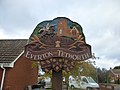
 Everton Cum Tetworth sign - geograph.org.uk - 5819345.jpg 4,608 × 3,456; 5.45 MB
-
 Everton cum Tetworth village sign - geograph.org.uk - 5802069.jpg 5,202 × 3,465; 2.81 MB
-
 Everton Cum Tetworth Village Sign - panoramio.jpg 4,000 × 3,000; 3.5 MB
-
 Everton cum Tetworth.JPG 3,291 × 4,500; 2.24 MB
-
 Everton Lower School - geograph.org.uk - 2769875.jpg 3,872 × 2,592; 3.72 MB
-
 Everton village hall - geograph.org.uk - 5802074.jpg 5,202 × 3,465; 3.05 MB
-
 Everton Village Hall - geograph.org.uk - 6215236.jpg 1,024 × 768; 153 KB
-
 Farm buildings, Everton - geograph.org.uk - 5802072.jpg 4,848 × 2,859; 2.88 MB
-
 Farm track off Tempsford Road - geograph.org.uk - 6215231.jpg 1,024 × 768; 159 KB
-
 Farm track running west from Drove Road - geograph.org.uk - 5592307.jpg 640 × 480; 171 KB
-
 Farmland - geograph.org.uk - 382682.jpg 640 × 481; 53 KB
-

-
 Fernbury Farm barns - geograph.org.uk - 5802054.jpg 5,202 × 3,465; 3 MB
-
 Field edge and wheat - geograph.org.uk - 6213762.jpg 1,024 × 768; 166 KB
-
 Footpath approaching Sandy Road, Everton - geograph.org.uk - 5802064.jpg 5,202 × 3,465; 4.01 MB
-
 Footpath from Tetworth to Cold Arbour - geograph.org.uk - 532564.jpg 640 × 480; 102 KB
-
 Footpath near Gibraltar Farm - geograph.org.uk - 6209153.jpg 1,024 × 768; 184 KB
-
 Footpath to Everton - geograph.org.uk - 6212228.jpg 1,024 × 768; 256 KB
-

-
 Footpath to Gibraltar Farm - geograph.org.uk - 6212219.jpg 1,024 × 768; 235 KB
-
 Footpath to Gibraltar Farm - geograph.org.uk - 6212223.jpg 1,024 × 768; 276 KB
-
 Footpath to Gibraltar Farm - geograph.org.uk - 6212231.jpg 1,024 × 768; 188 KB
-
 Greensand Ridge Walk - geograph.org.uk - 6211278.jpg 1,024 × 768; 244 KB
-
 Greensand Ridge Walk near Old Woodbury - geograph.org.uk - 6211159.jpg 1,024 × 768; 191 KB
-
 Greensands Ridge Way barrier - geograph.org.uk - 5802053.jpg 5,202 × 3,465; 4.53 MB
-
 Lane from Woodbury Hall to Woodbury Low - geograph.org.uk - 533047.jpg 640 × 480; 107 KB
-
 Level crossing near Tempsford - geograph.org.uk - 2293827.jpg 1,024 × 632; 114 KB
-
 Looking westwards from the path to Everton - geograph.org.uk - 5802061.jpg 5,202 × 3,465; 2.71 MB
-

-
 Old Milepost - geograph.org.uk - 5525442.jpg 1,024 × 683; 282 KB
-
 On the Bedfordshire Greensand Ridge route - geograph.org.uk - 5819338.jpg 4,608 × 3,456; 5.93 MB
-
 Park Farm poppy fields, Everton - geograph.org.uk - 5802720.jpg 5,202 × 3,465; 3.91 MB
-
 Path to Everton - geograph.org.uk - 5802058.jpg 5,202 × 3,465; 4.43 MB
-
 Path towards Everton from Greensands Ridge Way - geograph.org.uk - 5802057.jpg 5,202 × 3,465; 2.19 MB
-
 Potato field near Story Farm - geograph.org.uk - 6211302.jpg 1,024 × 768; 257 KB
-
 Potton Road, Everton - geograph.org.uk - 2778966.jpg 640 × 480; 91 KB
-
 Right of Way anomaly - geograph.org.uk - 2769871.jpg 2,592 × 3,872; 2.71 MB
-
 Road Passing Warden Hill - geograph.org.uk - 5283186.jpg 4,608 × 3,456; 6.59 MB
-

-
 Roadway to Drove Road - geograph.org.uk - 6209176.jpg 1,024 × 768; 236 KB
-
 Route to Woodbury Hall and Storey Farm - geograph.org.uk - 5819355.jpg 4,608 × 3,456; 4.49 MB
-
 Sandy Heath TV mast - geograph.org.uk - 2769894.jpg 2,592 × 3,872; 2.99 MB
-

-
 Snacking on a Tree - geograph.org.uk - 533321.jpg 640 × 480; 141 KB
-
 Solar farm off Tempsford Road - geograph.org.uk - 6215229.jpg 1,024 × 768; 205 KB
-
 St. Mary's church, Everton - geograph.org.uk - 6215250.jpg 1,024 × 791; 130 KB
-
 Story Farm and the Greensand Ridge Walk - geograph.org.uk - 6211299.jpg 1,024 × 768; 218 KB
-
 Tempsford Road - geograph.org.uk - 6209110.jpg 1,024 × 768; 176 KB
-
 Tempsford Road looking towards Everton - geograph.org.uk - 2777864.jpg 640 × 480; 137 KB
-
 Tempsford Road towards Church End - geograph.org.uk - 4931876.jpg 640 × 428; 90 KB
-
 Terrace on Sandy Road, Everton - geograph.org.uk - 2765401.jpg 3,872 × 2,592; 3.6 MB
-
 Thatched cottage, Everton, Bedfordshire.jpg 5,202 × 3,465; 3.72 MB
-
 Thatched cottages in Everton (geograph 6209151).jpg 1,024 × 768; 171 KB
-
 The farm buildings, Woodbury Low Farm - geograph.org.uk - 6213767.jpg 1,024 × 768; 166 KB
-
 The Greensand Ridge Walk at Story Farm - geograph.org.uk - 6211296.jpg 1,024 × 768; 253 KB
-
 The Roman road - geograph.org.uk - 6212239.jpg 1,024 × 768; 234 KB
-
 The Skylark Ride - geograph.org.uk - 533292.jpg 640 × 480; 100 KB
-
 The Thornton Arms, Everton - geograph.org.uk - 2777865.jpg 640 × 479; 106 KB
-
 The Thornton Arms, Everton - geograph.org.uk - 5819350.jpg 4,608 × 3,456; 3.61 MB
-
 Thornton Arms, Everton - geograph.org.uk - 5802073.jpg 5,202 × 3,465; 2.1 MB
-
 Thornton Arms, Everton, Sandy - geograph.org.uk - 629508.jpg 640 × 480; 66 KB
-
 Timber stack - geograph.org.uk - 6212246.jpg 1,024 × 768; 170 KB
-
 Track to Woodbury Home Farm - geograph.org.uk - 6211182.jpg 1,024 × 768; 189 KB
-
 Tree nursery - geograph.org.uk - 282471.jpg 600 × 450; 51 KB
-
 Two spinneys - geograph.org.uk - 6212220.jpg 1,024 × 768; 143 KB
-

-
 View over part of the former RAF Tempsford - geograph.org.uk - 6209104.jpg 1,024 × 768; 165 KB
-
 We just got very wet - geograph.org.uk - 6211307.jpg 1,024 × 768; 186 KB
-
 Wheat field near Gilrags - geograph.org.uk - 6216958.jpg 1,024 × 768; 231 KB
-
 Woodbury Hall - geograph.org.uk - 6211290.jpg 1,024 × 768; 207 KB
-
 Woodbury Park - geograph.org.uk - 6211282.jpg 1,024 × 768; 215 KB
-
 Woodbury Park, Bedfordshire - geograph.org.uk - 5819357.jpg 4,608 × 3,456; 3.72 MB
-
 Woodland near Fernbury Farm - geograph.org.uk - 2394315.jpg 640 × 430; 30 KB
-
 Barn just west of the Roman Road - geograph.org.uk - 533279.jpg 640 × 480; 60 KB
-
 Everton - geograph.org.uk - 242336.jpg 600 × 461; 29 KB
-
 Farm entrance - geograph.org.uk - 372754.jpg 640 × 481; 58 KB
-
 Large copse NE of Woodbury Low Farm - geograph.org.uk - 533050.jpg 640 × 480; 65 KB
-
 Out in the sticks near Tetworth - geograph.org.uk - 533309.jpg 640 × 480; 84 KB
-
 Warden Hill - geograph.org.uk - 372748.jpg 640 × 481; 63 KB


_-_geograph.org.uk_-_2019134.jpg)


_-_geograph.org.uk_-_2866558.jpg)


.jpg)


