Category:Evenwood and Barony
Jump to navigation
Jump to search
civil parish in County Durham, England  | |||||
| Upload media | |||||
| Instance of | |||||
|---|---|---|---|---|---|
| Location | County Durham, North East England, England | ||||
| Population |
| ||||
 | |||||
Subcategories
This category has the following 4 subcategories, out of 4 total.
Media in category "Evenwood and Barony"
The following 200 files are in this category, out of 211 total.
(previous page) (next page)-
 "The Centre", Evenwood - geograph.org.uk - 5826842.jpg 640 × 480; 255 KB
-
 A farm and two trees - geograph.org.uk - 3634843.jpg 1,500 × 1,000; 1.15 MB
-
 A small concession to cyclists - geograph.org.uk - 3927804.jpg 640 × 480; 143 KB
-
 A68 at Witton - geograph.org.uk - 3927803.jpg 640 × 480; 114 KB
-
 A68 at Witton - geograph.org.uk - 3927806.jpg 640 × 480; 145 KB
-
 A688 entering Evenwood Gate - geograph.org.uk - 4832471.jpg 1,500 × 1,125; 1.69 MB
-
 A688 towards Bishop Auckland - geograph.org.uk - 5917515.jpg 640 × 480; 81 KB
-
 A688 west of Evenwood Gate - geograph.org.uk - 5826858.jpg 640 × 480; 305 KB
-
 A688, Evenwood Gate - geograph.org.uk - 5917517.jpg 640 × 480; 71 KB
-
 A688, Evenwood Gate - geograph.org.uk - 5919387.jpg 2,848 × 2,136; 1.22 MB
-

-
 B6282 towards Woodland - geograph.org.uk - 5915884.jpg 640 × 480; 66 KB
-
 Balloon at Witton Castle - geograph.org.uk - 6183266.jpg 1,024 × 768; 183 KB
-

-
 Barn on Esperley Lane - geograph.org.uk - 5917478.jpg 640 × 480; 82 KB
-
 Barn, Millhouse Farm - geograph.org.uk - 5915868.jpg 640 × 480; 99 KB
-
 Big Joe's - geograph.org.uk - 5826071.jpg 640 × 480; 221 KB
-
 Blocked access to bridge over River Wear - geograph.org.uk - 5974290.jpg 2,000 × 1,500; 3.1 MB
-
 Bowes Close - geograph.org.uk - 2227338.jpg 3,722 × 2,305; 1.72 MB
-
 Bowes Close Farm, Ramshaw - geograph.org.uk - 5826493.jpg 640 × 480; 267 KB
-
 Bowes Hill - geograph.org.uk - 3927669.jpg 640 × 480; 145 KB
-
 Bowes Hill - geograph.org.uk - 5826505.jpg 640 × 480; 275 KB
-
 Brick pier of former railway viaduct - geograph.org.uk - 6285770.jpg 1,024 × 768; 349 KB
-
 Bridleway east of Witton Castle grounds - geograph.org.uk - 2204143.jpg 2,048 × 1,536; 1.14 MB
-

-
 Building site at Evenwood Gate - geograph.org.uk - 5826860.jpg 640 × 481; 253 KB
-
 Bungalow on Copeland Lane - geograph.org.uk - 5917542.jpg 640 × 361; 50 KB
-
 Bus Shelter, Near Morley Hall Farm - geograph.org.uk - 275179.jpg 640 × 383; 77 KB
-

-

-
 Copeland Lane towards West Auckland - geograph.org.uk - 5917538.jpg 640 × 480; 65 KB
-
 Copeland Lane, Evenwood - geograph.org.uk - 5917533.jpg 640 × 480; 61 KB
-
 Craggwood Caravan Park - geograph.org.uk - 3487320.jpg 5,184 × 3,456; 3.33 MB
-
 Cut silage field and woodland - geograph.org.uk - 5917510.jpg 640 × 480; 90 KB
-

-
 Derelict East Park farm - geograph.org.uk - 2421938.jpg 3,648 × 2,736; 2.52 MB
-
 Direction Sign – Signpost at Morley Farm - geograph.org.uk - 6680508.jpg 2,304 × 3,072; 2.68 MB
-

-
 Driveway to Tumbleweed House - geograph.org.uk - 3927191.jpg 640 × 480; 181 KB
-
 Driveway to Witton Castle - geograph.org.uk - 3927832.jpg 640 × 480; 203 KB
-
 Earthy desolation at Low Barns - geograph.org.uk - 5292512.jpg 1,500 × 1,001; 1.57 MB
-
 East Park Farm - geograph.org.uk - 2235780.jpg 2,000 × 1,087; 1.93 MB
-
 East pier of Gaunless Railway Viaduct (detail) - geograph.org.uk - 4626005.jpg 768 × 1,024; 335 KB
-
 East pier of Gaunless Railway Viaduct - geograph.org.uk - 4625990.jpg 768 × 1,024; 275 KB
-
 Elizabeth II postbox on Evenwood Lane, Evenwood - geograph.org.uk - 5919466.jpg 1,807 × 2,485; 1,004 KB
-
 Elizabeth II postbox on the A688, Evenwood Gate - geograph.org.uk - 5919384.jpg 1,934 × 2,374; 843 KB
-
 Entanglement of wood and water - geograph.org.uk - 4828957.jpg 1,500 × 1,125; 2.32 MB
-
 Entering Morley - geograph.org.uk - 5909919.jpg 640 × 480; 99 KB
-
 Entering Wind Mill - geograph.org.uk - 5915865.jpg 640 × 480; 87 KB
-
 Entrance to Evenwood Cemetery - geograph.org.uk - 2961745.jpg 3,648 × 2,736; 4.01 MB
-
 Entrance to Old Carterthorne Farm Campsite - geograph.org.uk - 3365923.jpg 3,648 × 2,736; 3.05 MB
-
 Evenfield Farm - geograph.org.uk - 2256901.jpg 1,600 × 1,014; 1.51 MB
-
 Evenwood Lane - geograph.org.uk - 3487340.jpg 4,919 × 3,280; 3.19 MB
-
 Evenwood Lane crossing Crook Beck Bridge - geograph.org.uk - 3323618.jpg 3,648 × 2,736; 2.39 MB
-
 Factory on Copeland Lane, Evenwood - geograph.org.uk - 5826846.jpg 640 × 480; 259 KB
-
 Fairfield off Evenwood Lane - geograph.org.uk - 3323615.jpg 3,648 × 2,736; 2.22 MB
-
 Fallen trees stranded at riverside - geograph.org.uk - 6360935.jpg 2,000 × 1,071; 2.28 MB
-
 Farm at High Toft Hill - geograph.org.uk - 2936181.jpg 1,600 × 1,069; 484 KB
-
 Farm at High Wether Hill - geograph.org.uk - 2952863.jpg 3,648 × 2,736; 2.07 MB
-
 Farm road approaching New Moors - geograph.org.uk - 3235515.jpg 1,500 × 935; 1.16 MB
-
 Farm road below Witton Castle - geograph.org.uk - 3927837.jpg 640 × 480; 160 KB
-

-
 Farmhouse at High Gordon - geograph.org.uk - 4091101.jpg 1,500 × 1,125; 1.55 MB
-
 Farmhouse at Martin Field House Farm - geograph.org.uk - 3332443.jpg 3,648 × 2,736; 2.2 MB
-
 Farmhouse at Morley Farm - geograph.org.uk - 2953150.jpg 2,940 × 2,174; 1.11 MB
-
 Fence line north of Sloshes Lane - geograph.org.uk - 5911098.jpg 640 × 480; 91 KB
-
 Field adjoining Low Farm Wood - geograph.org.uk - 3927822.jpg 640 × 480; 177 KB
-
 Field and footpath off Nettlebed Lane - geograph.org.uk - 3927403.jpg 640 × 480; 148 KB
-
 Field entrance of the B6282 - geograph.org.uk - 5915885.jpg 640 × 480; 99 KB
-
 Field entrance off Ramshaw Lane - geograph.org.uk - 5915828.jpg 640 × 480; 90 KB
-
 Field entrance, Bowes Hill - geograph.org.uk - 5915857.jpg 640 × 480; 93 KB
-
 Field near High Stonechester - geograph.org.uk - 2721361.jpg 1,500 × 1,127; 1.63 MB
-
 Field with hay bales off Esperley Lane - geograph.org.uk - 5826060.jpg 640 × 480; 315 KB
-
 Field with sheep - geograph.org.uk - 3928758.jpg 640 × 480; 143 KB
-
 Fields on north side of River Gaunless - geograph.org.uk - 3555449.jpg 1,500 × 1,000; 1.15 MB
-
 Fishing lake north of Witton Castle - geograph.org.uk - 2235628.jpg 2,000 × 1,500; 2.82 MB
-
 Fletcher Hill Farm - geograph.org.uk - 5915880.jpg 640 × 482; 83 KB
-
 Footpath and woodland, High Lands - geograph.org.uk - 5915888.jpg 480 × 640; 127 KB
-
 Footpath stiles north of Copeland Lane - geograph.org.uk - 3077067.jpg 3,648 × 2,736; 3.24 MB
-
 Ford at Witton-Le-Wear - geograph.org.uk - 4389361.jpg 3,872 × 2,592; 4.69 MB
-
 Former Railway Viaduct over the River Gaunless - geograph.org.uk - 6285766.jpg 768 × 1,024; 331 KB
-
 Gaunless Railway Viaduct - east piers - geograph.org.uk - 4626835.jpg 1,024 × 768; 388 KB
-
 Gordon Lane Entering Ramshaw - geograph.org.uk - 4991484.jpg 1,500 × 1,000; 1.48 MB
-
 Gordon Lane, Ramshaw - geograph.org.uk - 5826498.jpg 640 × 480; 250 KB
-
 Gordon Lane, Ramshaw - geograph.org.uk - 5915851.jpg 640 × 480; 85 KB
-

-
 Grazing near Cock's House Farm - geograph.org.uk - 5915860.jpg 640 × 480; 88 KB
-
 Grazing near High Wether Hill Farm - geograph.org.uk - 5911084.jpg 640 × 480; 65 KB
-
 Grazing near Morley Hall Farm - geograph.org.uk - 5909918.jpg 640 × 480; 88 KB
-
 Grazing off Ramshaw Lane - geograph.org.uk - 5915826.jpg 640 × 480; 60 KB
-
 Grazing off Sloshes Lane - geograph.org.uk - 5911100.jpg 640 × 480; 80 KB
-
 Grazing, Wind Mill - geograph.org.uk - 5915866.jpg 640 × 480; 76 KB
-
 Ha-ha at Witton Castle - geograph.org.uk - 2204103.jpg 2,048 × 1,536; 974 KB
-
 High Lands - geograph.org.uk - 1911174.jpg 2,517 × 3,837; 2.1 MB
-
 High Toft Hill - geograph.org.uk - 2227344.jpg 3,823 × 2,170; 1.22 MB
-
 High Toft Hill Farm - geograph.org.uk - 3927665.jpg 640 × 480; 112 KB
-
 High Wether Hill - geograph.org.uk - 2227397.jpg 3,888 × 2,423; 1.85 MB
-
 High Wether Hill - geograph.org.uk - 2227408.jpg 3,888 × 2,064; 1.55 MB
-
 High Wether Hill - geograph.org.uk - 3643346.jpg 1,500 × 1,000; 1.09 MB
-
 High Wether Hill Farm - geograph.org.uk - 5909939.jpg 640 × 480; 68 KB
-
 Hilton Lane south of Evenwood Gate - geograph.org.uk - 3323620.jpg 3,648 × 2,736; 2.59 MB
-
 Hilton Moor Lane heading south to Hilton - geograph.org.uk - 6123308.jpg 1,600 × 1,200; 331 KB
-
 Horses at Ramshaw - geograph.org.uk - 5826852.jpg 640 × 480; 312 KB
-
 House on Bowes Hill - geograph.org.uk - 5915855.jpg 640 × 480; 86 KB
-
 House on Landsbank, High Lands - geograph.org.uk - 1338793.jpg 640 × 480; 61 KB
-
 Houses in Wind Mill - geograph.org.uk - 3643407.jpg 1,500 × 1,000; 1.3 MB
-
 Houses on Evenwood Lane, Evenwood - geograph.org.uk - 5917525.jpg 640 × 480; 78 KB
-
 Houses on Fairfield, Evenwood - geograph.org.uk - 5917523.jpg 640 × 480; 81 KB
-
 Houses on Gordon Lane, Ramshaw - geograph.org.uk - 5915842.jpg 640 × 480; 62 KB
-
 Houses on Lands Road - geograph.org.uk - 5915893.jpg 640 × 480; 61 KB
-
 Houses on the A688, Evenwood Gate - geograph.org.uk - 5917518.jpg 640 × 480; 51 KB
-
 Houses, High Lands - geograph.org.uk - 5916076.jpg 640 × 480; 73 KB
-
 Hummer Beck, looking downstream (locally east) - geograph.org.uk - 6120532.jpg 1,600 × 1,200; 806 KB
-
 Hummerbeck Lane, near Bolton Garths - geograph.org.uk - 6123279.jpg 1,600 × 1,200; 691 KB
-

-
 Junction of minor road with the B6282 - geograph.org.uk - 2953214.jpg 3,648 × 2,736; 2.1 MB
-
 Lands Road (B6282) - geograph.org.uk - 5915896.jpg 640 × 480; 58 KB
-
 Lands Road (B6282) approaching crossroads - geograph.org.uk - 3342608.jpg 2,685 × 1,824; 1.37 MB
-
 Lane, Wind Mill - geograph.org.uk - 5915871.jpg 640 × 480; 95 KB
-
 Lone tree with lake beyond - geograph.org.uk - 5974359.jpg 2,000 × 1,500; 2.74 MB
-
 Low Butterknowle Farm - geograph.org.uk - 3302015.jpg 2,434 × 1,828; 1.7 MB
-
 Low Lands - geograph.org.uk - 1339121.jpg 640 × 480; 133 KB
-
 Low Stonechester - geograph.org.uk - 2721355.jpg 1,500 × 960; 1.43 MB
-
 Martin Field House - geograph.org.uk - 3927818.jpg 640 × 480; 138 KB
-
 Minor road entering High Lands from the north - geograph.org.uk - 6508192.jpg 2,000 × 1,500; 3.3 MB
-
 Minor road entering High Lands from the south - geograph.org.uk - 6508281.jpg 2,000 × 1,500; 2.88 MB
-
 Minor road reaching Wind Mill - geograph.org.uk - 3643379.jpg 1,500 × 1,000; 1.16 MB
-
 Minor road towards Bowes Hill - geograph.org.uk - 5915854.jpg 640 × 480; 95 KB
-
 Minor road towards Low Lands - geograph.org.uk - 5915889.jpg 640 × 480; 109 KB
-
 Minor road towards Toft Hill - geograph.org.uk - 5915859.jpg 640 × 480; 65 KB
-
 Minor road, High Lands - geograph.org.uk - 5915892.jpg 640 × 480; 83 KB
-
 Minor road, High Lands - geograph.org.uk - 5915895.jpg 640 × 480; 87 KB
-
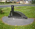 Monument to King Coal - geograph.org.uk - 2961798.jpg 1,579 × 1,299; 731 KB
-
 Morley Farm - geograph.org.uk - 1338807.jpg 640 × 480; 62 KB
-
 National Cycle Route 70 - geograph.org.uk - 5906463.jpg 640 × 480; 113 KB
-
 National Cycle Route 70 - geograph.org.uk - 5909937.jpg 640 × 480; 88 KB
-
 National Cycle Route 70 - geograph.org.uk - 5911087.jpg 640 × 480; 74 KB
-
 National Cycle Route 70 - geograph.org.uk - 5911091.jpg 640 × 480; 71 KB
-
 National Cycle Route 70 - geograph.org.uk - 5911102.jpg 640 × 480; 99 KB
-
 Nature Reserve on the River Gaunless - geograph.org.uk - 5826869.jpg 640 × 480; 296 KB
-
 Nettlebed Lane - geograph.org.uk - 5909915.jpg 640 × 480; 117 KB
-
 Nettlebed Lane at Rowntree Farm - geograph.org.uk - 5327686.jpg 4,000 × 3,000; 2.61 MB
-

-
 New (and blocked) field entrance off Hummerbeck Lane - geograph.org.uk - 6123296.jpg 1,600 × 1,200; 511 KB
-
 New house at Ramshaw - geograph.org.uk - 5826850.jpg 640 × 480; 329 KB
-
 Old water feature at Witton Castle - geograph.org.uk - 3927849.jpg 640 × 480; 247 KB
-
 Ordnance Survey Flush Bracket 2245 - geograph.org.uk - 5405333.jpg 3,756 × 2,817; 2.85 MB
-
 Pease fire-brick from Gaunless Railway Viaduct - geograph.org.uk - 4626054.jpg 1,024 × 768; 294 KB
-
 Pipeline parallel to Evenwood Lane - geograph.org.uk - 4991459.jpg 1,500 × 1,000; 1.13 MB
-
 Polytunnel, Cock's House Farm - geograph.org.uk - 5915863.jpg 640 × 480; 88 KB
-
 Primitive Methodist Chapel, Ramshaw - geograph.org.uk - 5915848.jpg 640 × 480; 70 KB
-

-
 Prohibition at Witton Park - geograph.org.uk - 3927843.jpg 640 × 480; 237 KB
-
 Public footpath to Evenwood - geograph.org.uk - 6120545.jpg 1,488 × 1,116; 474 KB
-
 Raby Street, Evenwood - geograph.org.uk - 5917528.jpg 640 × 480; 63 KB
-

-
 Railway path at Ramshaw - geograph.org.uk - 5826074.jpg 640 × 480; 339 KB
-
 Railway path at Ramshaw - geograph.org.uk - 5826849.jpg 640 × 480; 349 KB
-

-
 Rear view of Cafe 68 - geograph.org.uk - 5826517.jpg 640 × 480; 293 KB
-
 Retaining walls for the north bank of the River Wear - geograph.org.uk - 3765090.jpg 3,566 × 2,624; 2.87 MB
-
 Ripening oil seed rape off Hummerbeck Lane - geograph.org.uk - 6123300.jpg 1,600 × 1,200; 534 KB
-
 River bank protection - geograph.org.uk - 6793612.jpg 2,000 × 983; 2.03 MB
-
 River Gaunless east of viaduct - geograph.org.uk - 4625965.jpg 1,024 × 768; 199 KB
-
 River Wear at Low Barns - geograph.org.uk - 5821251.jpg 640 × 360; 267 KB
-
 River Wear at Witton - geograph.org.uk - 3927810.jpg 640 × 480; 164 KB
-

-
 Road bridge over Witton Row Beck at Witton Castle - geograph.org.uk - 2204091.jpg 2,048 × 1,536; 1.04 MB
-
 Road leading onto the bridge over the Wear - geograph.org.uk - 2899141.jpg 4,608 × 3,456; 5.61 MB
-
 Seat on verge at front of Swape Foot Farm - geograph.org.uk - 2953182.jpg 2,918 × 2,226; 1.04 MB
-
 Semi detached houses, Evenwood Gate - geograph.org.uk - 5917516.jpg 640 × 480; 60 KB
-

-
 Sheep grazing towards Ramshaw Hall - geograph.org.uk - 5915830.jpg 640 × 465; 65 KB
-
 Sign with minor road entering Low Lands - geograph.org.uk - 6510195.jpg 1,999 × 1,150; 2.52 MB
-
 Silage field near East Rowntree - geograph.org.uk - 5909914.jpg 640 × 480; 76 KB
-
 Site of former Randolph Colliery - geograph.org.uk - 2961844.jpg 1,824 × 1,368; 758 KB
-
 Snowed field west of Rowntree Farm - geograph.org.uk - 2721416.jpg 1,500 × 954; 1.11 MB
-
 South entrance to Witton Castle - geograph.org.uk - 4128977.jpg 640 × 480; 84 KB
-
 Stranded tree on Wear and weir - geograph.org.uk - 6361429.jpg 2,000 × 1,139; 2.21 MB
-
 Terraced houses at Ramshaw - geograph.org.uk - 5826064.jpg 640 × 480; 261 KB
-

-
 Terraced housing, High Lands - geograph.org.uk - 5915890.jpg 640 × 480; 57 KB
-
 Terraced housing, Low Bowes Close - geograph.org.uk - 5915852.jpg 640 × 480; 83 KB
-
 The 68 Cafe - geograph.org.uk - 5911110.jpg 640 × 480; 59 KB
-
 The 68 Café - geograph.org.uk - 6603965.jpg 640 × 480; 70 KB
-
 The Bay Horse Inn, Evenwood - geograph.org.uk - 5917529.jpg 640 × 414; 55 KB
-
 The former Evenwood Co-op building - geograph.org.uk - 2961761.jpg 3,648 × 2,736; 2.41 MB
-

-
 The River Wear near Witton Park - geograph.org.uk - 5906464.jpg 640 × 480; 63 KB
-
 This way to Bishop Auckland - geograph.org.uk - 6123305.jpg 1,600 × 1,200; 451 KB
-
 Toft Hill Hall Farm - geograph.org.uk - 3927679.jpg 640 × 480; 151 KB
-
 Track from High House to road - geograph.org.uk - 5328855.jpg 4,000 × 3,000; 3.19 MB
-
 Trackbed of disused railway by River Gaunless - geograph.org.uk - 4626951.jpg 1,024 × 769; 262 KB
-
 Trees along Hummer Beck - geograph.org.uk - 6120530.jpg 1,600 × 1,200; 609 KB
-
 Trig point with High House - geograph.org.uk - 4091071.jpg 1,500 × 1,024; 1.57 MB
-
 Valley of the Gill Beck - geograph.org.uk - 1338802.jpg 640 × 480; 75 KB
-
 Victorian postbox, High Lands - geograph.org.uk - 5916075.jpg 1,430 × 2,385; 708 KB
-
 View over Weardale - geograph.org.uk - 5826511.jpg 640 × 480; 352 KB
-
 Waterfall on Linburn Beck - geograph.org.uk - 3927812.jpg 640 × 480; 233 KB
-
 Weardale Way near Witton Hall - geograph.org.uk - 1731358.jpg 640 × 480; 65 KB


_-_geograph.org.uk_-_4626005.jpg)


_off_Copeland_Lane_-_geograph.org.uk_-_5917535.jpg)


_-_geograph.org.uk_-_6120532.jpg)


_-_geograph.org.uk_-_5915896.jpg)
_approaching_crossroads_-_geograph.org.uk_-_3342608.jpg)


_field_entrance_off_Hummerbeck_Lane_-_geograph.org.uk_-_6123296.jpg)


