Category:Evanton
Jump to navigation
Jump to search
village in Kiltearn parish, Highland, Scotland, UK  Hovedgata i Evanton | |||||
| Upload media | |||||
| Instance of | |||||
|---|---|---|---|---|---|
| Named after |
| ||||
| Location |
| ||||
| Commissioned by |
| ||||
| Owned by |
| ||||
| Inception |
| ||||
| Population |
| ||||
 | |||||
Deutsch: Evanton oder Baile Eòghainn ist ein Ort mit 1130 (Schätzung 2004) Einwohnern in der schottischen Region Ross. Der Ort liegt rund 24 km nördlich von Inverness, 10 km nordwestlich von Dingwall und 6.5 km südöstlich von Alness. Evan Fraser von Balconie gründete den Ort 1807.
English: Evanton is a large village in Easter Ross, in the Highland region of Scotland. It lies between the river Sgitheach and the Allt Graad, is 24 kilometres (15 miles) north of the city of Inverness, some 6.5 km (4 miles) south-west of Alness, and 10 km (6.5 miles) north-east of Dingwall. The village has a dozen or so streets, the main one being Balconie Street (B817). It has been described by analysts at Highland Council as a "commuting settlement", because most of the inhabitants work in other areas of Easter Ross and the greater Inverness area.
Français : Evanton ( Écossais: Baile Eòghainn) est une petite ville écossaise située dans la région des Ross, avec une population de 1105 habitants. Il est situé entre le fleuve Sgitheach et le fleuve Allt Graad. La ville au sens propre du terme date de 1807. Il a été fondé par Evan Fraser de Balconie, un propriétaire foncier local.
Gàidhlig: 'S e baile ann an Siorrachd Rois a tha ann am Baile Eòghainn no Baile Ur (Evanton sa Bheurla). Tha 1105 duine a' fuireach anns a' bhaile fhèin agus 1678 duine eile anns an "Evanton Settlement Zone").
Nederlands: Evanton ( Gaelisch:Baile Eòghainn) is een stad in het oosten van de Highlands (Ross), Schotland. De stad heeft een populatie van 1105. Het wordt gevestigd tussen de rivier Sgitheach en de rivier Allt Graad. Evanton werd opgericht in 1807 door Evan Fraser van Balconie.
Norsk bokmål: Evanton ( Skotsk gælisk: Baile Eòghainn) er en landsby (village) i regionen Highland i Skottland. Ved folketellingen i 2001 hadde Evanton 1 105 innbyggere. I 2006 ble folketallet estimert til 1 120 innbyggere.kilde www
Subcategories
This category has the following 2 subcategories, out of 2 total.
E
- Evanton railway station (2 F)
F
- Fyrish Monument (18 F)
Media in category "Evanton"
The following 84 files are in this category, out of 84 total.
-

-
 B817 - geograph.org.uk - 506878.jpg 640 × 426; 100 KB
-
 Balconie trig point - geograph.org.uk - 352927.jpg 639 × 479; 55 KB
-

-
 Blackrock Bunkhouse Evanton - geograph.org.uk - 1858769.jpg 3,648 × 2,736; 2.27 MB
-
 Chapel Street, Evanton - geograph.org.uk - 2099265.jpg 640 × 480; 99 KB
-
 Diamond Jubilee Hall, Evanton (geograph 6032805).jpg 1,280 × 960; 729 KB
-
 Elm, Glen Glass - geograph.org.uk - 207911.jpg 480 × 640; 120 KB
-
 End of the pier, Highland Deephaven - geograph.org.uk - 1885406.jpg 640 × 427; 54 KB
-
 Evanton Airfield - geograph.org.uk - 96495.jpg 640 × 399; 83 KB
-
 Evanton Post Off(ice) - geograph.org.uk - 2099260.jpg 640 × 480; 79 KB
-
 Evanton Post Office - geograph.org.uk - 213850.jpg 480 × 640; 77 KB
-
 Evanton Post Office - geograph.org.uk - 4719694.jpg 1,024 × 768; 318 KB
-
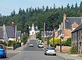
 EvantonMainStreet.jpg 1,850 × 920; 1.19 MB
-
 EvantonWelcome.JPG 1,280 × 960; 320 KB
-
 Forest, Glen Glass - geograph.org.uk - 207876.jpg 480 × 640; 150 KB
-
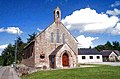
 Former chapel in Evanton (geograph 5847557).jpg 1,600 × 1,600; 708 KB
-
 Former chapel, Chapel Street, Evanton (geograph 6032828).jpg 1,280 × 880; 1.03 MB
-
 FyrishfromEvanton.JPG 387 × 238; 18 KB
-
 Glen Glass - geograph.org.uk - 207877.jpg 640 × 480; 143 KB
-
 Glen Glass - geograph.org.uk - 207884.jpg 640 × 480; 117 KB
-
 Glen Glass Road, Assynt - geograph.org.uk - 207867.jpg 640 × 480; 109 KB
-
 Houses on Drummond Road - geograph.org.uk - 4093161.jpg 640 × 480; 66 KB
-
 Houses on Nova Crescent, Culcairn - geograph.org.uk - 4093184.jpg 640 × 480; 72 KB
-
 Kiltearn Free Church of Scotland (geograph 6031939).jpg 1,280 × 960; 698 KB
-
 Kiltearn Free Church Of Scotland (geograph 6125474).jpg 800 × 800; 111 KB
-
 Kiltearn Free Church Of Scotland (geograph 6125481).jpg 1,024 × 640; 145 KB
-
 Overview of Evanton.jpg 1,022 × 535; 49 KB
-

-
 Railway Bridge at Kiltearn - geograph.org.uk - 207657.jpg 640 × 480; 144 KB
-
-
 Snowdrops at Knockancurin - geograph.org.uk - 368186.jpg 640 × 480; 175 KB
-

-

-
 The railway north at Kiltearn - geograph.org.uk - 207659.jpg 640 × 480; 116 KB
-
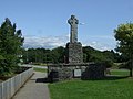 War Memorial, Evanton (geograph 4093165).jpg 640 × 480; 68 KB
-
 Which way^ - geograph.org.uk - 155688.jpg 640 × 480; 146 KB
-

-
 Assynt - geograph.org.uk - 207869.jpg 640 × 480; 59 KB
-
 Assynt water treatment works - geograph.org.uk - 207871.jpg 640 × 480; 84 KB
-
 Black Rock Campsite, Evanton - geograph.org.uk - 699948.jpg 640 × 480; 83 KB
-
 Cairn on the Windfarm - geograph.org.uk - 375980.jpg 640 × 425; 103 KB
-
 Cobhan Dubh - geograph.org.uk - 155702.jpg 640 × 480; 89 KB
-
 Creag Ruadh - geograph.org.uk - 155696.jpg 640 × 480; 101 KB
-
 Cromarty Firth from near Ardullie Lodge - geograph.org.uk - 617716.jpg 640 × 503; 114 KB
-
 Culnaskeath - geograph.org.uk - 368223.jpg 640 × 480; 104 KB
-
 Douglas fir - geograph.org.uk - 155722.jpg 480 × 640; 166 KB
-
 Drummond Farm - geograph.org.uk - 207646.jpg 640 × 480; 56 KB
-
 Drummonds Farm - geograph.org.uk - 207650.jpg 640 × 480; 80 KB
-
 Evanton - geograph.org.uk - 105960.jpg 640 × 480; 98 KB
-
 Evanton - geograph.org.uk - 213851.jpg 636 × 441; 65 KB
-
 Evanton - The Kiltearn Parish Church - geograph.org.uk - 225498.jpg 431 × 284; 19 KB
-

-

-

-
 Evanton looking West - geograph.org.uk - 1711.jpg 546 × 395; 58 KB
-
 Extraction lane - geograph.org.uk - 155664.jpg 640 × 480; 159 KB
-
 Farm Land near Evanton - geograph.org.uk - 110648.jpg 640 × 480; 95 KB
-
 Footpath to Black Rock Gorge - geograph.org.uk - 699951.jpg 640 × 480; 140 KB
-
 Forest Clearing - geograph.org.uk - 1422543.jpg 640 × 480; 90 KB
-
 Forest Edge - geograph.org.uk - 1424071.jpg 640 × 480; 75 KB
-
 Forestry land near Loch Dubh - geograph.org.uk - 628073.jpg 640 × 480; 426 KB
-
 Harbour seals at low tide - geograph.org.uk - 533617.jpg 640 × 427; 79 KB
-
 Hill Cottage - geograph.org.uk - 718236.jpg 640 × 480; 109 KB
-
 Junction of track from Knockancurin - geograph.org.uk - 653100.jpg 640 × 480; 66 KB
-
 Larch woods, Cnoc Fyrish - geograph.org.uk - 155704.jpg 640 × 480; 128 KB
-
 Loch Dubh - geograph.org.uk - 628070.jpg 640 × 480; 463 KB
-
 Loch Dubh - geograph.org.uk - 628078.jpg 640 × 480; 432 KB
-

-
 Looking towards the trig point. - geograph.org.uk - 379092.jpg 640 × 425; 101 KB
-
 Novar Forest - geograph.org.uk - 155711.jpg 640 × 480; 151 KB
-
 Novar Forest - geograph.org.uk - 155718.jpg 640 × 480; 150 KB
-
 Novar Forest - geograph.org.uk - 155720.jpg 480 × 640; 146 KB
-
 Overgrown gateway - geograph.org.uk - 207881.jpg 640 × 480; 153 KB
-
 Redburn - geograph.org.uk - 207874.jpg 640 × 480; 66 KB
-
 Ride, Novar - geograph.org.uk - 155715.jpg 480 × 640; 116 KB
-
 Road to Katewell - geograph.org.uk - 368191.jpg 480 × 640; 126 KB
-
 Ruined house at Achleach - geograph.org.uk - 653104.jpg 640 × 480; 98 KB
-
 Scenic view - geograph.org.uk - 46345.jpg 394 × 600; 68 KB
-
 Scots pine near Corriefoulis - geograph.org.uk - 368196.jpg 480 × 640; 98 KB
-
 Strath Sgitheach - geograph.org.uk - 653086.jpg 640 × 480; 56 KB
-
 Swordale - geograph.org.uk - 368233.jpg 480 × 640; 94 KB
-
-

_-_geograph.org.uk_-_6022684.jpg)


.jpg)


_-_geograph.org.uk_-_2099260.jpg)


.jpg)
.jpg)


.jpg)
.jpg)
.jpg)


.jpg)


.jpg)


