Category:Evangelische Kirche Steckborn
Jump to navigation
Jump to search
| Object location | | View all coordinates using: OpenStreetMap |
|---|
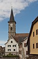
church building in Steckborn in the canton of Thurgau, Switzerland   | |||||
| Upload media | |||||
| Instance of | |||||
|---|---|---|---|---|---|
| Part of | |||||
| Named after | |||||
| Location |
| ||||
| Street address |
| ||||
| Heritage designation |
| ||||
 | |||||
Subcategories
This category has only the following subcategory.
Media in category "Evangelische Kirche Steckborn"
The following 15 files are in this category, out of 15 total.
-
 Dorfstrasse in Steckborn- MG 1136.jpg 3,000 × 1,688; 5.14 MB
-
 ETH-BIB-Steckborn, Zentrum aus 100 m-Inlandflüge-LBS MH01-001873.tif 6,490 × 4,642; 42.67 MB
-
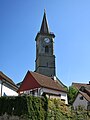
 Evangelisch-reformierte Kirche Steckborn Turm.jpg 2,362 × 3,543; 1.66 MB
-
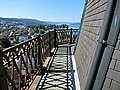 Evangelische Kirche Steckborn Plattform.JPG 4,000 × 3,000; 3.7 MB
-
 Evangelische Kirche Steckborn.JPG 3,000 × 4,000; 2.65 MB
-
 See-Restaurant Schwanen in Steckborn.jpg 2,500 × 3,500; 6.18 MB
-
 Seerestaurant Schwanen in Steckborn - panoramio.jpg 3,072 × 2,304; 4.02 MB
-
 Steckborn - panoramio (106).jpg 4,272 × 2,848; 8.42 MB
-
 Steckborn - panoramio (148).jpg 2,848 × 4,272; 6.24 MB
-
 Steckborn - panoramio (154).jpg 4,272 × 2,848; 6.8 MB
-
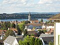 Steckborn Aussicht Stadt und evangelische Kirche.jpg 4,000 × 3,000; 5.43 MB
-
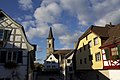
 Steckborn evangelische Kirche.jpg 4,000 × 3,000; 5.55 MB
-
 Steckborn-Ref-Kirche.jpg 1,333 × 2,045; 1.51 MB
-
 Steckborn-Turmhof-Seeseite-2.jpg 2,445 × 3,260; 1.37 MB
-
 SteckbornPlatz.jpg 5,184 × 3,888; 8.11 MB


.jpg)
.jpg)
.jpg)


