Category:Evangelische Kirche Schömberg (Landkreis Calw)
Jump to navigation
Jump to search
| Object location | | View all coordinates using: OpenStreetMap |
|---|
  | |||||
| Upload media | |||||
| Instance of | |||||
|---|---|---|---|---|---|
| Location | Schömberg, Calw District, Karlsruhe Government Region, Baden-Württemberg, Germany | ||||
 | |||||
Subcategories
This category has the following 2 subcategories, out of 2 total.
S
- Schömberger Sühnekreuz (3 F)
Media in category "Evangelische Kirche Schömberg (Landkreis Calw)"
The following 14 files are in this category, out of 14 total.
-
 Evang. Kirche Schömberg (Kreis Calw).JPG 4,000 × 3,000; 2.75 MB
-
 Evangelische Kirche in Schömberg - panoramio.jpg 3,072 × 2,304; 4.1 MB
-
 Evangelische Kirche Schömberg innen.jpg 4,027 × 3,035; 1.63 MB
-
 Landappbw 895851 1820 Evangelische Kirche Schömberg.jpg 1,440 × 1,920; 567 KB
-
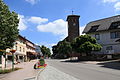 Schömberg - Hugo-Römpler-Straße-Liebenzeller Straße-Schwarzwaldstraße-Lindenstraße 01 ies.jpg 5,616 × 3,744; 16.18 MB
-
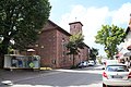 Schömberg - Liebenzeller Straße + Evangelische Kirche 01 ies.jpg 5,616 × 3,744; 16.6 MB
-
 Schömberg - Liebenzeller Straße - Evangelische Kirche 01 ies.jpg 3,744 × 5,616; 15.09 MB
-
 Schömberg - Liebenzeller Straße - Evangelische Kirche 02 ies.jpg 3,744 × 5,616; 18.72 MB
-
 Schömberg - Liebenzeller Straße - Evangelische Kirche 03 ies.jpg 5,616 × 3,744; 19.82 MB
-
 Schömberg - Schwarzwaldstraße + Evangelische Kirche 01 ies.jpg 5,616 × 3,744; 14.96 MB
-
 Schömberg - Schwarzwaldstraße + Evangelische Kirche 02 ies.jpg 3,744 × 5,616; 15.74 MB
-
 Schömberg - Schwarzwaldstraße + Evangelische Kirche 03 ies.jpg 5,616 × 3,744; 16.19 MB
-
 Schömberg - Schwarzwaldstraße - Evangelische Kirche 01 ies.jpg 5,616 × 3,744; 14.16 MB
-
 Schömberg - Schwarzwaldstraße - Kurpark + Evangelische Kirche 01 ies.jpg 5,616 × 3,744; 22.03 MB
.JPG)


