Category:Evangelische Kirche Mildenau (Sachsen)
Jump to navigation
Jump to search
| Object location | | View all coordinates using: OpenStreetMap |
|---|
church building in Mildenau, Saxony, Germany   | |||||
| Upload media | |||||
| Instance of | |||||
|---|---|---|---|---|---|
| Location | Mildenau, Erzgebirgskreis, Saxony, Germany | ||||
| Street address |
| ||||
| Heritage designation | |||||
| Inception |
| ||||
 | |||||
Subcategories
This category has only the following subcategory.
Media in category "Evangelische Kirche Mildenau (Sachsen)"
The following 14 files are in this category, out of 14 total.
-
 2017-09-22 Kirche Mildenau 01.jpg 2,664 × 4,000; 7.01 MB
-
 2017-09-22 Kirche Mildenau 02.jpg 2,664 × 4,000; 6.48 MB
-
 2017-09-22 Kirche Mildenau 03.jpg 2,998 × 4,018; 11.96 MB
-
 2017-09-22 Kirche Mildenau 07.jpg 3,616 × 1,879; 7.61 MB
-
 2017-09-22 Kirche Mildenau 08.jpg 2,664 × 4,000; 8.57 MB
-
 Ev.-luth. Kirche Mildenau (5).jpg 4,000 × 3,000; 2.4 MB
-
 Ev.-luth. Kirche Mildenau (6).jpg 3,000 × 4,000; 3.6 MB
-
 Ev.-luth. Kirche Mildenau (8).jpg 3,872 × 2,592; 2.74 MB
-
 Ev.-luth. Kirche Mildenau (9).jpg 2,560 × 1,920; 1.55 MB
-
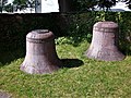 Ev.-luth. Kirche Mildenau, Glocken.jpg 4,000 × 3,000; 3.88 MB
-
 Ev.-luth. Kirche Mildenau, Portal.jpg 3,000 × 4,000; 1.99 MB
-
 Ev.-luth. Kirche Mildenau, Turm.jpg 3,000 × 4,000; 3.91 MB
-
 Liesel 05-09-2010 Kirche Mildenau.jpg 1,594 × 1,024; 402 KB
-
 Pfarrhaus Mildenau.jpg 4,000 × 3,000; 2.73 MB


.jpg)
.jpg)
.jpg)
.jpg)


