Category:Evangelisch-lutherische Kirche Großharthau
Jump to navigation
Jump to search
| Object location | | View all coordinates using: OpenStreetMap |
|---|
church building in Großharthau, Germany  | |||||
| Upload media | |||||
| Instance of | |||||
|---|---|---|---|---|---|
| Location | Großharthau, Bautzen District, Saxony, Germany | ||||
| Street address |
| ||||
| Heritage designation | |||||
| Inception |
| ||||
 | |||||
Deutsch: Evangelisch-lutherische Kirche Großharthau
| (Wikidata) |
Pages in category "Evangelisch-lutherische Kirche Großharthau"
This category contains only the following page.
Media in category "Evangelisch-lutherische Kirche Großharthau"
The following 13 files are in this category, out of 13 total.
-
 Dorfkirche Großharthau, Ansicht von NO.JPG 3,264 × 2,448; 1.59 MB
-
 Dorfkirche Großharthau, Ansicht von S.JPG 3,264 × 2,448; 1.15 MB
-
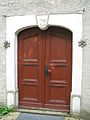 Dorfkirche Großharthau, Portal.JPG 2,448 × 3,264; 1.06 MB
-
 Großharthau-Kirche1.jpg 2,641 × 2,421; 2 MB
-
 Kirche großharthau 2020-02-22.jpg 3,648 × 2,736; 2.97 MB
-
 Kirche Großharthau Mai 2017 (1).jpg 3,648 × 5,472; 4.56 MB
-
 Kirche Großharthau Mai 2017 (2).jpg 5,472 × 3,648; 4.59 MB
-
 Kirche Großharthau Mai 2017 (3).jpg 3,648 × 5,472; 4.58 MB
-
 Kirche Großharthau Mai 2017 (4).jpg 3,648 × 5,472; 4.51 MB
-
 Kirche Großharthau Mai 2017 (5).jpg 3,648 × 5,472; 4.75 MB
-
 Kirche Großharthau Mai 2017 (8).jpg 5,472 × 3,648; 4.5 MB
-
 Kirche Großharthau Mai 2017 (9).jpg 3,648 × 5,472; 4.4 MB
-
 Was die Heimat erzählt (Störzner) 182a.jpg 483 × 685; 82 KB


.jpg)
.jpg)
.jpg)
.jpg)
.jpg)
.jpg)
.jpg)
_182a.jpg)