Category:Evaluation of images from Wiki Loves Earth 2016 in Spain - Round 1
Jump to navigation
Jump to search
Media in category "Evaluation of images from Wiki Loves Earth 2016 in Spain - Round 1"
The following 200 files are in this category, out of 1,195 total.
(previous page) (next page)-
 "Chumbera".jpg 4,160 × 2,336; 3.03 MB
-
 "Estero".jpg 4,160 × 2,336; 2.54 MB
-
 "Flamencos".jpg 4,608 × 2,592; 3.76 MB
-
 "Pedra da campá".jpg 4,320 × 3,240; 4.45 MB
-
 "Playa de la Casería".jpg 4,160 × 2,336; 2.24 MB
-
 "Senderos".jpg 4,160 × 2,336; 4.72 MB
-
 "Tinajas".jpg 4,608 × 2,592; 4.02 MB
-
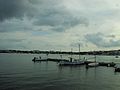
 "Velero".jpg 4,608 × 2,592; 4.01 MB
-
 "Vinagrillo".jpg 4,608 × 2,592; 3.56 MB
-
 009 Navegant vora Sant Feliu de Guíxols, al fons el puig de les Forques.JPG 2,112 × 2,756; 2.92 MB
-
 01 Platja des Geperut, amb es Pantaleu al fons (Sant Elm).JPG 4,416 × 3,312; 12.22 MB
-
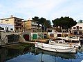
 01 Portocolom.JPG 2,816 × 2,112; 2.16 MB
-
 012 Can Sopa, riera Coma Clara 5 (Alella).JPG 2,816 × 2,112; 3.14 MB
-
 013 Costa de Tossa de Mar, des del cap de Tossa fins a Salionç.JPG 2,704 × 1,928; 3.03 MB
-
 018 Casa Nova de l'Obac, parc de Sant Llorenç del Munt i l'Obac (Vacarisses).JPG 2,816 × 1,792; 1.48 MB
-
 019 Can Sopa, riera Coma Clara 5 (Alella).JPG 2,816 × 2,112; 3.84 MB
-
 019 Conglomerat al parc de Sant Llorenç del Munt i l'Obac.JPG 2,816 × 2,112; 4.72 MB
-
 019 Excursió als canyons del Maresme, al fons el cap de Tossa.JPG 2,816 × 2,112; 2.25 MB
-
 02 Es Pantaleu des de la platja des Geperut (Sant Elm).JPG 4,416 × 3,312; 12.47 MB
-
 02 Portocolom.JPG 2,816 × 2,112; 3.44 MB
-
 023 Costa de Lloret i Canyelles.JPG 2,816 × 1,784; 2.22 MB
-
 024 Costa de Lloret, Canyelles i Llorell.JPG 2,816 × 1,320; 1.9 MB
-
 03 Platja des Geperut, amb es Pantaleu al fons (Sant Elm).JPG 4,416 × 3,312; 11.9 MB
-
 04 Portocolom.JPG 2,112 × 2,816; 3.17 MB
-
 041 Costa de Blanes, amb el turó de Sant Joan.JPG 2,816 × 1,784; 2.48 MB
-
 05 Platja des Geperut, amb es Pantaleu al fons (Sant Elm).JPG 4,416 × 3,312; 13.2 MB
-
 057 Jardí de Can Prunera (Sóller), amb la serra de Tramuntana al fons.JPG 2,816 × 2,112; 4.72 MB
-
 059 Can Jonc, riera Coma Clara 9 (Alella), angle sud-est.JPG 2,816 × 2,112; 2.85 MB
-
 06 Casa al peu de la serra de Tramuntana, vora la carretera de Valldemossa (Deià).JPG 2,816 × 2,112; 4.97 MB
-
 06 Portocolom.JPG 2,816 × 2,112; 3.57 MB
-
 060 Can Boquet, av. Sant Josep de Calassanç 8 (Alella).JPG 2,816 × 1,760; 2.31 MB
-
 07 Costa de Sant Elm, amb sa Dragonera al fons.JPG 3,312 × 4,416; 13.67 MB
-
 07 El Puig de Deià des de la carretera de Sóller.JPG 2,816 × 2,112; 4.39 MB
-
 07 Portocolom.JPG 2,816 × 2,112; 3.43 MB
-
 071 Vil·la Möller (Can Jonc Events), des de Can Magarola (Alella).JPG 2,816 × 2,112; 2.72 MB
-
 08 Portocolom al capvespre.JPG 4,416 × 3,312; 10.38 MB
-
 08 Portocolom.JPG 2,816 × 2,112; 3.38 MB
-
 08 Sant Joan i el Puig de Deià des de la carretera de Sóller.JPG 2,816 × 2,112; 4.53 MB
-
 083 Valldemossa i Sant Bartomeu des de la miranda dels Lledoners.JPG 2,816 × 2,112; 4.57 MB
-
 087 Can Pau Arenes, riera Coma Clara 23 (Alella), entrada a la finca.JPG 2,816 × 2,112; 2.89 MB
-
 09 Portocolom.JPG 2,816 × 2,112; 3.78 MB
-
 092 Can Colomer, riera Coma Clara 27 (Alella).JPG 2,816 × 2,112; 3.53 MB
-
 093 Riera de Coma Clara (Alella), tàpia de Can Pau Arenes.JPG 2,816 × 2,112; 4.71 MB
-
 10 El Puig de Deià des de la carretera de Sóller.JPG 2,112 × 2,816; 4.46 MB
-
 10 Portocolom.JPG 2,816 × 2,112; 3.8 MB
-
 100 Tossa de Mar, cala i torre des Codolar.JPG 2,816 × 2,112; 2.59 MB
-
 103 Tossa de Mar, cala i torre des Codolar.JPG 2,112 × 2,816; 2.42 MB
-
 105 Tossa de Mar, torre des Codolar, cap de Tossa i far.JPG 2,816 × 1,896; 2.72 MB
-
 107 La costa a ponent de Tossa de Mar, la Bola i sa Pedra Tallada.JPG 2,728 × 2,032; 3.44 MB
-
 109 Tossa de Mar, cala i torre des Codolar.JPG 2,112 × 2,816; 2.58 MB
-
 11 Portocolom.JPG 2,816 × 2,112; 1.68 MB
-
 113 Platja de Tossa de Mar.JPG 2,816 × 2,112; 2.96 MB
-
 118 Platja de Tossa de Mar.JPG 2,752 × 2,016; 3.36 MB
-
 119 Barques davant la platja de Tossa de Mar.JPG 2,816 × 2,112; 2.68 MB
-
 12 Portocolom al capvespre.JPG 4,416 × 3,312; 9.51 MB
-
 12 Sant Joan i el Puig de Deià des de la carretera de Sóller.JPG 2,816 × 2,112; 4.78 MB
-
 121 Sóller i la serra de Tramuntana des de la carretera Ma-11.JPG 2,816 × 2,112; 5.18 MB
-
 122 Can Magarola (Alella), des del camí del Greny.JPG 2,816 × 2,112; 3.21 MB
-
 125 Can Tito Serra Nou (Alella), des del camí del Greny.JPG 2,816 × 2,112; 2.89 MB
-
 127 Can Ferrer (Tossa de Mar).JPG 2,736 × 1,816; 1.67 MB
-
 13 Son Moragues, actualment restaurant El Olivo, carretera de Sóller (Deià).JPG 2,816 × 2,112; 5.78 MB
-
 134 Can Bruy (Alella), des del camí del Greny.JPG 2,816 × 2,112; 5.52 MB
-
 135 Vinyes al camí del Greny (Alella), al fons la vall de la riera de Coma Clara.JPG 2,816 × 2,112; 5.18 MB
-
 14 Cases al camí de Son Canals (Deià).JPG 2,816 × 2,112; 5.04 MB
-
 142 Cala Pola (Tossa de Mar), vaixell.JPG 2,112 × 2,816; 3.2 MB
-
 15 Can Fussimany (Deià).JPG 2,816 × 2,112; 5.25 MB
-
 15 Portocolom al capvespre.JPG 3,312 × 4,416; 9.24 MB
-
 16 Portocolom al capvespre.JPG 4,416 × 3,312; 9.42 MB
-
 16 Sa Dragonera des del mollet de na Caragola (Sant Elm).JPG 3,312 × 4,416; 15.69 MB
-
 17 Punta Blanca (Sant Elm), al fons sa Dragonera.JPG 4,416 × 3,312; 16.79 MB
-
 174 Port Salvi (Sant Feliu de Guíxols), amb l'ermita de Sant Elm al fons.JPG 2,816 × 2,112; 3.08 MB
-
 176 Llosa des Freu, al fons la platja de Sant Feliu de Guíxols.JPG 2,816 × 1,872; 2.37 MB
-
 177 Punta de Garbí (Sant Feliu de Guíxols).JPG 1,980 × 2,612; 2.28 MB
-

-
 178 Punta de Garbí (Sant Feliu de Guíxols).JPG 2,816 × 2,112; 2.06 MB
-
 18 Sa Dragonera des de Sant Elm.JPG 3,312 × 4,416; 11.46 MB
-
 19 Portocolom.JPG 2,816 × 2,112; 4.59 MB
-
 190 Platja de Sant Feliu de Guíxols, taules de surf i barques.JPG 2,816 × 2,112; 2.78 MB
-
 2. Lagunas de Ruidera, Parque Natural.jpg 4,320 × 3,240; 4.93 MB
-
 21 Es Pantaleu i sa Dragonera des de la platja Petita (Sant Elm).JPG 3,312 × 4,416; 12.11 MB
-
 21 Portocolom al capvespre.JPG 4,416 × 3,312; 10.31 MB
-
 217 Riera de Coma Fosca (Alella), vora Can Cinto.JPG 2,816 × 2,112; 4.75 MB
-
 22 Portocolom al capvespre.JPG 3,312 × 4,416; 8.81 MB
-
 22 Portocolom.JPG 2,816 × 2,112; 3.3 MB
-
 24 Portocolom.JPG 2,816 × 2,112; 3.6 MB
-
 24 Sant Elm, amb es Pantaleu al fons, des de la platja Petita.JPG 4,416 × 3,312; 11.65 MB
-
 241 Can Pareras, riera Coma Fosca 33-37 (Alella), des de l'av. Jaume Rius i Fabra.JPG 2,816 × 2,112; 4.98 MB
-
 26 Portocolom.JPG 2,816 × 2,112; 2.82 MB
-
 27 Portocolom.JPG 2,816 × 2,112; 2.65 MB
-
 28 Portocolom.JPG 2,816 × 2,112; 3.08 MB
-
 29 Portocolom.JPG 2,816 × 2,112; 2.65 MB
-
 292 Can Bruy, camí de Martorelles 8 (Alella).JPG 2,816 × 2,112; 4.2 MB
-
 32 Portocolom.JPG 2,816 × 2,112; 3.43 MB
-
 34 Portocolom.JPG 2,816 × 2,112; 4.13 MB
-
 35 Portocolom.JPG 2,816 × 2,112; 3.96 MB
-
 36 Portocolom.JPG 2,816 × 2,112; 4.7 MB
-
 37 Portocolom.JPG 2,816 × 2,112; 3.93 MB
-
 38 Portocolom.JPG 2,816 × 2,112; 3.73 MB
-
 40 Portocolom.JPG 2,816 × 2,112; 3.87 MB
-
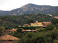
 48 Son Moragues i el puig de sa Galera (Deià), des del cementiri.JPG 2,816 × 2,112; 4.3 MB
-
 A Coruña dende o Faro Pequeno de Mera 9X2011.jpg 3,795 × 2,592; 2.53 MB
-
 A Lanzada 23IV2011 01.jpg 2,000 × 3,008; 2.63 MB
-
 A Lanzada 23IV2011 02.jpg 3,008 × 2,000; 2.96 MB
-
 Adaja y Serrota.jpg 4,288 × 2,848; 2.99 MB
-
 Almendro Reserva natural especial del Chinyero.jpg 2,560 × 1,920; 1.22 MB
-
 Almendros en Férez.jpg 4,608 × 3,456; 10.29 MB
-
 Alta Garrotxa - Wall below Sant Grau D'Entreperes.JPG 4,000 × 3,000; 4.97 MB
-
 Alta Garrotxa Juniperus.jpg 1,840 × 1,232; 955 KB
-
 Alta Garrotxa Sant Grau dEntreperes 2006-10.jpg 2,048 × 1,536; 671 KB
-
 Alta Garrotxa-Can Diumenjo 2006 1.JPG 1,840 × 1,232; 801 KB
-
 Alta Garrotxa-Can Diumenjo 2006 2.JPG 1,840 × 1,232; 894 KB
-
 Alta Garrotxa-Can Diumenjo.JPG 4,000 × 3,000; 4.92 MB
-
 Alta Garrotxa-Morning Fog in Llierca Valley1.jpg 3,000 × 4,000; 4.93 MB
-
 Alta Garrotxa-Morning Fog in Llierca Valley2.jpg 4,000 × 3,000; 4.88 MB
-
 Alta Garrotxa-Rocabruna Castle 2.JPG 4,000 × 3,000; 4.88 MB
-
 Alta Garrotxa-Rocabruna Castle Walls.JPG 4,000 × 3,000; 4.98 MB
-
 Alta Garrotxa-Rocabruna Castle2.JPG 4,000 × 3,000; 5 MB
-
 Alta Garrotxa-Sant Grau dEntreperes-Baptistal Fond.jpg 2,048 × 1,536; 645 KB
-
 Alta Garrotxa-Sant Grau dEntreperes.jpg 2,048 × 1,536; 636 KB
-
 Amanecer en las Marismas del Odiel II.JPG 4,608 × 3,072; 2.1 MB
-
 Amanecer en las Marismas del Odiel III.JPG 4,608 × 3,072; 1.96 MB
-
 Anaga radar.jpg 4,320 × 3,240; 2.82 MB
-
 Anaga. luz.jpg 2,560 × 1,920; 1.2 MB
-
 Anochece en Candelario.jpg 2,448 × 2,448; 3.82 MB
-
 Anochecer en la Albufera.jpg 2,560 × 1,920; 1,011 KB
-
 Antigo aeródromo da Lanzada 23IV2011.jpg 3,008 × 2,000; 2.18 MB
-
 Arbutus unedo 33333.jpg 4,288 × 2,848; 3 MB
-
 Arc de pedra al pas de la foradada.JPG 3,648 × 2,736; 2.16 MB
-
 Arcoiris sobre el río Nava 01.jpg 3,968 × 2,232; 5.33 MB
-
 Arcoiris sobre el río Nava 03.jpg 3,968 × 2,232; 5.38 MB
-
 Arcoiris sobre el río Nava 04.jpg 3,968 × 2,232; 4.62 MB
-
 Area Das Rodas.jpg 3,696 × 2,448; 2.03 MB
-
 Arroyo Esporádico de un afluente del Guadalix.jpg 3,696 × 2,448; 4.87 MB
-
 Arroyo esporádico encajado.jpg 3,696 × 2,448; 5 MB
-
 Arroyo Estacional.jpg 3,696 × 2,448; 4.9 MB
-
 As Catedrais 20IX2013.jpg 3,008 × 2,000; 1.45 MB
-
 As Pontes de Gatín 18VII2010 01.jpg 2,000 × 3,008; 3.23 MB
-
 As Pontes de Gatín 20III2014 01.jpg 2,000 × 3,008; 1.49 MB
-
 As Pontes de Gatín 20III2014 02.jpg 3,008 × 2,000; 1.6 MB
-
 As Pontes de Gatín 20III2014 03.jpg 2,000 × 3,008; 1.47 MB
-
 Atardecer en Anaga.JPG 3,648 × 2,736; 1.56 MB
-
 Atardecer en las islas Cíes desde la playa de Samil.jpg 3,648 × 2,736; 2.39 MB
-
 Au esperant a un mirador del Delta de l'Ebre.jpg 5,315 × 3,543; 1.44 MB
-
 Ayódar.JPG 1,920 × 1,080; 1.48 MB
-
 B08J2517 Velilla del rio Carrion.jpg 1,920 × 1,280; 2.48 MB
-
 Bajada al Charco Pataco, Letur.jpg 3,456 × 4,608; 12.49 MB
-
 Balneario de Arnedillo.jpg 3,024 × 4,032; 5.85 MB
-
 Barca en Fazouro 21IX2013.jpg 3,008 × 2,000; 1.48 MB
-
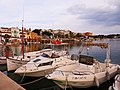
 Barcas en la playa de La Casería de Ossio.JPG 3,072 × 2,304; 2.63 MB
-
 BARRACA D´EN DALI.JPG 3,872 × 2,592; 2.43 MB
-
 Barranco de Guayadeque (1).jpg 5,312 × 2,988; 4.88 MB
-
 Barranco de Guayadeque, ladera.jpg 5,312 × 2,988; 7.09 MB
-
 Barranco de las Palomeras(5).JPG 3,264 × 2,448; 1.85 MB
-
 Barranco de Valdeplata.jpg 5,020 × 3,347; 8.02 MB
-
-

-
 Basilica de Covandonga.jpg 4,224 × 3,168; 2.91 MB
-
 Boca del Asno (2 de mayo de 2015, parque natural Sierra Norte de Guadarrama) 03.jpg 3,888 × 2,592; 5.65 MB
-
 Bosque colorido 2.jpg 1,840 × 3,264; 3.57 MB
-
 Bosque de Irati (3).JPG 3,264 × 2,448; 1.75 MB
-
 Bosque de Irati(2).JPG 3,264 × 2,448; 1.91 MB
-
 Bosque de Irati.JPG 3,264 × 2,448; 1.79 MB
-
 Bosque en el Barranco del Agua.jpg 5,184 × 3,888; 7.73 MB
-
 Bosque nuboso laurilsilva.jpg 5,184 × 3,888; 9.97 MB
-
 Busto de Philippe Cousteau en Salinas, Castrillon.jpg 4,224 × 3,168; 1.31 MB
-
 Béhobie.JPG 4,608 × 3,456; 7.78 MB
-
 Búnker en cala Mica (3 de agosto de 2014, Es Mercader) 01.jpg 3,888 × 2,592; 4.48 MB
-
 Búnker en cala Mica (3 de agosto de 2014, Es Mercader) 02.jpg 3,888 × 2,592; 5.38 MB
-
 Búnker en cala Mica (3 de agosto de 2014, Es Mercader) 03.jpg 3,888 × 2,592; 5.39 MB
-
 Búnker en cala Mica (3 de agosto de 2014, Es Mercader) 05.jpg 2,592 × 3,888; 4.9 MB
-
 Búnker en cala Mica Cala Mica (3 de agosto de 2014, Es Mercader) 04.jpg 3,888 × 2,592; 5.09 MB
-
 Cabalgando en Trafalgar.jpg 2,592 × 1,944; 761 KB
-
 Cabo Touriñán 13VII2013 02.jpg 3,008 × 2,000; 1.3 MB
-
 Cabo Touriñán 13VII2013 03.jpg 3,008 × 2,000; 1.28 MB
-
 Cabo Touriñán 13VII2013 04.jpg 3,008 × 2,000; 1.33 MB
-
 Cala Bini Malá. Costa norte de Menorca.JPG 5,456 × 3,632; 5.31 MB
-
 Cala d'Algairens (4 de agosto de 2014, Ciutadella) 04.JPG 3,888 × 2,592; 5.75 MB
-
 Cala d'Algairens (4 de agosto de 2014, Ciutadella) 05.jpg 3,888 × 2,592; 6.74 MB
-
 Cala d'Algairens (4 de agosto de 2014, Ciutadella) 07.jpg 3,888 × 2,592; 4.24 MB
-
 Cala d'Algairens (4 de agosto de 2014, Ciutadella) 08.jpg 3,888 × 2,592; 6.58 MB
-
 Cala en Porter (3 de agosto de 2015, Alaior) 01.jpg 3,840 × 2,160; 4 MB
-
 Cala Llucalari (30 de julio de 2014, Alaior) 03.JPG 3,888 × 2,592; 5.36 MB
-
 Cala Llucalari (30 de julio de 2014, Alaior) 05.JPG 3,888 × 2,592; 5.21 MB
-
 Cala Mica (3 de agosto de 2014, Es Mercader) 01.jpg 6,277 × 2,520; 18 MB
-
 Cala Mica (3 de agosto de 2014, Es Mercader) 02.jpg 3,888 × 2,592; 3.87 MB
-
 Cala Mica (3 de agosto de 2014, Es Mercader) 03.jpg 3,888 × 2,592; 5.01 MB
-
 Cala Mica (3 de agosto de 2014, Es Mercader) 04.jpg 3,888 × 2,592; 4.97 MB
-
 Cala Mica (3 de agosto de 2014, Es Mercader) 05.jpg 3,888 × 2,592; 4.71 MB
-
 Cala Mica (3 de agosto de 2014, Es Mercader) 06.jpg 3,888 × 2,592; 5 MB
-
 Cala mondrago.jpg 1,536 × 2,048; 1.36 MB
-
 Cala Pregonda. Menorca Costa Norte. Art.JPG 5,456 × 3,632; 4.56 MB
-
 Cala Pregonda. Menorca costa Norte. Diagonal.JPG 5,456 × 3,632; 5.72 MB
-
 CALA S´ALGUER.JPG 3,872 × 2,592; 2.37 MB
-
 Cala Tirant (4 de agosto de 2015, es Mercadal) 01.jpg 3,840 × 2,160; 3.23 MB
-
 Cala Tirant (4 de agosto de 2015, es Mercadal) 02.jpg 3,840 × 2,160; 3.43 MB
-
 Cala Tirant (4 de agosto de 2015, es Mercadal) 03.jpg 3,840 × 2,160; 3.33 MB
-
 Cala Tirant (4 de agosto de 2015, es Mercadal) 04.jpg 3,840 × 2,160; 3.75 MB
-
 Cala Tirant (4 de agosto de 2015, es Mercadal) 05.jpg 2,160 × 3,840; 4.34 MB
-
 Cala Tirant (4 de agosto de 2015, es Mercadal) 06.jpg 3,840 × 1,754; 3.31 MB
-
 Cala Vedella sunset.jpg 5,184 × 3,456; 1.92 MB


.JPG)

.JPG)

.JPG)
.JPG)


.JPG)


.JPG)


.JPG)
,_amb_la_serra_de_Tramuntana_al_fons.JPG)
,_angle_sud-est.JPG)
.JPG)

.JPG)


,_des_de_Can_Magarola_(Alella).JPG)


,_entrada_a_la_finca.JPG)

.JPG)
,_t%C3%A0pia_de_Can_Pau_Arenes.JPG)


,_des_del_cam%C3%AD_del_Greny.JPG)
,_des_del_cam%C3%AD_del_Greny.JPG)
.JPG)
.JPG)
,_des_del_cam%C3%AD_del_Greny.JPG)
,_al_fons_la_vall_de_la_riera_de_Coma_Clara.JPG)
.JPG)
,_vaixell.JPG)
.JPG)


.JPG)
,_al_fons_sa_Dragonera.JPG)
,_amb_l%27ermita_de_Sant_Elm_al_fons.JPG)

.JPG)

.JPG)


.JPG)

,_vora_Can_Cinto.JPG)


,_des_de_l%27av._Jaume_Rius_i_Fabra.JPG)


.JPG)


,_des_del_cementiri.JPG)


.jpg)

.JPG)

_01.jpg)
.jpg)

_03.jpg)

.JPG)
.JPG)


_01.jpg)
_02.jpg)
_03.jpg)
_05.jpg)
_04.jpg)


_04.JPG)
_05.jpg)
_07.jpg)
_08.jpg)
_01.jpg)
_03.JPG)
_05.JPG)
_02.jpg)
_03.jpg)
_04.jpg)
_05.jpg)
_06.jpg)


_01.jpg)
_02.jpg)
_03.jpg)
_04.jpg)
_05.jpg)
_06.jpg)

_01.jpg)