Category:Esh, County Durham
Jump to navigation
Jump to search
English: Esh is a village and civil parish in County Durham, England.
village and civil parish in County Durham, United Kingdom  | |||||
| Upload media | |||||
| Instance of | |||||
|---|---|---|---|---|---|
| Location | County Durham, North East England, England | ||||
| Population |
| ||||
| Said to be the same as | Esh (Wikimedia duplicated page, civil parish) | ||||
 | |||||
Subcategories
This category has the following 4 subcategories, out of 4 total.
Media in category "Esh, County Durham"
The following 200 files are in this category, out of 202 total.
(previous page) (next page)-

-
 Almost completed new house at Biggen Gardens - geograph.org.uk - 3458732.jpg 3,608 × 2,682; 1.98 MB
-
 Autumn colours along Hamsteels Lane - geograph.org.uk - 5357594.jpg 4,450 × 3,234; 7.69 MB
-
 Barn just east of Biggen House Farm - geograph.org.uk - 3458714.jpg 3,314 × 2,502; 2.17 MB
-
 Biggin Terrace - geograph.org.uk - 5357608.jpg 4,608 × 3,456; 6.84 MB
-
 Blackburh Beck - geograph.org.uk - 3399835.jpg 4,608 × 3,456; 5.11 MB
-
 Blackburn Beck - geograph.org.uk - 4690049.jpg 3,833 × 2,921; 6.77 MB
-
 Blackburn farm - geograph.org.uk - 2800538.jpg 3,010 × 1,966; 796 KB
-
 Blackburn farm - geograph.org.uk - 4690009.jpg 4,608 × 3,456; 5.58 MB
-

-
 Bridge over Blackburn Beck - geograph.org.uk - 3810958.jpg 1,500 × 1,000; 2.19 MB
-
 Bridge over the Blackburn Beck - geograph.org.uk - 5819041.jpg 1,600 × 1,078; 755 KB
-
 Broadgate Road - geograph.org.uk - 3372785.jpg 640 × 480; 69 KB
-
 Broadgate Road - geograph.org.uk - 4986656.jpg 640 × 480; 72 KB
-
 Bus on the A691, Newlands - geograph.org.uk - 4896110.jpg 640 × 480; 45 KB
-

-

-
 Bus stop on Front Street, Quebec - geograph.org.uk - 4986479.jpg 640 × 480; 79 KB
-
 Cattle grid on farm access road - geograph.org.uk - 2265804.jpg 640 × 480; 41 KB
-
 Children's playground, Quebec - geograph.org.uk - 4986492.jpg 640 × 480; 78 KB
-
 Clifford's House Farm, Quebec - geograph.org.uk - 5356257.jpg 4,608 × 3,456; 6.66 MB
-
 Close up of North Farm from Low Moor Road - geograph.org.uk - 4760142.jpg 4,608 × 3,456; 5.83 MB
-
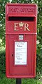
 Close up, Elizabeth II postbox on Front Street, Esh - geograph.org.uk - 4985262.jpg 1,300 × 2,452; 702 KB
-
 Close up, Elizabeth II postbox on Front Street, Quebec - geograph.org.uk - 4985196.jpg 1,406 × 2,783; 791 KB
-
 Close up, Elizabeth II postbox, Wilk's Hill - geograph.org.uk - 4985174.jpg 1,325 × 2,593; 699 KB
-
 Converted byre at Clifford's House Farm - geograph.org.uk - 5356266.jpg 4,608 × 3,456; 5.81 MB
-
 Cottage at Heugh near Esh Winning - geograph.org.uk - 2265792.jpg 640 × 480; 52 KB
-
 Crop field and hedgerow - geograph.org.uk - 4986653.jpg 640 × 480; 73 KB
-
 Crop field beside woodland, Hill Top - geograph.org.uk - 4986525.jpg 640 × 480; 102 KB
-
 Crop field, Hill Top - geograph.org.uk - 4986526.jpg 640 × 480; 82 KB
-
 Crop in field E. of Quebec - geograph.org.uk - 1847487.jpg 639 × 359; 290 KB
-
 Decorative Seat - geograph.org.uk - 5819006.jpg 1,024 × 689; 366 KB
-
 Diggerland Adventure Park - geograph.org.uk - 5819019.jpg 1,024 × 643; 174 KB
-
-
 East end of Front Street, Quebec - geograph.org.uk - 5356278.jpg 4,608 × 3,456; 6.37 MB
-

-

-
 Elizabeth II postbox, Wilk's Hill - geograph.org.uk - 4985171.jpg 640 × 480; 65 KB
-
 Entering Quebec - geograph.org.uk - 4986478.jpg 640 × 480; 90 KB
-
 Entering Wilk's Hill - geograph.org.uk - 4986257.jpg 640 × 480; 65 KB
-
 Entrance to Diggerland at Langley Park - geograph.org.uk - 3458684.jpg 3,648 × 2,736; 1.84 MB
-
 Escarpment at Greenland Bank - geograph.org.uk - 5356340.jpg 4,608 × 3,456; 5.64 MB
-
 Esh Cross - geograph.org.uk - 76503.jpg 640 × 427; 141 KB
-
 Esh Bank - geograph.org.uk - 4986505.jpg 640 × 480; 81 KB
-
 Esh Cross and Village Green - geograph.org.uk - 1847475.jpg 639 × 359; 340 KB
-
 Esh Glebe House - geograph.org.uk - 3398114.jpg 4,608 × 3,456; 4.99 MB
-
 Esh Laude - geograph.org.uk - 3399775.jpg 4,608 × 3,456; 5.05 MB
-
 Esh village - geograph.org.uk - 277993.jpg 640 × 480; 53 KB
-
 Farm buildings at Low Esh Farm - geograph.org.uk - 3397024.jpg 4,608 × 3,456; 4.82 MB
-
 Farm buildings, Low Esh Farm - geograph.org.uk - 4986518.jpg 640 × 480; 65 KB
-
 Farm lane on north side of Esh Winning - geograph.org.uk - 3812600.jpg 1,500 × 941; 1.33 MB
-
 Farm track (footpath), Low Esh Farm - geograph.org.uk - 4986520.jpg 640 × 480; 72 KB
-
 Farmhouse at Ushaw Farm - geograph.org.uk - 2311593.jpg 640 × 480; 37 KB
-
 Farmland and pylons, Greenland - geograph.org.uk - 4986497.jpg 640 × 480; 46 KB
-
 Farmland view - geograph.org.uk - 2800547.jpg 3,264 × 2,448; 1.24 MB
-
 Farmland, Wilk's Hill - geograph.org.uk - 4986253.jpg 640 × 480; 61 KB
-
 Fence in fields west of Esh Winning - geograph.org.uk - 5019638.jpg 4,608 × 3,456; 4.97 MB
-
 Field beside the old railway line - geograph.org.uk - 5819029.jpg 1,600 × 1,002; 444 KB
-
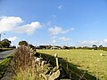
 Field edge with Farhill Plantation - geograph.org.uk - 4731152.jpg 1,500 × 1,000; 1.65 MB
-
 Field entrance Hedleyhill Lane - geograph.org.uk - 4986239.jpg 640 × 480; 95 KB
-

-
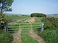
 Field gate beside the B6302 - geograph.org.uk - 5027781.jpg 4,392 × 3,148; 4.27 MB
-
 Fields north of Quebec - geograph.org.uk - 3140377.jpg 4,608 × 3,456; 5.64 MB
-
 Fishing Pond - geograph.org.uk - 951376.jpg 640 × 480; 115 KB
-
 Football pitch, Quebec - geograph.org.uk - 4986494.jpg 640 × 480; 73 KB
-
 Footpath over Hamsteels Beck to Hamsteels Road - geograph.org.uk - 3458749.jpg 3,648 × 2,736; 2.49 MB
-
 Footpath southwest from Biggen Gardens - geograph.org.uk - 3458723.jpg 3,648 × 2,736; 1.98 MB
-
 Footpath to Esh - geograph.org.uk - 5819057.jpg 1,024 × 653; 195 KB
-
 Footpath to Heugh and beyond - geograph.org.uk - 2265808.jpg 640 × 480; 62 KB
-
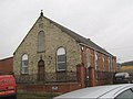
 Former miners Institute, Quebec - geograph.org.uk - 5355328.jpg 4,608 × 3,456; 5.35 MB
-

-
 Former vicarage, Quebec - geograph.org.uk - 5356541.jpg 4,608 × 3,456; 5.96 MB
-
 Front Street - geograph.org.uk - 4986522.jpg 640 × 480; 64 KB
-
 Front Street - geograph.org.uk - 5819070.jpg 1,024 × 662; 223 KB
-
 Front Street, Esh - geograph.org.uk - 4985265.jpg 640 × 480; 71 KB
-
 Front Street, Quebec - geograph.org.uk - 4985202.jpg 640 × 480; 70 KB
-
 Front Street, Wilk's Hill - geograph.org.uk - 4986474.jpg 640 × 480; 63 KB
-
 Graveyard near to Quebec - geograph.org.uk - 3812498.jpg 1,500 × 1,000; 1.87 MB
-
 Grazing and stone wall, Esh Bank - geograph.org.uk - 4986502.jpg 640 × 480; 92 KB
-
 Grazing sheep beside Greenland Road - geograph.org.uk - 5356312.jpg 4,608 × 3,456; 6.59 MB
-
 Grazing, Esh Bank - geograph.org.uk - 4986503.jpg 640 × 480; 71 KB
-
 Greenland Bank - geograph.org.uk - 4887090.jpg 640 × 480; 73 KB
-
 Greenland Farm - geograph.org.uk - 1840885.jpg 640 × 388; 367 KB
-
 Greenland farm - geograph.org.uk - 4760505.jpg 4,608 × 3,456; 5.55 MB
-
 Greenland Road - geograph.org.uk - 4986496.jpg 640 × 480; 46 KB
-
 Greenland Road - geograph.org.uk - 4986498.jpg 640 × 480; 68 KB
-
 Groove Bank - geograph.org.uk - 4986517.jpg 640 × 480; 71 KB
-
 Hall Road, Esh - geograph.org.uk - 4986510.jpg 640 × 480; 79 KB
-
 Hamsteels Inn Quebec - geograph.org.uk - 2268663.jpg 640 × 480; 50 KB
-
 Heading east from Esh - geograph.org.uk - 4986515.jpg 640 × 480; 54 KB
-
 Heading south from Hill Top - geograph.org.uk - 4986634.jpg 640 × 480; 60 KB
-
 Hedleyhill Lane (B6301) - geograph.org.uk - 4986250.jpg 640 × 480; 52 KB
-
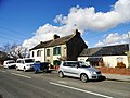
 Houses on Front Street, Quebec - geograph.org.uk - 4986488.jpg 640 × 434; 49 KB
-
 Houses on Front Street, Quebec - geograph.org.uk - 4986493.jpg 640 × 480; 80 KB
-
 Houses on Hall Road, Esh - geograph.org.uk - 4986508.jpg 640 × 480; 72 KB
-
 Houses, Esh - geograph.org.uk - 4986506.jpg 640 × 385; 64 KB
-
 Houses, Wilk's Hill - geograph.org.uk - 4986259.jpg 640 × 480; 66 KB
-

-

-
 Lanchester Valley - geograph.org.uk - 3372777.jpg 640 × 480; 98 KB
-
 Lanchester Valley Railway Path - geograph.org.uk - 3372766.jpg 640 × 480; 73 KB
-
 Lanchester Valley Walk - geograph.org.uk - 3458696.jpg 3,648 × 2,736; 2.93 MB
-
 Langley Park - geograph.org.uk - 1949550.jpg 1,500 × 843; 1.35 MB
-
 Langley Park - geograph.org.uk - 5819077.jpg 1,600 × 1,079; 502 KB
-
 Looking across the fields - geograph.org.uk - 5357582.jpg 4,089 × 3,200; 6.88 MB
-
 Looking across to Millgate Cottages - geograph.org.uk - 3396981.jpg 4,608 × 3,456; 4.83 MB
-
 Looking across to Usher College - geograph.org.uk - 3396557.jpg 4,608 × 3,456; 4.54 MB
-
 Looking along the lane towards Quebec - geograph.org.uk - 5353316.jpg 4,372 × 3,114; 4.83 MB
-
 Looking along the road to Esh - geograph.org.uk - 3397063.jpg 4,608 × 3,456; 5.28 MB
-
 Looking along to Park Wood - geograph.org.uk - 3396560.jpg 4,608 × 3,456; 4.63 MB
-
 Looking down Groove Bank - geograph.org.uk - 4986521.jpg 640 × 480; 79 KB
-
 Looking east along Greenland Road - geograph.org.uk - 5356296.jpg 4,608 × 3,456; 6.06 MB
-
 Looking north from Groove Bank - geograph.org.uk - 3397054.jpg 4,608 × 3,456; 5.2 MB
-
 Looking North from the railway path - geograph.org.uk - 2800544.jpg 3,264 × 2,448; 1.45 MB
-
 Looking north up Broadgate Road - geograph.org.uk - 3595687.jpg 3,648 × 2,736; 3.14 MB
-
 Looking west from the track south of Blackburn - geograph.org.uk - 4760123.jpg 4,608 × 3,456; 5.46 MB
-
 Low Esh Farm - geograph.org.uk - 3397014.jpg 4,608 × 3,456; 5.14 MB
-
 Marley Houses, Quebec - geograph.org.uk - 5353411.jpg 4,608 × 3,456; 5.04 MB
-
 Millgate Cottages - geograph.org.uk - 3396619.jpg 4,608 × 3,456; 4.7 MB
-
 Millgate Cottages - geograph.org.uk - 4986637.jpg 640 × 480; 58 KB
-
 North side of Front Street, Quebec - geograph.org.uk - 5356236.jpg 4,608 × 3,456; 5.08 MB
-
 Notice board of the former Parish Church , Hamsteels - geograph.org.uk - 3670881.jpg 1,824 × 1,368; 783 KB
-
 Old outbuildings at Heugh farm - geograph.org.uk - 5019115.jpg 4,604 × 3,450; 3.82 MB
-
 Park Wood - geograph.org.uk - 3229586.jpg 1,500 × 1,125; 1.5 MB
-
 Path north from Park Wood - geograph.org.uk - 3603348.jpg 3,648 × 2,736; 3.21 MB
-
 Path to Esh - geograph.org.uk - 5819063.jpg 1,024 × 656; 211 KB
-
 Path to Stobbilee Farm - geograph.org.uk - 4689888.jpg 4,608 × 3,456; 5.84 MB
-
 Plantations amid farmland near to Esh - geograph.org.uk - 4762066.jpg 1,500 × 760; 936 KB
-
 Poppies at the edge of a field - geograph.org.uk - 5018678.jpg 3,505 × 2,447; 2.98 MB
-
 Poppies in the field - geograph.org.uk - 5819053.jpg 1,600 × 1,030; 568 KB
-
 Power line south of Greenland Road - geograph.org.uk - 5356357.jpg 4,608 × 3,456; 5.25 MB
-
 Prospect of Langley Park - geograph.org.uk - 3372799.jpg 640 × 480; 82 KB
-
 Puddles along the Lanchester Valley Walk - geograph.org.uk - 3810682.jpg 1,000 × 1,500; 1.56 MB
-
 Pylon Line Across Fields - geograph.org.uk - 1840858.jpg 640 × 429; 335 KB
-
 Quarry House Farm - geograph.org.uk - 4664533.jpg 4,608 × 3,456; 5.77 MB
-
 Quarry House Farm, Wilk's Hill - geograph.org.uk - 3670799.jpg 1,147 × 883; 320 KB
-
 Quarry House Farm, Wilk's Hill - geograph.org.uk - 4986475.jpg 640 × 480; 64 KB
-
 Quebec hamlet - geograph.org.uk - 3670855.jpg 1,747 × 1,149; 798 KB
-
 Quebec Village from the south - geograph.org.uk - 3140358.jpg 4,608 × 3,456; 5.21 MB
-
 Quebec village street - geograph.org.uk - 3140367.jpg 4,608 × 3,456; 4.68 MB
-
 Quebec Welfare Park football field - geograph.org.uk - 3458899.jpg 3,510 × 2,544; 1.9 MB
-
 Rear of buildings at Ushaw College - geograph.org.uk - 4762470.jpg 1,500 × 1,000; 2 MB
-
 Road east of Wilk's Hill - geograph.org.uk - 4664530.jpg 4,608 × 3,456; 5.61 MB
-
 Road junction at Esh - geograph.org.uk - 3398127.jpg 4,608 × 3,456; 5.08 MB
-
 Road junction at Quebec - geograph.org.uk - 5356281.jpg 4,608 × 3,456; 5.48 MB
-
 Road junction on Low Moor Road - geograph.org.uk - 4986500.jpg 640 × 480; 73 KB
-
 Road junction on the B6302 - geograph.org.uk - 5028470.jpg 4,608 × 3,456; 4.99 MB
-
 Roadways at 'Diggerland' - geograph.org.uk - 3810717.jpg 1,500 × 1,000; 1.25 MB
-
 Roadworks on Front Street, Esh - geograph.org.uk - 4986514.jpg 640 × 480; 69 KB
-
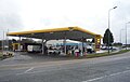 Service station on the A691 - geograph.org.uk - 4896114.jpg 640 × 408; 49 KB
-
 Sheep in a roadside field - geograph.org.uk - 5353327.jpg 4,608 × 3,456; 5.47 MB
-
 Sign for the Cross Keys public house, Esh - geograph.org.uk - 4986513.jpg 1,501 × 3,018; 693 KB
-
 St John the Baptist Church, Quebec - geograph.org.uk - 5353450.jpg 4,608 × 3,456; 6.94 MB
-
 St Michael's R C Church, Esh - geograph.org.uk - 3399803.jpg 4,608 × 3,456; 4.85 MB
-
 Stile on field path - geograph.org.uk - 5017558.jpg 4,608 × 3,456; 5.75 MB
-
 The B6301 nearing crossroads on Clickemin Hill - geograph.org.uk - 3668969.jpg 2,432 × 1,824; 1.38 MB
-
 The Blackburn Beck - geograph.org.uk - 5819046.jpg 1,024 × 672; 345 KB
-
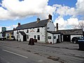
 The Board Inn - geograph.org.uk - 952862.jpg 640 × 480; 64 KB
-
 The Cross Keys at Esh - geograph.org.uk - 2266840.jpg 640 × 480; 46 KB
-
 The Cross Keys pub in Esh village - geograph.org.uk - 3398104.jpg 4,608 × 3,456; 4.28 MB
-
 The Cross Keys public house, Esh - geograph.org.uk - 4986512.jpg 640 × 480; 54 KB
-
 The farmhouse at Heugh farm - geograph.org.uk - 5019154.jpg 4,608 × 3,456; 4.94 MB
-

-
 The Hamsteels Inn, Quebec - geograph.org.uk - 4986486.jpg 640 × 480; 54 KB
-
 The Hamsteels Inn, Quebec - geograph.org.uk - 5356245.jpg 4,608 × 3,456; 4.8 MB
-
 The lane to Quebec looking east - geograph.org.uk - 5353356.jpg 4,510 × 3,320; 6.23 MB
-
 The school house, Quebec - geograph.org.uk - 5356544.jpg 4,512 × 3,324; 5.65 MB
-
 Top of the bank - geograph.org.uk - 3396582.jpg 4,608 × 3,456; 4.37 MB
-
 Track running west from Heugh farm - geograph.org.uk - 5019170.jpg 4,608 × 3,456; 5.05 MB
-
 Track towards Hag House farm - geograph.org.uk - 952336.jpg 640 × 480; 86 KB
-
 Trees along Hedleyhope Burn, Esh Winning - geograph.org.uk - 5017411.jpg 4,608 × 3,456; 5.2 MB
-
 Ushaw Farm - geograph.org.uk - 4986644.jpg 640 × 480; 78 KB
-
 View across the fields to Wilk's Hill - geograph.org.uk - 5355220.jpg 4,608 × 3,456; 5.64 MB
-
 View along Low Moor Road - geograph.org.uk - 4760188.jpg 4,608 × 3,456; 5.82 MB
-
 View along the road leading to Biggin Farm - geograph.org.uk - 3399867.jpg 4,608 × 3,456; 5.01 MB
-
 View down the Browney valley - geograph.org.uk - 4761035.jpg 4,608 × 3,456; 4.75 MB
-
 View east from Esh Bank - geograph.org.uk - 3399889.jpg 4,608 × 3,456; 5 MB
-
 View north from Greenland Road - geograph.org.uk - 4760525.jpg 4,608 × 3,456; 5.26 MB
-
 View NW from Low Moor Road - geograph.org.uk - 4760202.jpg 4,608 × 3,456; 6.35 MB
-
 View of Esh village from Low Moor Road - geograph.org.uk - 4760131.jpg 4,608 × 3,456; 5.3 MB
-
 View of Quarry Farm at Wilks Hill - geograph.org.uk - 5353333.jpg 4,608 × 3,456; 6.34 MB
-
 View of the village of Esh from the east - geograph.org.uk - 3397032.jpg 4,608 × 3,456; 5.17 MB
-
 View over the Valley - geograph.org.uk - 2799611.jpg 3,264 × 2,448; 1.54 MB
-
 View south along the edge of Heugh Wood - geograph.org.uk - 5019013.jpg 4,608 × 3,456; 5.81 MB
-
 View south down the path to Newhouse Road, Esh Winning - geograph.org.uk - 5018698.jpg 4,608 × 3,456; 4.7 MB
-
 View south from the A691 near Kaysburn - geograph.org.uk - 4689904.jpg 4,608 × 3,456; 5.48 MB
-
 View south from the old railway walk - geograph.org.uk - 4689975.jpg 4,608 × 3,456; 5.13 MB
-
 View to the north near Quebec - geograph.org.uk - 3140395.jpg 4,608 × 3,456; 5.28 MB
-
 View up the Browney Valley - geograph.org.uk - 4760231.jpg 4,608 × 3,456; 5.6 MB
-
 View west along the field path - geograph.org.uk - 3396978.jpg 4,608 × 3,456; 5.09 MB
-
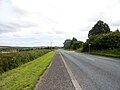
 View west down the B6302 - geograph.org.uk - 5028479.jpg 4,608 × 3,456; 5.59 MB
-
 View west from Esh Laude - geograph.org.uk - 3398155.jpg 4,608 × 3,456; 5.58 MB
-
 View west from Greenland Road - geograph.org.uk - 4760493.jpg 4,608 × 3,456; 5.9 MB
-
 Village church at Quebec - geograph.org.uk - 5355244.jpg 3,972 × 2,992; 6.77 MB
-
 Village Green at Esh - geograph.org.uk - 2266833.jpg 640 × 480; 63 KB
-
 Village Hall, Quebec - geograph.org.uk - 4986485.jpg 640 × 480; 75 KB
-
 Village Hall, Quebec, County Durham - geograph.org.uk - 4440232.jpg 640 × 480; 57 KB
-
 Village of Quebec - geograph.org.uk - 1840911.jpg 640 × 480; 493 KB
-
 West Hamsteels Farm - geograph.org.uk - 5358834.jpg 4,504 × 3,312; 5.63 MB
-
 Wilk's Hill - geograph.org.uk - 4664544.jpg 4,608 × 3,456; 5.01 MB


,_Low_Esh_Farm_-_geograph.org.uk_-_4986520.jpg)


_-_geograph.org.uk_-_4986250.jpg)


