Category:Escrick
Jump to navigation
Jump to search
village in United Kingdom  | |||||
| Upload media | |||||
| Instance of | |||||
|---|---|---|---|---|---|
| Location | Selby, North Yorkshire, Yorkshire and the Humber, England | ||||
| Population |
| ||||
| Said to be the same as | Escrick (Wikimedia duplicated page, civil parish) | ||||
 | |||||
English: Escrick is a village and civil parish in the Selby district of North Yorkshire, England. It is situated north of Selby on the main A19 road.
Subcategories
This category has the following 10 subcategories, out of 10 total.
B
- The Black Bull, Escrick (4 F)
E
- Escrick railway station (2 F)
G
- Garden Temple, Escrick (3 F)
H
- Hollicars wood, Escrick (2 F)
M
- Moreby Wood, Escrick (3 F)
- Mount Bridge, Escrick (5 F)
P
- Escrick Park (10 F)
S
- St Helen's, Escrick (11 F)
W
- Wheldrake Lane (38 F)
Media in category "Escrick"
The following 200 files are in this category, out of 250 total.
(previous page) (next page)-
 "Cycle the Solar System" - geograph.org.uk - 2434435.jpg 640 × 480; 114 KB
-
 7 km mark - geograph.org.uk - 4137744.jpg 640 × 427; 119 KB
-
 A green corridor - geograph.org.uk - 2434221.jpg 640 × 480; 118 KB
-
 A green corridor - geograph.org.uk - 2434228.jpg 480 × 640; 133 KB
-
 A green corridor - geograph.org.uk - 2434452.jpg 640 × 480; 127 KB
-

-
 A19 lay-by - geograph.org.uk - 4751050.jpg 640 × 480; 39 KB
-
 A19 lay-by - geograph.org.uk - 4751052.jpg 640 × 480; 68 KB
-
 A19 near Escrick - geograph.org.uk - 3810459.jpg 640 × 427; 98 KB
-
 A19 towards Selby - geograph.org.uk - 2561150.jpg 1,600 × 1,200; 527 KB
-
 A19 towards Selby - geograph.org.uk - 2561164.jpg 1,600 × 1,200; 345 KB
-
 Abandoned track - geograph.org.uk - 5641019.jpg 1,024 × 768; 243 KB
-
 Across to Gray Reins - geograph.org.uk - 6136928.jpg 1,024 × 683; 525 KB
-
 Aim for the gap in the trees - geograph.org.uk - 5314086.jpg 1,024 × 768; 172 KB
-
 Air cooled heaven, Escrick Park - geograph.org.uk - 5123350.jpg 3,884 × 1,858; 1.7 MB
-
 Along Wheldrake Lane - geograph.org.uk - 3810670.jpg 640 × 427; 53 KB
-
 Alongside Nursery Plantation - geograph.org.uk - 5314760.jpg 1,024 × 768; 172 KB
-
 Approaching the A19 - geograph.org.uk - 3810451.jpg 640 × 427; 89 KB
-
 Autumn colours - geograph.org.uk - 3717954.jpg 427 × 640; 144 KB
-
 Autumnal cherry trees - geograph.org.uk - 4715737.jpg 427 × 640; 120 KB
-
 Autumnal trees - geograph.org.uk - 3717980.jpg 640 × 427; 133 KB
-
 Avenue of trees - geograph.org.uk - 3077889.jpg 480 × 640; 170 KB
-
 Baled up beside Mount Farm - geograph.org.uk - 5072945.jpg 3,030 × 1,650; 3.77 MB
-
 Barley near Stillingfleet - geograph.org.uk - 3568969.jpg 640 × 427; 75 KB
-
 Bend in the road - geograph.org.uk - 3810442.jpg 640 × 427; 83 KB
-
 Biomass Plantation and Pallion Dike - geograph.org.uk - 5314043.jpg 1,024 × 768; 202 KB
-
 Bridge Dike - geograph.org.uk - 2755661.jpg 640 × 480; 91 KB
-
 Bridge over a drain - geograph.org.uk - 4137737.jpg 427 × 640; 149 KB
-
 Bridge over Halfpenny Dike - geograph.org.uk - 3810465.jpg 640 × 427; 118 KB
-
 Bridge over Pallion Dike - geograph.org.uk - 5319265.jpg 1,024 × 768; 244 KB
-
 Bridge to Mount Farm ahead - geograph.org.uk - 4271974.jpg 1,024 × 768; 300 KB
-
 Bridleway alongside Gray Reins - geograph.org.uk - 5315206.jpg 1,024 × 768; 236 KB
-
 Bridleway alongside Gray Reins - geograph.org.uk - 5315208.jpg 1,024 × 768; 171 KB
-
 Bridleway near Tileshed Farm - geograph.org.uk - 6136905.jpg 1,024 × 683; 549 KB
-
 Bridleway to Southmoor Road - geograph.org.uk - 6136906.jpg 1,024 × 683; 403 KB
-
 Bridleway towards Common Farm - geograph.org.uk - 2561453.jpg 1,600 × 1,200; 347 KB
-
 Carr Lane - geograph.org.uk - 3810461.jpg 640 × 427; 117 KB
-
 Carrs Meadow - geograph.org.uk - 2026558.jpg 640 × 480; 231 KB
-
 Carrs Meadow - geograph.org.uk - 4136549.jpg 640 × 427; 100 KB
-
 Carrs Meadow - geograph.org.uk - 4626778.jpg 640 × 427; 89 KB
-
 Catleys Lodge - geograph.org.uk - 5170588.jpg 640 × 427; 146 KB
-
 Cedar near Escrick - geograph.org.uk - 4847215.jpg 547 × 640; 253 KB
-
 Clearing in Hollicarrs Wood - geograph.org.uk - 4627115.jpg 640 × 427; 138 KB
-
 Common Wood - geograph.org.uk - 313456.jpg 640 × 480; 68 KB
-
 Cottage, Mill Hill - geograph.org.uk - 2561448.jpg 1,600 × 1,200; 449 KB
-
 Cycle path and earthworks - geograph.org.uk - 6783644.jpg 1,024 × 683; 529 KB
-
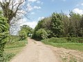
 Cycle path to York - geograph.org.uk - 3810438.jpg 640 × 427; 61 KB
-
 Deepening Shadows - geograph.org.uk - 201076.jpg 640 × 480; 100 KB
-
 Dike and Footpath to Spring Wood - geograph.org.uk - 2379065.jpg 3,264 × 2,448; 2.04 MB
-
 Drain at Escrick - geograph.org.uk - 2741788.jpg 1,500 × 1,125; 1.88 MB
-

-
 Drainage Dyke - geograph.org.uk - 313462.jpg 480 × 640; 111 KB
-
 Drive to Menagerie Farm - geograph.org.uk - 4938648.jpg 640 × 427; 81 KB
-
 Earthworks beside the path - geograph.org.uk - 6783620.jpg 1,024 × 683; 589 KB
-
 Edge of Hollicarrs Wood - geograph.org.uk - 3244359.jpg 640 × 480; 115 KB
-
 Edge of Hollicarrs Wood - geograph.org.uk - 3244388.jpg 640 × 480; 150 KB
-
 Entrance into Escrick Park estate. - geograph.org.uk - 956980.jpg 640 × 407; 56 KB
-

-
 Escrick Estate from Sheep Walk - geograph.org.uk - 2027480.jpg 640 × 480; 244 KB
-
 Escrick Park - geograph.org.uk - 3245087.jpg 640 × 480; 99 KB
-
 Escrick Park estate - geograph.org.uk - 1460335.jpg 640 × 480; 110 KB
-
 Escrick Park Rideway - geograph.org.uk - 5315203.jpg 1,024 × 768; 171 KB
-
 Escrick YO19, UK - panoramio - tom.h.jpg 2,048 × 1,536; 459 KB
-
 Escrick YO19, UK - panoramio.jpg 2,048 × 1,536; 316 KB
-
 Falling leaves - geograph.org.uk - 3717984.jpg 427 × 640; 148 KB
-
 Farm buildings and yard at Swan Farm - geograph.org.uk - 295055.jpg 640 × 480; 67 KB
-
 Farm track - geograph.org.uk - 2561131.jpg 1,600 × 1,200; 514 KB
-
 Farmland east of the A19 - geograph.org.uk - 2561144.jpg 1,600 × 1,200; 424 KB
-
 Farmland from the railway bridge - geograph.org.uk - 6495056.jpg 1,024 × 683; 505 KB
-
 Farmland in Escrick Park estate - geograph.org.uk - 4627123.jpg 640 × 427; 113 KB
-
 Farmland near Bell Farm - geograph.org.uk - 2561194.jpg 1,600 × 1,200; 662 KB
-
 Farmland near Chequer Hall - geograph.org.uk - 2561457.jpg 1,600 × 1,200; 428 KB
-
 Farmland near Escrick - geograph.org.uk - 2561136.jpg 1,600 × 1,200; 471 KB
-
 Farmland near Manor Farm - geograph.org.uk - 2561452.jpg 640 × 480; 87 KB
-
 Farmland near Manor Farm - geograph.org.uk - 6136909.jpg 1,024 × 683; 556 KB
-
 Farmland near Stillingfleet Hill Farm - geograph.org.uk - 2561112.jpg 1,600 × 1,200; 638 KB
-
 Farmland near the A19 - geograph.org.uk - 3810444.jpg 640 × 427; 58 KB
-
 Farmland near Winchat Hall - geograph.org.uk - 2561439.jpg 1,600 × 1,200; 377 KB
-
 Farmland off Mill Hill - geograph.org.uk - 2561446.jpg 1,600 × 1,200; 558 KB
-
 Farmland off the A19 - geograph.org.uk - 2561158.jpg 1,600 × 1,200; 348 KB
-
 Farmland off Wheldrake Lane - geograph.org.uk - 3810675.jpg 640 × 427; 62 KB
-
 Farmland south of Wheldrake Lane - geograph.org.uk - 6454141.jpg 1,024 × 683; 548 KB
-
 Farmland towards Gamble's Rush - geograph.org.uk - 2561184.jpg 1,600 × 1,200; 636 KB
-
 Farmland towards Moreby Far Wood - geograph.org.uk - 2561124.jpg 1,600 × 1,200; 605 KB
-
 Farmland, Escrick Park - geograph.org.uk - 2561443.jpg 1,600 × 1,200; 431 KB
-
 Felled trees beside the path - geograph.org.uk - 6783640.jpg 1,024 × 683; 624 KB
-
 Fence near Escrick Station - geograph.org.uk - 6409998.jpg 1,024 × 768; 606 KB
-
 Field boundary - geograph.org.uk - 6136929.jpg 1,024 × 683; 585 KB
-
 Field Boundary off Wheldrake Lane - geograph.org.uk - 5956572.jpg 1,024 × 683; 472 KB
-
 Field edge and drain - geograph.org.uk - 5314115.jpg 1,024 × 768; 260 KB
-
 Field of lawn turf - geograph.org.uk - 4938642.jpg 640 × 427; 67 KB
-
 Field west of A19 - geograph.org.uk - 2741760.jpg 1,500 × 843; 1.25 MB
-
 Fields from the woods - geograph.org.uk - 4137749.jpg 640 × 427; 93 KB
-
 Fields of lawn turf - geograph.org.uk - 4938646.jpg 640 × 427; 73 KB
-
 Flag at Tileshed Farm Cottage - geograph.org.uk - 6454123.jpg 1,024 × 683; 510 KB
-
 Footpath between Escrick and Spring Wood - geograph.org.uk - 2379080.jpg 3,264 × 2,448; 2.24 MB
-
 Footpath Southeast of Spring Wood - geograph.org.uk - 2379120.jpg 3,264 × 2,448; 1.82 MB
-
 Garden on the site of Escrick Station - geograph.org.uk - 3077847.jpg 480 × 640; 166 KB
-
 Gardens at Escrick Station - geograph.org.uk - 3568971.jpg 640 × 427; 152 KB
-
 Gashouse Plantation - geograph.org.uk - 4137751.jpg 427 × 640; 168 KB
-
 Ghostly gatepiers - geograph.org.uk - 4297609.jpg 1,024 × 768; 164 KB
-
 Gray Reins plantation - geograph.org.uk - 6136923.jpg 1,024 × 683; 774 KB
-
 Halfpenny Dike at the edge of North Selby Mine - geograph.org.uk - 2379174.jpg 3,264 × 2,448; 2.04 MB
-
 Heading towards the A19 - geograph.org.uk - 2148063.jpg 800 × 600; 279 KB
-
 Hedgerow and track - geograph.org.uk - 6454139.jpg 1,024 × 683; 601 KB
-
 Hollicarrs Wood - geograph.org.uk - 2028675.jpg 480 × 640; 316 KB
-
 Hollicarrs Wood - geograph.org.uk - 3244385.jpg 640 × 480; 166 KB
-
 Hollicarrs Wood - geograph.org.uk - 4627113.jpg 427 × 640; 160 KB
-
 Horse jump along Temple Walk - geograph.org.uk - 4626792.jpg 640 × 427; 106 KB
-
 Horse jump in Hollicarrs Wood - geograph.org.uk - 2028613.jpg 640 × 480; 287 KB
-
 Horse jumps - geograph.org.uk - 3244364.jpg 640 × 480; 153 KB
-
 Horse jumps - geograph.org.uk - 3245085.jpg 640 × 480; 159 KB
-
 Horse jumps - geograph.org.uk - 4137731.jpg 640 × 427; 163 KB
-
 House on Wheldrake Lane - geograph.org.uk - 3810472.jpg 640 × 427; 80 KB
-
 Jumps near the temple - geograph.org.uk - 4626806.jpg 640 × 427; 86 KB
-
 Lawn in front of Escrick Village Hall - geograph.org.uk - 2741778.jpg 1,500 × 1,125; 1.2 MB
-
 Let there be light ^ - geograph.org.uk - 643451.jpg 640 × 480; 274 KB
-
 Log beside a harvested field - geograph.org.uk - 5076788.jpg 800 × 600; 148 KB
-

-
 Looking along Wheldrake Lane - geograph.org.uk - 3810672.jpg 640 × 427; 54 KB
-
 Looking towards Common Wood - geograph.org.uk - 3244363.jpg 640 × 480; 89 KB
-
 Memorial to Wayne - geograph.org.uk - 4314445.jpg 1,600 × 1,062; 975 KB
-
 Memorial to Wayne - geograph.org.uk - 4314446.jpg 1,265 × 931; 575 KB
-
 Menagerie Farm - geograph.org.uk - 1460329.jpg 640 × 480; 122 KB
-
 Menagerie Farm Cottages - geograph.org.uk - 313448.jpg 640 × 480; 112 KB
-

-
 Mile stone at concentric garden - geograph.org.uk - 643552.jpg 640 × 480; 282 KB
-
 Mileage marker on the Trans Pennine Trail - geograph.org.uk - 4314454.jpg 1,600 × 1,062; 787 KB
-
 Minor road towards Escrick - geograph.org.uk - 2561447.jpg 1,600 × 1,200; 634 KB
-
 Minor road towards Escrick - geograph.org.uk - 2561449.jpg 1,600 × 1,200; 620 KB
-
 Minor road towards the A19 - geograph.org.uk - 2561117.jpg 1,600 × 1,200; 537 KB
-
 Minor road towards the A19 - geograph.org.uk - 2561140.jpg 1,600 × 1,200; 578 KB
-
 Minor road towards Wheldrake - geograph.org.uk - 2561462.jpg 1,600 × 1,200; 523 KB
-
 Mount Bridge - geograph.org.uk - 5950368.jpg 1,600 × 1,200; 1.03 MB
-
 Mount Farm - geograph.org.uk - 2755679.jpg 640 × 480; 93 KB
-
 Mount Farm - geograph.org.uk - 643439.jpg 640 × 480; 193 KB
-
 Mount Farm from the Cycleway - geograph.org.uk - 1460575.jpg 640 × 480; 84 KB
-
 Mount Pleasant Farm - geograph.org.uk - 5314766.jpg 1,024 × 768; 182 KB
-
 Mount Pleasant Farm near Escrick - geograph.org.uk - 440053.jpg 640 × 480; 87 KB
-
 Neptune - geograph.org.uk - 2941878.jpg 640 × 480; 169 KB
-
 Nursery Plantation - geograph.org.uk - 5314759.jpg 1,024 × 768; 367 KB
-
 Off the track - geograph.org.uk - 5072938.jpg 3,072 × 1,728; 4.31 MB
-

-
 Onwards ^ - geograph.org.uk - 643463.jpg 640 × 480; 190 KB
-
 Palms Lit - panoramio.jpg 2,816 × 1,638; 1.31 MB
-
 Parkhill Dike at Storkney Hill - geograph.org.uk - 4314444.jpg 1,600 × 1,062; 954 KB
-

-
 Partly prepared field - geograph.org.uk - 5319274.jpg 1,024 × 768; 141 KB
-
 Path in Hollicarrs Wood - geograph.org.uk - 3245043.jpg 480 × 640; 169 KB
-
 Path in Hollicarrs Wood - geograph.org.uk - 4626829.jpg 640 × 427; 135 KB
-
 Path near Escrick Station - geograph.org.uk - 6783646.jpg 683 × 1,024; 485 KB
-
 Path to York - geograph.org.uk - 3717985.jpg 427 × 640; 153 KB
-
 Path towards Selby - geograph.org.uk - 6783626.jpg 1,024 × 683; 637 KB
-
 Permissive bridleway to Glade farm - geograph.org.uk - 2755705.jpg 640 × 480; 109 KB
-

-
 Planet Neptune - geograph.org.uk - 643570.jpg 640 × 480; 286 KB
-
 Planet Neptune milepost - geograph.org.uk - 643577.jpg 640 × 480; 216 KB
-
 Potter's Lane - geograph.org.uk - 5314764.jpg 1,024 × 768; 141 KB
-
 Potter's Lane - geograph.org.uk - 5314767.jpg 1,024 × 768; 266 KB
-
-
 Prepared field off Wheldrake Lane - geograph.org.uk - 6022211.jpg 1,024 × 768; 179 KB
-
 Racers gather - geograph.org.uk - 4136546.jpg 640 × 427; 117 KB
-
 Ring of light - geograph.org.uk - 643564.jpg 640 × 480; 287 KB
-
 Road to Escrick - geograph.org.uk - 4938651.jpg 427 × 640; 88 KB
-

-
 Sewage Works - geograph.org.uk - 272170.jpg 640 × 480; 56 KB
-
 Sheep Walk - geograph.org.uk - 2028602.jpg 640 × 480; 259 KB
-
 Sheep Walk - geograph.org.uk - 5170587.jpg 640 × 427; 134 KB
-
 Sheepwalk Plantation - geograph.org.uk - 2026609.jpg 640 × 480; 253 KB
-
 Sign regarding access - geograph.org.uk - 6136930.jpg 1,024 × 683; 432 KB
-
 Skipwith Road - geograph.org.uk - 271759.jpg 640 × 477; 55 KB
-
 South of Mount Bridge - geograph.org.uk - 4918017.jpg 480 × 640; 123 KB
-
 Southmoor Road - geograph.org.uk - 6136931.jpg 1,024 × 618; 545 KB
-
 Spring House Farm - geograph.org.uk - 295061.jpg 640 × 480; 133 KB
-
 Spring House Farm over the fields - geograph.org.uk - 2379094.jpg 3,264 × 2,448; 1.7 MB
-
 Start line - geograph.org.uk - 4136514.jpg 640 × 427; 107 KB
-
 Start of the Escrick 10k - geograph.org.uk - 5170586.jpg 640 × 427; 143 KB
-
 Start of the race - geograph.org.uk - 4626782.jpg 640 × 427; 108 KB
-
 Stillingfleet Beck - geograph.org.uk - 5950373.jpg 1,600 × 1,200; 498 KB
-
 Stubble field and Whinchat Hall - geograph.org.uk - 5314757.jpg 1,024 × 768; 218 KB
-
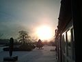
 Sunset - panoramio - tom.h.jpg 1,600 × 633; 98 KB
-
 Surface warning - geograph.org.uk - 6410001.jpg 768 × 1,024; 825 KB
-
 Sustrans Route 65 - geograph.org.uk - 877033.jpg 640 × 480; 105 KB
-
 Temple Walk - geograph.org.uk - 3145354.jpg 640 × 480; 111 KB
-
 Temple Walk - geograph.org.uk - 4626786.jpg 640 × 427; 85 KB
-
 The A19 south of Escrick - geograph.org.uk - 295081.jpg 640 × 480; 73 KB
-
 The Carrs, Escrick - geograph.org.uk - 6022207.jpg 1,024 × 768; 160 KB
-
 The cycleway heads towards Moreby wood - geograph.org.uk - 2148054.jpg 800 × 600; 283 KB
-
 The entrance to Queen Margaret's School - geograph.org.uk - 2466825.jpg 800 × 600; 318 KB
-
 The Menagerie - geograph.org.uk - 4136567.jpg 640 × 427; 92 KB
-
 The Selby to York cycleway to York - geograph.org.uk - 2147975.jpg 800 × 600; 358 KB
-
 The Trans Pennine Trail near Escrick - geograph.org.uk - 5077253.jpg 800 × 600; 135 KB
-
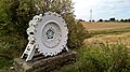 These teeth were made for mining - geograph.org.uk - 5072849.jpg 3,072 × 1,728; 3.93 MB
-
 Tileshed Farm - geograph.org.uk - 2561455.jpg 1,600 × 1,200; 375 KB
-
 Tileshed Farmland - geograph.org.uk - 750467.jpg 640 × 427; 55 KB
-
 Time to land at Neptune - geograph.org.uk - 4271986.jpg 1,024 × 768; 350 KB
-
 Towards a pond near Bell farm - geograph.org.uk - 2755723.jpg 640 × 480; 91 KB
-
 Towards Common Wood - geograph.org.uk - 3244357.jpg 640 × 480; 100 KB
-
 Towards Mount Bridge - geograph.org.uk - 2755693.jpg 640 × 480; 130 KB
-
 Towards Stillingfleet hill - geograph.org.uk - 2737206.jpg 640 × 480; 56 KB


