Category:Eryrys
Jump to navigation
Jump to search
village in Wales  | |||||
| Upload media | |||||
| Instance of | |||||
|---|---|---|---|---|---|
| Location | Denbighshire, Wales | ||||
 | |||||
Cymraeg: Pentref a phlwyf yn Sir Ddinbych yw Eryrys. Saif bum milltir i'r de o dref yr Wyddgrug ac ychydig i'r gogledd-ddwyrain o bentref Llanarmon-yn-Iâl. Ar fryn carreg galch Bryn Alyn, mae'r pentref 350m uwch lefel y môr, ac yn un o'r cystadleuwyr am y teitl o bentref uchaf Cymru.
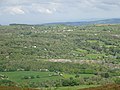
English: Eryrys (; alternate spelling Erryrys) is a village in Denbighshire, Wales, located at approximate grid reference SJ203578, five miles south of Mold. The village is built on the limestone formation of Bryn Alyn and many limestone outcrops can be seen close by. At 350m above sea level, Eryrys is one of a number of villages with a valid claim to be the highest in Wales; others include Bwlchgwyn, Wrexham (335m, but has a still-active church, which Eryrys does not), and Garn-yr-Erw, Torfaen (390m, but has no church or pub). There are several limestone quarries close to the village, some now closed but others still actively serving the local cement industry. Eryrys was formerly a lead-mining community, with the remains of several mines still visible nearby, although lead-mining in the area ceased in the late 19th century. The land around Eryrys is now primarily used for sheep-grazing, with also some dairy farming. Eryrys lies on the edge of the Clwydian Range Area of Outstanding Natural Beauty and many walking routes go through or around the village.
Media in category "Eryrys"
The following 10 files are in this category, out of 10 total.
-
 A view of the hills - geograph.org.uk - 209251.jpg 640 × 480; 125 KB
-
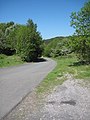
 Byway to Quarry Works - geograph.org.uk - 1327881.jpg 480 × 640; 158 KB
-
 Byway-Access Road to Quarry - geograph.org.uk - 1327806.jpg 480 × 640; 92 KB
-
 Eryrys from Foel Gyw, Bryniau Clwyd (Clwydian Hills), Cymru 15.jpg 4,896 × 3,672; 5.08 MB
-
 Eryrys from Foel Gyw, Bryniau Clwyd (Clwydian Hills), Cymru 16.jpg 4,896 × 3,672; 5.24 MB
-
 Eryrys, Sir Ddinbych 01.jpg 4,290 × 2,856; 1.49 MB
-
 Eryrys, Sir Ddinbych 18.jpg 4,290 × 2,856; 388 KB
-
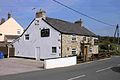
 Fron Deg, Eryrys. - geograph.org.uk - 113827.jpg 640 × 480; 125 KB
-
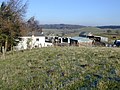
 Paddocks - geograph.org.uk - 195551.jpg 640 × 479; 95 KB
-
 Steps on the Clywdian Way - geograph.org.uk - 1327773.jpg 640 × 480; 164 KB


,_Cymru_15.jpg)
,_Cymru_16.jpg)


