Category:Erwarton
Jump to navigation
Jump to search
English: Erwarton is a village in the civil parish of Arwarton in the Babergh district of Suffolk, England. Located on the Shotley peninsula around south of Ipswich.
village in Suffolk, England  | |||||
| Upload media | |||||
| Instance of | |||||
|---|---|---|---|---|---|
| Location | Arwarton, Babergh, Suffolk, East of England, England | ||||
| Elevation above sea level |
| ||||
 | |||||
Subcategories
This category has the following 5 subcategories, out of 5 total.
E
- Erwarton Almshouses (2 F)
- Erwarton Bay (9 F)
M
- St Mary, Erwarton (9 F)
Q
- Queen's Head, Erwarton (7 F)
Media in category "Erwarton"
The following 16 files are in this category, out of 16 total.
-
 Church Farmhouse, Erwarton.jpg 3,456 × 2,304; 2.27 MB
-
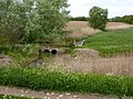
 Countryside around Erwarton - geograph.org.uk - 1282658.jpg 640 × 459; 109 KB
-
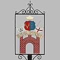
 Erwarton Village Sign.jpg 1,356 × 1,356; 150 KB
-
 Erwarton2.jpg 1,356 × 1,356; 261 KB
-

-

-
 Johnny All Alone Creek - geograph.org.uk - 1283075.jpg 518 × 640; 95 KB
-
 Lake near Erwarton - geograph.org.uk - 1282610.jpg 640 × 444; 98 KB
-
 Lake south of Erwarton Hall - geograph.org.uk - 1282592.jpg 640 × 446; 103 KB
-
 Lane and trees north of Erwarton Hall - geograph.org.uk - 1282555.jpg 640 × 495; 122 KB
-
 Lane between Shotley and Erwarton - geograph.org.uk - 1282507.jpg 640 × 434; 100 KB
-
 Looking inland at Johnny All Alone Creek - geograph.org.uk - 1283077.jpg 640 × 480; 137 KB
-
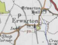 Map of Erwarton, OS 1946.png 188 × 147; 43 KB
-
 The bay at Johnny All Alone Creek - geograph.org.uk - 1283073.jpg 640 × 433; 112 KB
-
 Walking at Erwarton - geograph.org.uk - 2736178.jpg 1,024 × 768; 319 KB
-


