Category:Erlengraben (Wiesbach)
Jump to navigation
Jump to search
| NO WIKIDATA ID FOUND! Search for Erlengraben (Wiesbach) on Wikidata | |
| Upload media |
Media in category "Erlengraben (Wiesbach)"
The following 43 files are in this category, out of 43 total.
-
 Erlenbach (Erlengraben) und Erlengraben in Gänze R0016175.jpg 3,648 × 2,736; 3.57 MB
-
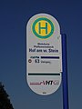 Erlenbach Bushaltestelle Weißer Stein R0015933.jpg 2,736 × 3,648; 3.44 MB
-
 Erlenbach kommt zum Erlengraben R0015965.jpg 2,736 × 3,648; 3.7 MB
-
 Erlengraben am Weg von Quellmulde R0016127.jpg 3,648 × 2,736; 3.72 MB
-
 Erlengraben an Steg Kita St. Georg Zufluss 2 R0015927.jpg 3,648 × 2,736; 3.56 MB
-
 Erlengraben befestigt an Waldwiese R0016074.jpg 2,736 × 3,648; 3.7 MB
-
 Erlengraben Befestigung an Spielplatz R0015913.jpg 3,648 × 2,736; 3.69 MB
-
 Erlengraben Befestigung und Dränage bei Steg bei Gärten R0016013.jpg 2,736 × 3,648; 3.55 MB
-
 Erlengraben beginnt in Wiese R0016095.jpg 3,648 × 2,736; 3.68 MB
-
 Erlengraben Damm nahe NABU-Schutzgebiet R0016018.jpg 3,648 × 2,736; 3.7 MB
-
 Erlengraben Erlenbach mündet R0015961.jpg 3,648 × 2,736; 3.71 MB
-
 Erlengraben Erlenbach mündet R0015964.jpg 2,736 × 3,648; 3.1 MB
-
 Erlengraben ganze Quellmulde ober Weg R0016132.jpg 3,648 × 2,736; 3.71 MB
-
 Erlengraben Graben von Quellmulde Durchlass Weg R0016134.jpg 3,648 × 2,736; 3.68 MB
-
 Erlengraben große Grabentasche R0015979.jpg 3,648 × 2,736; 3.72 MB
-
 Erlengraben Hydrant Weg R0015946.jpg 2,736 × 3,648; 3.63 MB
-
 Erlengraben Hydrant Weg R0015947.jpg 3,648 × 2,736; 3.42 MB
-
 Erlengraben kleine Grabentasche R0015976.jpg 3,648 × 2,736; 3.71 MB
-
 Erlengraben nordwärts im Bruchwald Runse R0016044.jpg 3,648 × 2,736; 3.75 MB
-
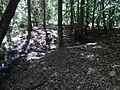 Erlengraben nordwärts im Bruchwald Zufluss R0016042.jpg 3,648 × 2,736; 3.76 MB
-
 Erlengraben ober NABU-Schutzgebiet R0016016.jpg 2,736 × 3,648; 3.69 MB
-
 Erlengraben ober Steg Kita St. Georg Auwiese oberhalb R0015929.jpg 3,648 × 2,736; 3.66 MB
-
 Erlengraben Quellmulde ober Weg R0016130.jpg 3,648 × 2,736; 3.67 MB
-
 Erlengraben Quelltümpel am Weg R0016146.jpg 3,648 × 2,736; 3.66 MB
-
 Erlengraben Quelltümpel am Weg, Abfluss R0016150.jpg 2,736 × 3,648; 3.67 MB
-
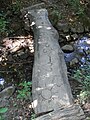 Erlengraben Steg Kita St. Georg R0015922.jpg 2,736 × 3,648; 3.62 MB
-
 Erlengraben südlich Weißer Stein Defekte Befestigung R0015931.jpg 2,736 × 3,648; 3.64 MB
-
 Erlengraben südlich Weißer Stein R0015932.jpg 2,736 × 3,648; 3.63 MB
-
 Erlengraben südwärts am Waldrand auf R0016021.jpg 3,648 × 2,736; 3.7 MB
-
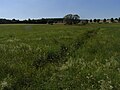
 Erlengraben südwärts an Waldwiese R0016029.jpg 3,648 × 2,736; 3.63 MB
-
 Erlengraben südwärts auf Waldwiese R0016033.jpg 3,648 × 2,736; 3.66 MB
-
 Erlengraben südwärts im Bruchwald Suhle R0016051.jpg 3,648 × 2,736; 3.73 MB
-
 Erlengraben südwärts im Waldrand Mehrlings-Erle R0016024.jpg 3,648 × 2,736; 3.65 MB
-
 Erlengraben Vereinigung Quelläste Wald und Wiese R0016337.jpg 3,648 × 2,736; 3.74 MB
-
 Erlengraben Viehtränke Wiese Bachbett R0015974.jpg 3,648 × 2,736; 3.62 MB
-
 Erlengraben Waldast an Fichtenwald R0016057.jpg 3,648 × 2,736; 3.69 MB
-
 Erlengraben Waldast beginnt R0016067.jpg 3,648 × 2,736; 3.73 MB
-
 Erlengraben Waldast R0016063.jpg 2,736 × 3,648; 3.75 MB
-
 Erlengraben Zufluss 1 Quellast Wiese R0016339.jpg 2,736 × 3,648; 3.65 MB
-
 Erlengraben Zufluss im Wald R0016069.jpg 2,736 × 3,648; 3.73 MB
-
 Wiesbach Erlengraben mündet R0015999.jpg 3,648 × 2,736; 3.65 MB
-
 Wiesbach Erlengraben mündet R0016000.jpg 2,736 × 3,648; 3.71 MB
-
 Wiesbach Zufluss an Spielplatz Pfaffenwiesbach R0015916.jpg 3,648 × 2,736; 3.7 MB
_und_Erlengraben_in_G%C3%A4nze_R0016175.jpg)


