Category:Erisos
Jump to navigation
Jump to search
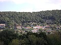
Ελληνικά: Ο Δήμος Ερίσου ήταν ένας από τους επτά δήμους και μία κοινότητα, στους οποίους διαιρούνταν διοικητικά η Κεφαλονιά την περίοδο που ίσχυσε το πρόγραμμα Καποδίστριας. Λειτούργησε την περίοδο 1999 -2010 οπότε και καταργήθηκε με την εφαρμογή του προγράμματος Καλλικράτης και εντάχθηκε στον νέο δήμο Κεφαλονιάς. Βρισκόταν στο βορειότερο άκρο του νησιού. Ο δήμος Ερίσου αποτελούνταν από 12 δημοτικά διαμερίσματα, καταλάμβανε έκταση 78,1 Km2 και είχε συνολικό πληθυσμό 1.963 κατοίκους. Έδρα του δήμου ήταν οι Βασιλικιάδες. Η περιοχή που καταλάμβανε ο δήμος Ερίσου είναι η πιο τουριστική του νησιού.
English: Erisos is a former municipality on the island of Kefalonia, Ionian Islands, Greece. Since the 2011 local government reform it is part of the municipality Kefalonia, of which it is a municipal unit. It is located in the northernmost part of the island, and has a land area of 78.114 km². It population was 1,963 at the 2001 census. The seat of the municipality was in Vasilikades but more known are the two small harbours Fiskardo and Ásos. Other town are Antipáta, Mesovoúnia, and Komitáta
subdivision of Sami Municipality, Greece  | |||||
| Upload media | |||||
| Instance of |
| ||||
|---|---|---|---|---|---|
| Location |
| ||||
| Population |
| ||||
 | |||||
Subcategories
This category has the following 2 subcategories, out of 2 total.
Media in category "Erisos"
The following 6 files are in this category, out of 6 total.
-
 Antipata-church.jpg 3,419 × 2,564; 3.23 MB
-
 Dimos Erisou.png 400 × 320; 21 KB
-
 Mesovounia.JPG 3,072 × 2,304; 2.84 MB
-
 Neohori Erisos.jpg 3,072 × 2,304; 2.91 MB
-
 Plagia 01.JPG 3,072 × 2,304; 2.97 MB
-
 Wv Erisos banner.JPG 3,017 × 431; 611 KB


