Category:Eriskay Causeway
Jump to navigation
Jump to search
architectural structure in Outer Hebrides, Scotland, UK  | |||||
| Upload media | |||||
| Instance of | |||||
|---|---|---|---|---|---|
| Location | Outer Hebrides, Scotland | ||||
 | |||||
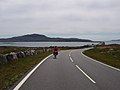
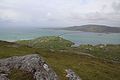
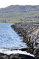
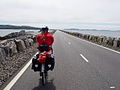
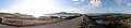
The Eriskay Causeway (Gaelic: Cabhsair Eirisgeigh) links the islands of South Uist and Eriskay, in the Outer Hebrides of Scotland.
Media in category "Eriskay Causeway"
The following 35 files are in this category, out of 35 total.
-
 Approach to Eriskay Causeway - geograph.org.uk - 1356155.jpg 640 × 480; 58 KB
-
 Approaching causeway to Eriskay - geograph.org.uk - 1163433.jpg 640 × 480; 48 KB
-
 Blick vom Beinn Sciathan auf den Straßendamm nach South Uist.jpg 5,184 × 3,456; 5.83 MB
-
 Causeway from Eriskay to South Uist - geograph.org.uk - 3076471.jpg 427 × 640; 101 KB
-
 Causeway to Eriskay from North - geograph.org.uk - 1561839.jpg 640 × 480; 73 KB
-
-
 Eriskay Causeway - Cabhsair Eirisgeigh - geograph.org.uk - 2562088.jpg 2,560 × 1,920; 1.74 MB
-
 Eriskay Causeway - geograph.org.uk - 119694.jpg 640 × 480; 80 KB
-
 Eriskay causeway - geograph.org.uk - 1435591.jpg 640 × 479; 129 KB
-
 Eriskay Causeway - geograph.org.uk - 2562074.jpg 2,560 × 1,920; 1.4 MB
-
 Eriskay Causeway - geograph.org.uk - 2562155.jpg 2,560 × 1,920; 2.37 MB
-
 Eriskay Causeway - geograph.org.uk - 3175648.jpg 640 × 360; 203 KB
-
 Eriskay Causeway - geograph.org.uk - 4120956.jpg 640 × 480; 155 KB
-
 Eriskay Causeway - geograph.org.uk - 5447206.jpg 1,024 × 768; 136 KB
-
 Eriskay Causeway - opened 2002 - geograph.org.uk - 4543224.jpg 1,800 × 1,012; 1.12 MB
-
 Eriskay causeway 20090608.jpg 800 × 601; 210 KB
-
 Eriskay causeway from South Uist - geograph.org.uk - 219936.jpg 640 × 429; 87 KB
-
 Eriskay Causeway towards South Uist - geograph.org.uk - 2764146.jpg 640 × 430; 33 KB
-
 Eriskay from Easabhal - geograph.org.uk - 15953.jpg 640 × 400; 45 KB
-
 Eriskay Village - geograph.org.uk - 346214.jpg 640 × 480; 75 KB
-
 Eriskay, the causeway - geograph.org.uk - 3210126.jpg 640 × 480; 43 KB
-
 Eriskay-Eiriosgaigh and South Uist-Uibhist a Deas - geograph.org.uk - 4604106.jpg 3,264 × 2,448; 4.12 MB
-

-

-
 Otters Crossing, Eriskay.jpg 3,264 × 2,448; 2.08 MB
-
 Over the Sound to Eriskay - geograph.org.uk - 1356272.jpg 640 × 480; 61 KB
-
 South Uist to Eriskay Causeway. - geograph.org.uk - 444609.jpg 640 × 480; 69 KB
-
 Southern end of the Eriskay Causeway - geograph.org.uk - 4543227.jpg 1,800 × 1,013; 1.34 MB
-
 The Causeway to Eriskay - geograph.org.uk - 1522317.jpg 640 × 480; 43 KB
-
 The causeway to South Uist - geograph.org.uk - 1357259.jpg 640 × 480; 66 KB
-
 The Eriskay Causeway - geograph.org.uk - 4977527.jpg 800 × 600; 111 KB
-
 The Eriskay Causeway at Rubha Bàn - geograph.org.uk - 4120960.jpg 640 × 480; 162 KB
-
 Vatersay Fae003.jpg 3,648 × 2,736; 4.14 MB
-
 Vatersay Fae004.jpg 4,912 × 1,080; 2.37 MB
-


