Category:Eridge
Jump to navigation
Jump to search
English: Eridge is a village in the civil parish of Rotherfield, in the Wealden district of East Sussex.
Subcategories
This category has the following 4 subcategories, out of 4 total.
E
- Holy Trinity church, Eridge (8 F)
- Eridge World War I Memorial (1 F)
O
- Oasts in Eridge (13 F)
Media in category "Eridge"
The following 63 files are in this category, out of 63 total.
-
-

-
 Bridge over a small stream, Forge Wood - geograph.org.uk - 1492472.jpg 640 × 430; 197 KB
-
 Converted stable block, Eridge Green - geograph.org.uk - 1492835.jpg 640 × 430; 137 KB
-
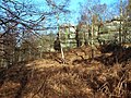
 Coppiced tree near Eridge Rocks - geograph.org.uk - 1492847.jpg 640 × 430; 140 KB
-
 Coppicing in Eridge Old Park - geograph.org.uk - 1412005.jpg 640 × 480; 117 KB
-
 Cottages, Warren Farm Lane, Eridge Green - geograph.org.uk - 1492837.jpg 640 × 430; 126 KB
-
 Deer Gate into Eridge Park - geograph.org.uk - 1412033.jpg 640 × 480; 139 KB
-
 Ebenezer Cottage, Eridge Green - geograph.org.uk - 1492820.jpg 640 × 430; 146 KB
-
 Ebenezer Cottage, Eridge Green - geograph.org.uk - 1492823.jpg 640 × 430; 140 KB
-
 Eridge Green across the fields - geograph.org.uk - 1492515.jpg 640 × 430; 131 KB
-
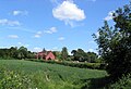
 Eridge Hall - geograph.org.uk - 1492519.jpg 640 × 430; 125 KB
-
 Eridge Park Lake - geograph.org.uk - 1412026.jpg 640 × 360; 73 KB
-
 Eridge Rocks - geograph.org.uk - 1492841.jpg 640 × 430; 162 KB
-
 Eridge, Kent - panoramio.jpg 3,000 × 2,250; 1.39 MB
-

-
 Footbridge (2 of 3) near Norman Cottages - geograph.org.uk - 1412137.jpg 640 × 480; 122 KB
-
 Footbridge (3 of 3) Near Norman Cottages - geograph.org.uk - 1412139.jpg 640 × 480; 120 KB
-
 Footbridge in Eridge Old Park - geograph.org.uk - 1412038.jpg 640 × 480; 128 KB
-
 Footbridge near Fisheries Track - geograph.org.uk - 1412043.jpg 640 × 480; 126 KB
-
 Forge Wood - geograph.org.uk - 1492486.jpg 640 × 430; 119 KB
-

-
 Half timbered house, Eridge Green - geograph.org.uk - 1492505.jpg 640 × 322; 77 KB
-
 Hall off A26 - geograph.org.uk - 1803126.jpg 1,024 × 768; 201 KB
-

-
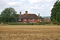
 Houses near Warren Farm - geograph.org.uk - 1492853.jpg 640 × 430; 152 KB
-

-

-

-
 Kissing Gate near Eridge Lake - geograph.org.uk - 1412031.jpg 640 × 480; 107 KB
-
 Lake at Eridge Old Park - geograph.org.uk - 1802968.jpg 1,024 × 768; 122 KB
-
 Looking towards Crown House, Eridge - geograph.org.uk - 1492540.jpg 640 × 430; 133 KB
-
 Looking towards Eridge Green - geograph.org.uk - 1492511.jpg 640 × 430; 133 KB
-
 Modern Cottages at Eridge Green - geograph.org.uk - 1802785.jpg 1,024 × 700; 736 KB
-
 Permissive Path in Eridge Old Park - geograph.org.uk - 1411979.jpg 640 × 480; 125 KB
-
 Programme for Unionist Demonstration, Eridge Park, 6 August 1888.jpg 1,624 × 1,308; 333 KB
-
 Road to Warren Farm, Eridge Rocks - geograph.org.uk - 1492848.jpg 640 × 430; 170 KB
-
 Sandstone outcrop at Eridge Green - geograph.org.uk - 1802766.jpg 768 × 1,024; 892 KB
-
 Sandstone Rocks at Eridge Green - geograph.org.uk - 1802751.jpg 1,024 × 768; 1.34 MB
-

-
 The Huntsman pub at Eridge - geograph.org.uk - 2497110.jpg 1,024 × 768; 319 KB
-
 The Huntsman public house - geograph.org.uk - 1802808.jpg 1,024 × 700; 728 KB
-
 The Huntsman public house at Eridge - geograph.org.uk - 1483474.jpg 640 × 427; 65 KB
-
 The Nevill Crest and Gun - geograph.org.uk - 807386.jpg 640 × 355; 59 KB
-
 The Nevill Crest and Gun, Eridge 01.JPG 2,013 × 1,510; 681 KB
-
 The Nevill Crest and Gun, Eridge 02.JPG 2,048 × 1,536; 741 KB
-

-

-

-

-

-

-

-

-

-

-

-
-
 Unused Stile on Tunbridge Wells Circular - geograph.org.uk - 1412110.jpg 640 × 480; 121 KB
-
 Warren Farm - geograph.org.uk - 1492851.jpg 640 × 430; 141 KB
-
 Warren Farm - geograph.org.uk - 1492864.jpg 640 × 430; 139 KB
-
 Warren Farm Lane - geograph.org.uk - 1412120.jpg 640 × 480; 111 KB
-


_near_Normans_Cottages_-_geograph.org.uk_-_1412133.jpg)
_near_Norman_Cottages_-_geograph.org.uk_-_1412137.jpg)
_Near_Norman_Cottages_-_geograph.org.uk_-_1412139.jpg)


