Category:Eremita Mesa
Jump to navigation
Jump to search

Eremita Mesa (in Spanish: Hermit Mesa)
Subcategories
This category has the following 4 subcategories, out of 4 total.
D
- Dripping Springs Trail (7 F)
E
- Eremita Mesa (east aspect) (6 F)
- Eremita Mesa (west aspect) (1 F)
H
Media in category "Eremita Mesa"
The following 16 files are in this category, out of 16 total.
-
 131112-Z-WT236-003 (10855083144).jpg 3,600 × 2,400; 2.35 MB
-
 Arizona. LOC 99446124-3.jpg 6,534 × 8,020; 11.28 MB
-
 Arizona. LOC 99446126-10.jpg 4,965 × 6,200; 5.47 MB
-
 Arizona. LOC 99446126-2.jpg 5,014 × 6,252; 6.24 MB
-
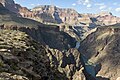
 Eremita Mesa (8315954874).jpg 5,244 × 1,768; 11.06 MB
-
 Eremita Mesa, Cocopa Point, Travertine and Boucher Canyons.png 1,125 × 2,001; 11.53 MB
-
 Eremita Mesa, South Rim Grand Canyon, with Hermit Canyon and Pima Point.png 1,125 × 2,001; 11.33 MB
-
 Grand Canyon Tonto Trail 3710 (8227004193).jpg 3,000 × 1,993; 802 KB
-
 GrandCanyon1.jpg 1,536 × 2,048; 417 KB
-
 GrandCanyonAerialViewByPhilKonstantin.jpg 800 × 600; 132 KB
-
 Harvey Butchart's hiking map - Flickr - brewbooks (6).jpg 3,264 × 2,448; 4.13 MB
-
 Le Grand Canyon (2).jpg 4,088 × 2,904; 2.36 MB
-

-
 NPS grand-canyon-topo-map.jpg 8,420 × 4,819; 8.89 MB
-
 Vesta and Diana, South Rim, Grand Canyon.jpg 2,701 × 1,963; 2.39 MB
-
 Yuma Point, Eremita Mesa (east aspect), Hermit Canyon (west flank).png 1,125 × 2,001; 10.93 MB
.jpg)


.jpg)


.jpg)
.jpg)


,_Hermit_Canyon_(west_flank).png)
.jpg)