Category:Erdington
Jump to navigation
Jump to search
English: Erdington is a suburb of Birmingham, England,United Kingdom, five miles northeast of the city centre and borders Sutton Coldfield. It is also a council constituency, managed by its own district committee.
Dansk: Erdington er en forstad til Birmingham, England. Den ligger omkring 8 km nordøst for det centrale Birmingham og grænser op til Sutton Coldfield. Det er også en valgkreds, der bliver forvaltet af den egen distriktkomite. Den formelle valgkreds er mindre end Erdington ward, og Tyburn (tidligere Kingsbury), Stockland Green og Kingstanding, selvom hele Kingstanding og det meste af Tyburn og Stockland Green wards ligger uden for den historiske grænse til Erdington.
Suomi: Erdington on yksi Birminghamin kaupungin kymmenestä vaalipiiristä. Se muodostuu neljästä äänestysalueesta: Erdington, Tyburn, Kingstanding ja Stockland Green. Vuonna 2009 Erdingtonissa oli 94 700 asukasta.
Gaeilge: Is ceantar suite i m Birmingham é Erdington.
Polski: Erdington – dzielnica w Anglii, w West Midlands, w dystrykcie Birmingham. W 2011 dzielnica liczyła 22828 mieszkańców. Erdington jest wspomniana w Domesday Book (1086) jako Hardintone.
suburb of Birmingham, England, UK  | |||||
| Upload media | |||||
| Instance of | |||||
|---|---|---|---|---|---|
| Location | Birmingham, West Midlands, England | ||||
| Different from | |||||
 | |||||
Subcategories
This category has the following 13 subcategories, out of 13 total.
C
- Chester Road railway station (9 F)
E
F
- Fort Dunlop (28 F)
G
H
L
- Lad in the Lane (2 F)
P
R
- Rookery House (3 F)
T
- The Feast (Anuradha Patel) (2 F)
W
- Witton Lakes, Birmingham (7 F)
Media in category "Erdington"
The following 122 files are in this category, out of 122 total.
-
 A little bit of Los Angeles - geograph.org.uk - 1854125.jpg 480 × 640; 159 KB
-

-
 Access to Pype Hayes Park, Plants Brook - geograph.org.uk - 1738670.jpg 768 × 576; 108 KB
-
 Architectural detail, Erdington - geograph.org.uk - 6106199.jpg 2,028 × 1,216; 455 KB
-
 Awaiting demolition - geograph.org.uk - 6192764.jpg 3,264 × 2,448; 1.86 MB
-

-
 Barbers Teas, Always Please, Brookvale Road, Birmingham (2458315993).jpg 3,000 × 4,000; 5.66 MB
-
 Bin waiting for a bus^ - geograph.org.uk - 6192767.jpg 2,448 × 3,264; 1.87 MB
-

-
 BirminghamErdington2007Constituency.svg 238 × 282; 77 KB
-
 BirminghamErdingtonConstituency.png 180 × 230; 3 KB
-
 BirminghamErdingtonConstituency.svg 180 × 230; 41 KB
-
 Bleak Hill Park - 2011-01-29.jpg 3,872 × 2,592; 4.04 MB
-
 Blooming marvellous - geograph.org.uk - 1854121.jpg 640 × 480; 109 KB
-

-

-
 Carver Court, Chester Road - geograph.org.uk - 1854141.jpg 640 × 480; 129 KB
-
 Cedar Drive, Erdington, Birmingham - geograph.org.uk - 1501937.jpg 640 × 445; 85 KB
-
 Chase Grove, Pype Hayes - geograph.org.uk - 1762933.jpg 922 × 692; 162 KB
-
 Chester Road - geograph.org.uk - 198644.jpg 640 × 480; 72 KB
-
 Chester Road 19th century housing - geograph.org.uk - 1598809.jpg 480 × 640; 60 KB
-
 Chester Road 19th century housing - geograph.org.uk - 1598810.jpg 480 × 640; 56 KB
-

-
 Conservative Club, Erdington - geograph.org.uk - 1656788.jpg 640 × 480; 69 KB
-

-
 Cutbacks - expect more soon - geograph.org.uk - 1854152.jpg 480 × 640; 143 KB
-
 Distinctive Building, Edwards Road - geograph.org.uk - 1656862.jpg 480 × 640; 58 KB
-

-
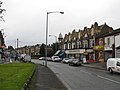
 Erdington - Norfolk Road - geograph.org.uk - 974989.jpg 640 × 480; 73 KB
-
 Erdington - Oliver Road - geograph.org.uk - 974980.jpg 480 × 640; 83 KB
-
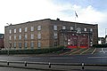 Erdington fire station - geograph.org.uk - 1144022.jpg 640 × 427; 199 KB
-
 Erdington Fire Station.jpg 1,024 × 768; 320 KB
-
 Erdington Hall Bridge - geograph.org.uk - 2650.jpg 640 × 480; 79 KB
-
 Erdington swimming pool - geograph.org.uk - 1144105.jpg 640 × 427; 203 KB
-
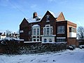
 ErdingtonLibrary.JPG 1,280 × 960; 336 KB
-
 Esso Birmingham Terminal.jpg 640 × 480; 94 KB
-

-
 Finger post - Handsworth, Birmingham - Andy Mabbett.JPG 1,536 × 2,048; 943 KB
-

-
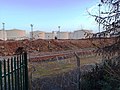
 Football grounds, Shrubbery Close - geograph.org.uk - 1738644.jpg 768 × 576; 103 KB
-
 Former barbers shop, Sutton Road - geograph.org.uk - 1598138.jpg 480 × 640; 62 KB
-
 Garden and Garage - geograph.org.uk - 1632402.jpg 480 × 640; 173 KB
-
 Gravelly Lane retailing, Erdington - geograph.org.uk - 974976.jpg 640 × 480; 66 KB
-
 Gully leading to Berwood Farm Road - geograph.org.uk - 1762960.jpg 692 × 922; 173 KB
-
 Gully, Berwood Farm Road - geograph.org.uk - 1762979.jpg 922 × 692; 155 KB
-
 Gully, Penndale Close, Pype Hayes - geograph.org.uk - 1762956.jpg 692 × 922; 141 KB
-
 Hollywood Care Home, Erdington - geograph.org.uk - 1657300.jpg 640 × 480; 74 KB
-
 Holte & Bracebridge Almshouses 1.jpg 4,000 × 3,000; 2.43 MB
-

-

-
 Kingsbury Road, Erdington - geograph.org.uk - 1560569.jpg 442 × 640; 96 KB
-

-
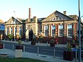
 Lindsworth School (North) - geograph.org.uk - 1598769.jpg 640 × 480; 110 KB
-

-
 Lyndhurst Estate, Beechmount Drive - geograph.org.uk - 1598788.jpg 640 × 480; 107 KB
-

-

-

-
 Lyndhurst Estate, Kentmere Tower - geograph.org.uk - 1598801.jpg 480 × 640; 90 KB
-
 Lyndhurst Estate, Normanton Tower - geograph.org.uk - 1598778.jpg 640 × 480; 95 KB
-

-

-

-
 Mazda Service Centre, Orphanage Road - geograph.org.uk - 1656768.jpg 640 × 480; 61 KB
-

-

-
 Mrs Lynne.jpg 627 × 751; 85 KB
-
 New Housing, Pype Hayes - geograph.org.uk - 1762943.jpg 922 × 692; 116 KB
-
 North Birmingham Busways 96 A696HNB.jpg 1,320 × 880; 231 KB
-
 Nursing Home, Chester Road - geograph.org.uk - 1854156.jpg 640 × 480; 102 KB
-

-
 Park view, Pype Hayes Park - geograph.org.uk - 1743481.jpg 768 × 576; 143 KB
-
 Park view, Pype Hayes Park - geograph.org.uk - 1743503.jpg 768 × 576; 82 KB
-
 Penns Primary School - geograph.org.uk - 1670103.jpg 800 × 600; 98 KB
-
 Plants Brook path - geograph.org.uk - 1738652.jpg 768 × 576; 136 KB
-
 Plants brook, Pype Hayes - geograph.org.uk - 1740476.jpg 576 × 768; 124 KB
-

-
 Pype Hayes Golf Course - geograph.org.uk - 1738685.jpg 768 × 576; 121 KB
-
 Pype Hayes Park.JPG 2,240 × 1,488; 1.3 MB
-
 River Tame and Overflow Channel - geograph.org.uk - 381933.jpg 600 × 450; 207 KB
-
 Roadworks, Erdington.jpg 480 × 640; 96 KB
-
 Sanctuary Housing, Chester Road - geograph.org.uk - 1599218.jpg 640 × 480; 145 KB
-

-

-

-
 Short Heath Park - 2011-01-29.jpg 2,592 × 3,872; 4.68 MB
-
 Sign Service - Erdington, Birmingham - geograph.org.uk - 6382041.jpg 1,024 × 683; 81 KB
-

-
 Six Ways Erdington - geograph.org.uk - 304574.jpg 640 × 480; 117 KB
-

-
 Station Road, Erdington - geograph.org.uk - 304584.jpg 640 × 480; 124 KB
-
 Stockland Green Health Centre - geograph.org.uk - 13618.jpg 640 × 426; 108 KB
-
 Street Atlas of Birmingham - 1939 - Sheet 04 - Erdington (west).jpg 1,000 × 776; 470 KB
-
 Sunset in Erdington - geograph.org.uk - 4639819.jpg 1,600 × 1,187; 254 KB
-

-
 Sutton New Road, Erdington - geograph.org.uk - 304577.jpg 640 × 480; 101 KB
-
 Sutton Road Surgery, Erdington - geograph.org.uk - 1598807.jpg 640 × 480; 100 KB
-
 Sutton Road, Erdington - 904 bus (14228331264).jpg 4,288 × 3,216; 1.39 MB
-
 Sutton Road, Erdington - 904 bus - 4916 (14041892889).jpg 4,288 × 3,216; 3.33 MB
-
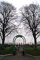
 The Gardens, Erdington - geograph.org.uk - 1291164.jpg 640 × 480; 106 KB
-
 The Green, Erdington - geograph.org.uk - 5703630.jpg 1,024 × 768; 137 KB
-
 The Red Lion, Erdington (geograph 5381422).jpg 1,469 × 1,102; 552 KB
-

-
 Under the M6 - geograph.org.uk - 13916.jpg 640 × 426; 97 KB
-

-

-

-

-
 Victorian House, Chester Road - geograph.org.uk - 1854147.jpg 640 × 480; 149 KB
-
 Warren Farm Estate.jpg 1,584 × 532; 533 KB
-
 WaterFeatureErdington.JPG 1,280 × 960; 357 KB
-
 What's with the Bins^ - geograph.org.uk - 6192765.jpg 2,448 × 3,264; 2.11 MB
-

-

-

-

-
 Woolworths Erdington. - geograph.org.uk - 1135811.jpg 640 × 480; 69 KB
-

-

-
 Yenton Primary School - geograph.org.uk - 1854133.jpg 640 × 480; 179 KB
-
 Failure - geograph.org.uk - 19501.jpg 610 × 458; 63 KB
-
 Towards Bromford - geograph.org.uk - 13575.jpg 640 × 426; 113 KB


.jpg)


_-_geograph.org.uk_-_1598769.jpg)


.jpg)


.jpg)
.jpg)


.jpg)


